Enable Location

We need your location to show you interesting places around you

Discover nearby places

Find interesting locations and hidden gems around you

Precise directions

Get accurate directions and distances to places

Your location is never shared with other users. It's only used when you tap the location button.

Fort Morris

Log in to your account

Start exploring — it's free

Trusted by 65,786 travelers worldwide

Continue with Google
Continue with Apple
or

We will send you a code to connect

By continuing, you accept our Terms and Conditions and our Privacy Policy

Check your inbox

We've sent a pincode in your inbox. Please enter the code below.

Fort Morris
Discussion Reviews 1 Photos
4.8k Popularity

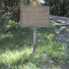
Fort Morris, Colonial fortification in Liberty County, Georgia, US.

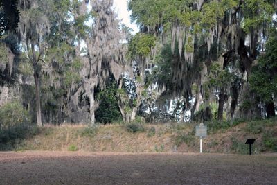
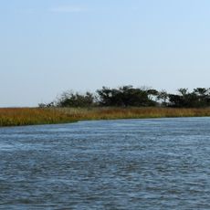
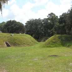
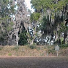
Fort Morris is an earthwork fortification in Liberty County, Georgia, built on a bend of the Medway River. The site retains its original ramparts, bastions, and gun emplacements, giving a clear picture of how the defensive layout was organized.

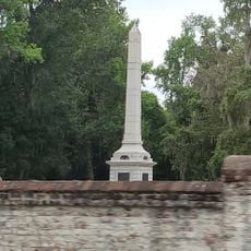
The fortification was built at the start of the American Revolutionary War to control access along the Medway River. British forces captured it in 1779 after a siege, but held it for only a few months before withdrawing.

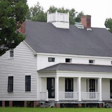
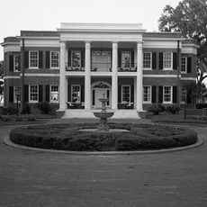
The site reflects how people organized their community defense and prepared for threats during the colonial period through the layout of the fortifications. Walking around the earthen walls gives a sense of how residents valued strategic positioning along this river corridor.

Visitors can walk along the earthen walls and get close to the gun positions throughout the grounds. After rain the surface of the ramparts can become slippery, so sturdy footwear is a good idea.

During the 1779 siege, fewer than 100 defenders held out against a much larger British force long enough to evacuate supplies and the wounded. The British commander reportedly demanded surrender, and the American commander's reply became one of the most defiant responses of the war.

The community of curious travelers

AroundUs brings together thousands of curated places, local tips, and hidden gems, enriched daily by 60,000 contributors worldwide.

Start exploring
GPS coordinates
31.76791,-81.28119
Latest update
March 3, 2026 10:07
Around this place
Wormsloe Historic Site
United States of America

Wormsloe Historic Site

30.8 km
St. Catherines Island
United States of America

St. Catherines Island

19.1 km
Skidaway Island State Park
United States of America

Skidaway Island State Park

29.5 km
Wassaw Island
United States of America

Wassaw Island

31.9 km
Blackbeard Island National Wildlife Refuge
United States of America

Blackbeard Island National Wildlife Refuge

31.5 km
Harris Neck National Wildlife Refuge
United States of America

Harris Neck National Wildlife Refuge

15 km
Bethesda Academy
United States of America

Bethesda Academy

27.6 km
Fort McAllister
United States of America

Fort McAllister

15.9 km
Coast Guard Air Station Savannah
United States of America

Coast Guard Air Station Savannah

31.5 km
Fort McAllister Historic Park
United States of America

Fort McAllister Historic Park

16.1 km
Fort Morris Historic Site
United States of America

Fort Morris Historic Site

1.2 km
Savannah–Ogeechee Canal
United States of America

Savannah–Ogeechee Canal

33.1 km
Wormsloe State Historic Site
United States of America

Wormsloe State Historic Site

31 km
Memorial Stadium
United States of America

Memorial Stadium

31.5 km
Wild Heron
United States of America

Wild Heron

23.3 km
Midway Historic District
United States of America

Midway Historic District

14.8 km
Fort McAllister
United States of America

Fort McAllister

15.9 km
Kilkenny
United States of America

Kilkenny

7.8 km
Liberty County Courthouse
United States of America

Liberty County Courthouse

31 km
Isle of Hope United Methodist Church
United States of America

Isle of Hope United Methodist Church

31.7 km
Flemington Presbyterian Church
United States of America

Flemington Presbyterian Church

29.7 km
Bryan Neck Presbyterian Church
United States of America

Bryan Neck Presbyterian Church

8.4 km
Bacon-Fraser House
United States of America

Bacon-Fraser House

30.9 km
Walthourville Presbyterian Church
United States of America

Walthourville Presbyterian Church

31.6 km
Stewart–Screven Monument
United States of America

Stewart–Screven Monument

14.8 km
Woodmanston Site
United States of America

Woodmanston Site

19.8 km
Richmond Hill Plantation (Richmond Hill, Georgia)
United States of America

Richmond Hill Plantation (Richmond Hill, Georgia)

17.5 km
Stillwell Towers
United States of America

Stillwell Towers

34.2 km
Show the full map
Reviews
Share your experience

No review yet

Discussions
Start a discussion...

No discussion yet

« Fort Morris - Colonial fortification in Liberty County, Georgia, US » is provided by Around Us (aroundus.com). Images and texts are derived from Wikimedia project under a Creative Commons license. You are allowed to copy, distribute, and modify copies of this page, under the conditions set by the license, as long as this note is clearly visible.

Discover hidden gems everywhere you go!

From secret cafés to breathtaking viewpoints, skip the crowded tourist spots and find places that match your style. Our app makes it easy with voice search, smart filtering, route optimization, and insider tips from travelers worldwide. Download now for the complete mobile experience.

Around Us App Screenshot

A unique approach to discovering new places

Le Figaro

All the places worth exploring

France Info

A tailor-made excursion in just a few clicks

20 Minutes

Around Us
Travel Guide & Maps
Download

Send to your phone

QR Code
1

Open the camera app on your mobile.

2

Point at the QR code with your camera. A notification will appear.

3

Tap the notification to open the link.