Enable Location

We need your location to show you interesting places around you

Discover nearby places

Find interesting locations and hidden gems around you

Precise directions

Get accurate directions and distances to places

Your location is never shared with other users. It's only used when you tap the location button.

Harris Neck National Wildlife Refuge

Log in to your account

Start exploring — it's free

Trusted by travelers worldwide

Continue with Google
Continue with Apple
or

We will send you a code to connect

By continuing, you accept our Terms and Conditions and our Privacy Policy

Check your inbox

We've sent a pincode in your inbox. Please enter the code below.

Harris Neck National Wildlife Refuge

Harris Neck National Wildlife Refuge, National Wildlife Refuge in McIntosh County, Georgia, United States.

Description

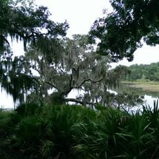
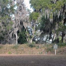
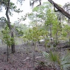
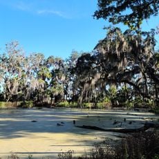
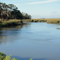
Harris Neck National Wildlife Refuge is a protected area on a former military airfield with 2,762 acres of saltwater marsh, grassland, mixed deciduous woods, and cropland. The land contains multiple habitat types that support a wide variety of animal and plant life.

History

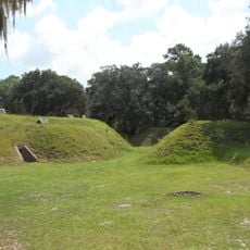
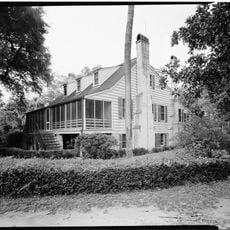
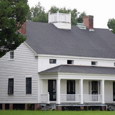
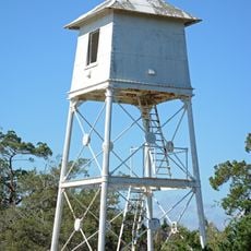
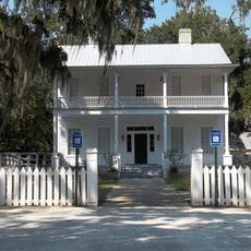
The land was owned by William Thomas Harris in the 1700s and later served as an Army airfield during World War II. It became a wildlife refuge in 1962 and has been managed for conservation ever since.

Culture

The refuge is part of the Colonial Coast Birding Trail, a network of 18 sites across Georgia dedicated to bird watching and nature learning. This connection to other protected areas helps visitors understand how different habitats support wildlife populations across the region.

Practical

The refuge offers over 15 miles of paved roads and trails available daily from 6:00 am to 7:00 pm at no charge. Well-maintained pathways lead through different habitat areas and provide good opportunities to see wildlife.

Did you know?

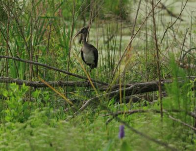
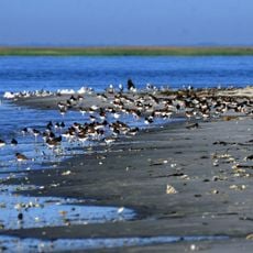
This site is home to Georgia's largest wood stork colony, a nesting area that draws attention from bird watchers across the region. The presence of these large wading birds makes it a key location for understanding coastal bird populations.

Location
Inception
1962
GPS coordinates
31.63330,-81.26670
Latest update
December 9, 2025 18:46

AroundUs brings together thousands of curated places, local tips, and hidden gems, enriched daily by 60,000 contributors worldwide. Discover all places nearby (Georgia).

Around this place
St. Catherines Island
United States of America

St. Catherines Island

10.1 km
Fort King George
United States of America

Fort King George

33.1 km
Butler Island Plantation
United States of America

Butler Island Plantation

35.4 km
Blackbeard Island National Wildlife Refuge
United States of America

Blackbeard Island National Wildlife Refuge

16.7 km
Fort McAllister
United States of America

Fort McAllister

29.5 km
Fort Morris
United States of America

Fort Morris

15 km
Fort McAllister Historic Park
United States of America

Fort McAllister Historic Park

29.1 km
Fort Morris Historic Site
United States of America

Fort Morris Historic Site

14.3 km
Wolf Island National Wildlife Refuge
United States of America

Wolf Island National Wildlife Refuge

32.2 km
Fort Barrington
United States of America

Fort Barrington

37.3 km
Sapelo Island Light
United States of America

Sapelo Island Light

26.9 km
Wild Heron
United States of America

Wild Heron

37.8 km
Ashantilly
United States of America

Ashantilly

31.3 km
Midway Historic District
United States of America

Midway Historic District

24.3 km
Fort McAllister
United States of America

Fort McAllister

29.4 km
Kilkenny
United States of America

Kilkenny

18.4 km
Sapelo Island Range Front Light
United States of America

Sapelo Island Range Front Light

27.1 km
Duplin River
United States of America

Duplin River

24.6 km
St. Cyprian's Episcopal Church
United States of America

St. Cyprian's Episcopal Church

33.4 km
St. Andrew's Episcopal Church
United States of America

St. Andrew's Episcopal Church

33.4 km
Flemington Presbyterian Church
United States of America

Flemington Presbyterian Church

39 km
West Darien Historic District
United States of America

West Darien Historic District

33.2 km
Bryan Neck Presbyterian Church
United States of America

Bryan Neck Presbyterian Church

23.2 km
Walthourville Presbyterian Church
United States of America

Walthourville Presbyterian Church

35.4 km
Stewart–Screven Monument
United States of America

Stewart–Screven Monument

24.7 km
Woodmanston Site
United States of America

Woodmanston Site

20.8 km
Vernon Square-Columbus Square Historic District
United States of America

Vernon Square-Columbus Square Historic District

33.3 km
Richmond Hill Plantation (Richmond Hill, Georgia)
United States of America

Richmond Hill Plantation (Richmond Hill, Georgia)

32.5 km
Show the full map
« Harris Neck National Wildlife Refuge - National Wildlife Refuge in McIntosh County, Georgia, United States » is provided by Around Us (aroundus.com). Images and texts are derived from Wikimedia project under a Creative Commons license. You are allowed to copy, distribute, and modify copies of this page, under the conditions set by the license, as long as this note is clearly visible.

Discover hidden gems everywhere you go!

From secret cafés to breathtaking viewpoints, skip the crowded tourist spots and find places that match your style. Our app makes it easy with voice search, smart filtering, route optimization, and insider tips from travelers worldwide. Download now for the complete mobile experience.

Around Us App Screenshot

A unique approach to discovering new places

Le Figaro

All the places worth exploring

France Info

A tailor-made excursion in just a few clicks

20 Minutes

Around Us
Travel Guide & Maps
Download

Send to your phone

QR Code
1

Open the camera app on your mobile.

2

Point at the QR code with your camera. A notification will appear.

3

Tap the notification to open the link.