Enable Location

We need your location to show you interesting places around you

Discover nearby places

Find interesting locations and hidden gems around you

Precise directions

Get accurate directions and distances to places

Your location is never shared with other users. It's only used when you tap the location button.

St. Catherines Island

Log in to your account

Start exploring — it's free

Trusted by 62,622 travelers worldwide

Continue with Google
Continue with Apple
or

We will send you a code to connect

By continuing, you accept our Terms and Conditions and our Privacy Policy

Check your inbox

We've sent a pincode in your inbox. Please enter the code below.

St. Catherines Island, Historic district in Liberty County, Georgia, US

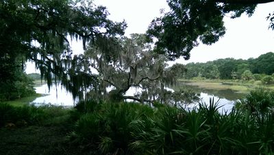
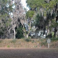
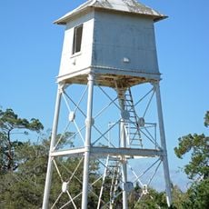
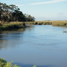
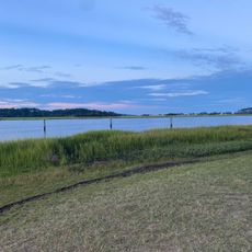
St. Catherines Island is a historic site on Georgia's coast featuring marshlands, forests, and sandy beaches. The island contains multiple archaeological sites including ancient settlement remains and foundations of earlier occupation.

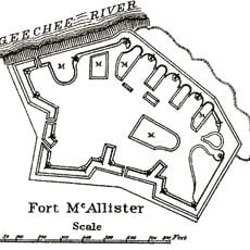
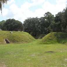
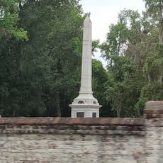
Spanish missionaries founded Santa Catalina de Guale settlement here in 1587, establishing the northernmost Atlantic post of their colonial effort. The mission thrived for roughly a century before being abandoned in 1680.

The island's name honors a Christian saint and reflects the spiritual role Spanish missionaries held here for nearly a century. Visitors can observe remnants of this past through archaeological sites scattered across the landscape.

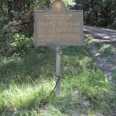
Access to the island is managed by a foundation and requires advance arrangements for research or educational programs. Visitors should plan ahead as available visits are limited and weather can affect travel to and from the site.

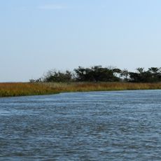
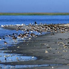
The island serves as a critical nesting ground where sea turtles return each year to lay their eggs. Roughly half the surface consists of salt marshes that harbor hundreds of bird species and support intricate coastal ecosystems.

The community of curious travelers

AroundUs brings together thousands of curated places, local tips, and hidden gems, enriched daily by 60,000 contributors worldwide.

Start exploring
Location
GPS coordinates
31.63056,-81.16014
Latest update
December 7, 2025 19:26
Around this place
Fort King George
United States of America

Fort King George

38.3 km
Skidaway Island State Park
United States of America

Skidaway Island State Park

36.9 km
Wassaw Island
United States of America

Wassaw Island

34.4 km
Blackbeard Island National Wildlife Refuge
United States of America

Blackbeard Island National Wildlife Refuge

16.3 km
Harris Neck National Wildlife Refuge
United States of America

Harris Neck National Wildlife Refuge

10.1 km
Bethesda Academy
United States of America

Bethesda Academy

37.1 km
Fort McAllister
United States of America

Fort McAllister

29.2 km
Fort Morris
United States of America

Fort Morris

19.1 km
Fort McAllister Historic Park
United States of America

Fort McAllister Historic Park

28.2 km
Fort Morris Historic Site
United States of America

Fort Morris Historic Site

18.9 km
Wolf Island National Wildlife Refuge
United States of America

Wolf Island National Wildlife Refuge

34 km
Gray's Reef National Marine Sanctuary
United States of America

Gray's Reef National Marine Sanctuary

33.5 km
Sapelo Island Light
United States of America

Sapelo Island Light

29.1 km
Dorchester Academy
United States of America

Dorchester Academy

34.6 km
Wild Heron
United States of America

Wild Heron

38.3 km
Ashantilly
United States of America

Ashantilly

36.7 km
Midway Historic District
United States of America

Midway Historic District

32 km
Fort McAllister
United States of America

Fort McAllister

29.2 km
Kilkenny
United States of America

Kilkenny

18.2 km
Sapelo Island Range Front Light
United States of America

Sapelo Island Range Front Light

29.3 km
Duplin River
United States of America

Duplin River

27.5 km
West Darien Historic District
United States of America

West Darien Historic District

38.9 km
Bryan Neck Presbyterian Church
United States of America

Bryan Neck Presbyterian Church

25.4 km
Stewart–Screven Monument
United States of America

Stewart–Screven Monument

32.3 km
Woodmanston Site
United States of America

Woodmanston Site

30.6 km
Vernon Square-Columbus Square Historic District
United States of America

Vernon Square-Columbus Square Historic District

38.9 km
Butter Bean Beach
United States of America

Butter Bean Beach

36.3 km
Richmond Hill Plantation (Richmond Hill, Georgia)
United States of America

Richmond Hill Plantation (Richmond Hill, Georgia)

34.5 km
Show the full map
« St. Catherines Island - Historic district in Liberty County, Georgia, US » is provided by Around Us (aroundus.com). Images and texts are derived from Wikimedia project under a Creative Commons license. You are allowed to copy, distribute, and modify copies of this page, under the conditions set by the license, as long as this note is clearly visible.

Discover hidden gems everywhere you go!

From secret cafés to breathtaking viewpoints, skip the crowded tourist spots and find places that match your style. Our app makes it easy with voice search, smart filtering, route optimization, and insider tips from travelers worldwide. Download now for the complete mobile experience.

Around Us App Screenshot

A unique approach to discovering new places

Le Figaro

All the places worth exploring

France Info

A tailor-made excursion in just a few clicks

20 Minutes

Around Us
Travel Guide & Maps
Download

Send to your phone

QR Code
1

Open the camera app on your mobile.

2

Point at the QR code with your camera. A notification will appear.

3

Tap the notification to open the link.