Enable Location

We need your location to show you interesting places around you

Discover nearby places

Find interesting locations and hidden gems around you

Precise directions

Get accurate directions and distances to places

Your location is never shared with other users. It's only used when you tap the location button.

Gavilan Peak

Log in to your account

Start exploring — it's free

Trusted by 61,558 travelers worldwide

Continue with Google
Continue with Apple
or

We will send you a code to connect

By continuing, you accept our Terms and Conditions and our Privacy Policy

Check your inbox

We've sent a pincode in your inbox. Please enter the code below.

Gavilan Peak

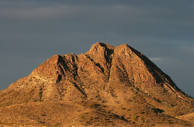
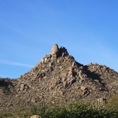
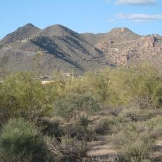
Gavilan Peak, Mountain summit in Maricopa County, Arizona.

Description

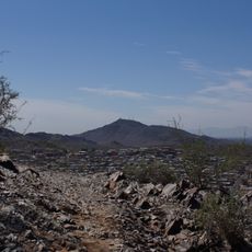
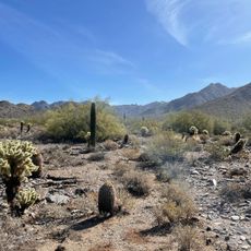
Gavilan Peak is a mountain summit in Maricopa County, Arizona, rising to about 2,980 feet with steep slopes and multiple climbing routes available. The rocky peak can be approached from different directions, each offering varying levels of difficulty for hikers.

History

The peak received its name during the 1880s, a period when the Arizona region experienced conflicts between American military units and local groups. The naming reflects the complex history of this turbulent era in the American West.

Culture

The name Gavilan comes from Spanish and refers to the hawks that live on the mountain slopes, birds that people in the area have long observed.

Practical

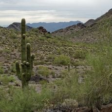
Access to the summit requires permission from landowners since the area is private property with limited entry points. It is best to clarify access conditions in advance and bring appropriate hiking gear for mountain terrain.

Did you know?

Near the peak lies the Starflash Ranch, which gained attention in 1997 when authorities discovered illegal explosive stockpiles during a federal investigation. This unusual event remains a lesser-known aspect of the local area's history.

Location
GPS coordinates
33.90698,-112.12405
Latest update
December 14, 2025 09:44

AroundUs brings together thousands of curated places, local tips, and hidden gems, enriched daily by 60,000 contributors worldwide. Discover all places nearby (Maricopa County).

Around this place
Lake Pleasant Regional Park
United States of America

Lake Pleasant Regional Park

13.4 km
Musical Instrument Museum
United States of America

Musical Instrument Museum

29.9 km
Wet'n'Wild Phoenix
United States of America

Wet'n'Wild Phoenix

23.6 km
Anthem Veterans Memorial
United States of America

Anthem Veterans Memorial

5 km
Castles N' Coasters
United States of America

Castles N' Coasters

37.3 km
Pinnacle Peak
United States of America

Pinnacle Peak

31.2 km
Phoenix Mountain Preserve
United States of America

Phoenix Mountain Preserve

37.8 km
Black Mountain
United States of America

Black Mountain

19.7 km
Martin Auto Museum
United States of America

Martin Auto Museum

28.9 km
Phoenix Arizona Temple
United States of America

Phoenix Arizona Temple

23.6 km
Horsethief Basin Lake
United States of America

Horsethief Basin Lake

32.7 km
Pioneer Living History Village
United States of America

Pioneer Living History Village

10.1 km
Deer Valley Petroglyph Preserve
United States of America

Deer Valley Petroglyph Preserve

24.9 km
Desert Storm
United States of America

Desert Storm

37.3 km
Sahuaro Ranch
United States of America

Sahuaro Ranch

37.3 km
Congregation Beth Israel
United States of America

Congregation Beth Israel

24.7 km
North Mountain Park
United States of America

North Mountain Park

36.1 km
Gateway Trailhead - McDowell Sonoran Preserve

Gateway Trailhead - McDowell Sonoran Preserve

37.8 km
Pinnacle Peak Park
United States of America

Pinnacle Peak Park

31.4 km
Cave Creek Museum
United States of America

Cave Creek Museum

18.4 km
Glendale Veterans War Memorial
United States of America

Glendale Veterans War Memorial

37.1 km
Copper Creek Guard Station
United States of America

Copper Creek Guard Station

36.8 km
Pioneer Arizona Living History Museum
United States of America

Pioneer Arizona Living History Museum

10 km
Peoria Theatre
United States of America

Peoria Theatre

37.9 km
Monterra at WestWorld
United States of America

Monterra at WestWorld

37.6 km
Glendale Main Library
United States of America

Glendale Main Library

37.1 km
Agua Fria River Bridge
United States of America

Agua Fria River Bridge

37.3 km
Maggie Mine Bridge
United States of America

Maggie Mine Bridge

18.6 km
Show the full map
« Gavilan Peak - Mountain summit in Maricopa County, Arizona » is provided by Around Us (aroundus.com). Images and texts are derived from Wikimedia project under a Creative Commons license. You are allowed to copy, distribute, and modify copies of this page, under the conditions set by the license, as long as this note is clearly visible.

Discover hidden gems everywhere you go!

From secret cafés to breathtaking viewpoints, skip the crowded tourist spots and find places that match your style. Our app makes it easy with voice search, smart filtering, route optimization, and insider tips from travelers worldwide. Download now for the complete mobile experience.

Around Us App Screenshot

A unique approach to discovering new places

Le Figaro

All the places worth exploring

France Info

A tailor-made excursion in just a few clicks

20 Minutes

Around Us
Travel Guide & Maps
Download

Send to your phone

QR Code
1

Open the camera app on your mobile.

2

Point at the QR code with your camera. A notification will appear.

3

Tap the notification to open the link.