Enable Location

We need your location to show you interesting places around you

Discover nearby places

Find interesting locations and hidden gems around you

Precise directions

Get accurate directions and distances to places

Your location is never shared with other users. It's only used when you tap the location button.

Tecate Peak

Log in to your account

Save your favorite places
Create custom travel routes
Rate and review places
Access the full interactive map
Continue with Google
Continue with Apple
Continue with email
By continuing, you accept our Terms and Conditions and our Privacy Policy
Create an account
Add to collection
Map
Suggest a change
Share

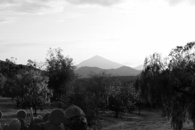
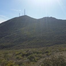
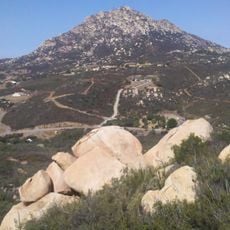
Tecate Peak, Mountain summit in San Diego County, US.

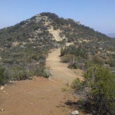
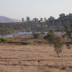
Tecate Peak is a mountain summit in San Diego County near the Mexican border, rising to 1,184 meters above sea level. From the top you can see across both California and Baja California.

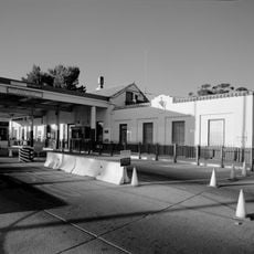
The peak has served as a border marker between the United States and Mexico since the international boundary was established in this region. This role makes the mountain historically important to the border area.

The peak is called Kuuchamaa by the Kumeyaay people and remains a sacred place in their cultural traditions today. Visitors can sense the spiritual importance of this location, which continues to hold meaning for the local indigenous community.

The summit is accessible via maintained hiking trails that start from a designated parking area and lead to the top. It is important to prepare for changing weather conditions and challenging terrain.

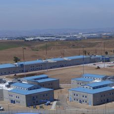
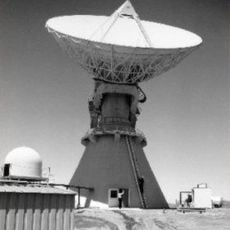
The mountain hosts communication towers and border patrol facilities that are actively used for monitoring the border. These modern structures contrast with the mountain's long history as a spiritual place.

Location: San Diego County

GPS coordinates: 32.57951,-116.68881

Latest update: December 14, 2025 09:45

Photos
Around this place
Richard J. Donovan Correctional Facility
United States of America

Richard J. Donovan Correctional Facility

22.9 km
Cross Border Xpress
United States of America

Cross Border Xpress

27 km
North Island Credit Union Amphitheatre
United States of America

North Island Credit Union Amphitheatre

29.8 km
Viejas Casino
United States of America

Viejas Casino

29.2 km
Skyline Church
United States of America

Skyline Church

30.6 km
Lower Otay Reservoir
United States of America

Lower Otay Reservoir

22.7 km
The Trompo Interactive Museum
Mexico

The Trompo Interactive Museum

25.2 km
Otay Mountain
United States of America

Otay Mountain

14.7 km
Pine Valley Creek Bridge
United States of America

Pine Valley Creek Bridge

29.7 km
San Miguel Mountain
United States of America

San Miguel Mountain

26.6 km
Tijuana México Temple
Mexico

Tijuana México Temple

24.6 km
Sweetwater Reservoir
United States of America

Sweetwater Reservoir

30.9 km
Mexico

Auditorio Fausto Gutierrez Moreno

29.3 km
Hospital Angeles Tijuana
Mexico

Hospital Angeles Tijuana

30.7 km
Barrett Dam
United States of America

Barrett Dam

11.1 km
Loveland Dam
United States of America

Loveland Dam

24.6 km
La Posta Astro-Geophysical Observatory
United States of America

La Posta Astro-Geophysical Observatory

26.1 km
Lyons Peak
United States of America

Lyons Peak

15.3 km
McGinty Mountain
United States of America

McGinty Mountain

25.1 km
Savage Dam
United States of America

Savage Dam

22.4 km
Morena Reservoir
United States of America

Morena Reservoir

18.8 km
Pacific Southwest Railway Museum Association
United States of America

Pacific Southwest Railway Museum Association

20.7 km
Estación de Inspección de los Estados Unidos-Tecate
United States of America

Estación de Inspección de los Estados Unidos-Tecate

5.8 km
Jardín Ahorrador de Agua en el Cuyamaca College
United States of America

Jardín Ahorrador de Agua en el Cuyamaca College

29.8 km
South Bay Botanic Gardens
United States of America

South Bay Botanic Gardens

29.6 km
Museum
United States of America

Museum

29.8 km
Amber Interactive Center
United States of America

Amber Interactive Center

25.5 km
Cine Zaragoza
Mexico

Cine Zaragoza

23.4 km
Show the full map
Reviews

Visited this place? Tap the stars to rate it and share your experience / photos with the community! Try now! You can cancel it anytime.

« Tecate Peak - Mountain summit in San Diego County, US » is provided by Around Us (aroundus.com). Images and texts are derived from Wikimedia project under a Creative Commons license. You are allowed to copy, distribute, and modify copies of this page, under the conditions set by the license, as long as this note is clearly visible.

Discover hidden gems everywhere you go!

From secret cafés to breathtaking viewpoints, skip the crowded tourist spots and find places that match your style. Our app makes it easy with voice search, smart filtering, route optimization, and insider tips from travelers worldwide. Download now for the complete mobile experience.

Around Us App Screenshot

A unique approach to discovering new places

Le Figaro

All the places worth exploring

France Info

A tailor-made excursion in just a few clicks

20 Minutes