Chest opened
+${chestReward.xp} XP
Explorer
NOUVEAU ×${chestReward.collectible.quantity}
tapez pour fermer
Chest locked

Open chests in the app

Around Us is built for your phone — chests unlock when you walk, explore and capture nearby places.

Enable Location

We need your location to show you interesting places around you

Discover nearby places

Find interesting locations and hidden gems around you

Precise directions

Get accurate directions and distances to places

Your location is never shared with other users. It's only used when you tap the location button.

Log in to your account

Start exploring — it's free

Trusted by 72,977 travelers worldwide

Continue with Google
Continue with Apple
or

We will send you a code to connect

By continuing, you accept our Terms and Conditions and our Privacy Policy

Check your inbox

We've sent a pincode in your inbox. Please enter the code below.

Black Island, Georgia
Discussion Reviews Photo
1.4k Popularity

Black Island, Georgia, Tidal island in McIntosh County, Georgia, US

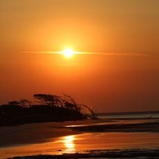
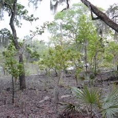
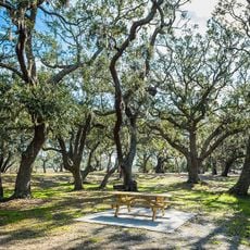
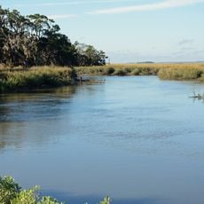
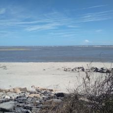
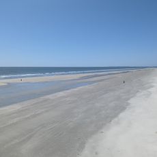
Black Island is a tidal island off the Georgia coast in McIntosh County. Dense native forests and extensive marsh areas make up most of the landscape, interrupted by sandy and muddy shores.

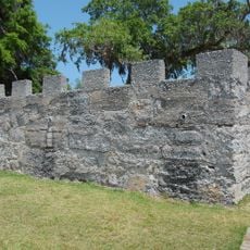
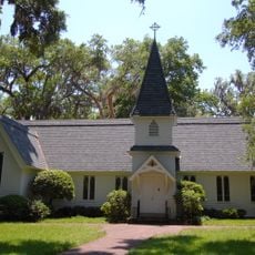
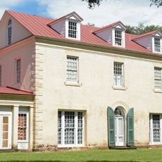
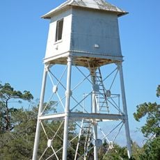
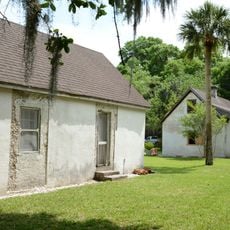
The island once served as a strategic lookout point for Fort King George during colonial times. It later became a private hunting preserve owned by R. J. Reynolds Jr., shaping its role in the region's past.

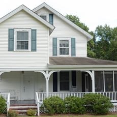
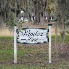
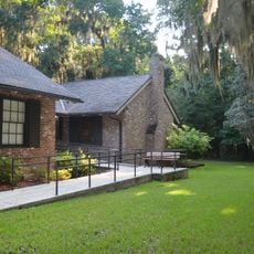
The private residential community on Black Island maintains its exclusivity through controlled access and gated entrances, preserving the natural environment.

Access to the island is tied to low tide periods when natural pathways to the mainland appear as exposed sand and mud flatten out. Planning your visit around tidal cycles and weather conditions helps ensure a safe and successful trip.

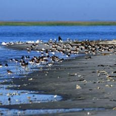
The island's tidal rhythms reshape its accessible landscape each day as water levels reveal and hide potential walking routes. This constant shift influences how local wildlife and seabirds make use of the mudflats and shallow waters.

The community of curious travelers

AroundUs brings together thousands of curated places, local tips, and hidden gems, enriched daily by 60,000 contributors worldwide.

Start exploring
GPS coordinates
31.37080,-81.40153
Latest update
December 14, 2025 17:04
Around this place
Igbo Landing Historic Site
United States of America

Igbo Landing Historic Site

20.5 km
Fort Frederica National Monument
United States of America

Fort Frederica National Monument

16.5 km
Fort King George
United States of America

Fort King George

1.6 km
Butler Island Plantation
United States of America

Butler Island Plantation

4.6 km
Hofwyl-Broadfield Plantation
United States of America

Hofwyl-Broadfield Plantation

9.2 km
Blackbeard Island National Wildlife Refuge
United States of America

Blackbeard Island National Wildlife Refuge

22.4 km
Wolf Island National Wildlife Refuge
United States of America

Wolf Island National Wildlife Refuge

11.5 km
Fort Barrington
United States of America

Fort Barrington

23.8 km
Sapelo Island Light
United States of America

Sapelo Island Light

11.3 km
Christ Church
United States of America

Christ Church

16.8 km
Massengale Beach
United States of America

Massengale Beach

25.8 km
Ashantilly
United States of America

Ashantilly

1.6 km
The King and Prince Beach & Golf Resort
United States of America

The King and Prince Beach & Golf Resort

25.9 km
Sapelo Island Range Front Light
United States of America

Sapelo Island Range Front Light

11.4 km
Duplin River
United States of America

Duplin River

10.8 km
St. Cyprian's Episcopal Church
United States of America

St. Cyprian's Episcopal Church

2.9 km
Ballard School
United States of America

Ballard School

21 km
Old Glynn County Courthouse
United States of America

Old Glynn County Courthouse

25.8 km
St. Andrew's Episcopal Church
United States of America

St. Andrew's Episcopal Church

2.9 km
West Darien Historic District
United States of America

West Darien Historic District

3.4 km
Colored Memorial School and Risley High School
United States of America

Colored Memorial School and Risley High School

25.4 km
Needwood Baptist Church and School
United States of America

Needwood Baptist Church and School

10.6 km
Vernon Square-Columbus Square Historic District
United States of America

Vernon Square-Columbus Square Historic District

2.9 km
Windsor Park Historic District
United States of America

Windsor Park Historic District

25.8 km
Fort Frederica Visitor Center
United States of America

Fort Frederica Visitor Center

16.5 km
Sea Island Beach
United States of America

Sea Island Beach

21.1 km
Nanny Goat Beach
United States of America

Nanny Goat Beach

13.6 km
Hamilton Plantation Slave Cabins
United States of America

Hamilton Plantation Slave Cabins

22.2 km
Show the full map
Reviews
Share your experience

No review yet

Discussions
Start a discussion...

No discussion yet

« Black Island, Georgia - Tidal island in McIntosh County, Georgia, US » is provided by Around Us (aroundus.com). Images and texts are derived from Wikimedia project under a Creative Commons license. You are allowed to copy, distribute, and modify copies of this page, under the conditions set by the license, as long as this note is clearly visible.

Discover hidden gems everywhere you go!

From secret cafés to breathtaking viewpoints, skip the crowded tourist spots and find places that match your style. Our app makes it easy with voice search, smart filtering, route optimization, and insider tips from travelers worldwide. Download now for the complete mobile experience.

Around Us App Screenshot

A unique approach to discovering new places

Le Figaro

All the places worth exploring

France Info

A tailor-made excursion in just a few clicks

20 Minutes

Around Us
Travel Guide & Maps
Download

Send to your phone

QR Code
1

Open the camera app on your mobile.

2

Point at the QR code with your camera. A notification will appear.

3

Tap the notification to open the link.