
El Ghabra, commune and town in Mauritania
Location: Barkewol or Aftout Department
Location: Assaba Region
GPS coordinates: 16.65000,-12.66667
Latest update: March 30, 2025 22:18

Great Mosque of Touba
396.1 km
Niokolo-Koba National Park
408.1 km
Diama Dam
403.1 km
Djoudj National Bird Sanctuary
383.6 km
Stade Olympique
388 km
Biffeche
400.2 km
Aoukar Depression
368.5 km
MacCarthy Island
413.8 km
Terjit
404.1 km
Mosque Saudique
386.6 km
Gouina Falls
338 km
National Museum of Mauritania
386.1 km
National Library of Mauritania
386.1 km
Félou Falls
292 km
Talari Gorges
367.7 km
Cercles de pierres de Wassu
404.8 km
Usine des eaux de Mbakhana
400.1 km
Mosque Marocaine
386.3 km
Tata of Koniakary
298.3 km
Ibn Abbas Mosque
386.4 km
Bird Island
407.4 km
Eisenbahnbrücke von Kidira
248.7 km
Straßenbrücke von Kidira
249.3 km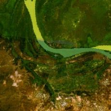
Isla Pangon
412.5 km
Isla Pasari
361.6 km
Fort de Médine
288.8 km
Stade Bassi Coulibaly
278.9 km
Dream Land Ocean
396 kmReviews
Visited this place? Tap the stars to rate it and share your experience / photos with the community! Try now! You can cancel it anytime.
Discover hidden gems everywhere you go!
From secret cafés to breathtaking viewpoints, skip the crowded tourist spots and find places that match your style. Our app makes it easy with voice search, smart filtering, route optimization, and insider tips from travelers worldwide. Download now for the complete mobile experience.

A unique approach to discovering new places❞
— Le Figaro
All the places worth exploring❞
— France Info
A tailor-made excursion in just a few clicks❞
— 20 Minutes