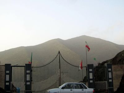
Iran–Iraq border, international border
The Iran-Iraq border is a land and partial maritime boundary between Iran and Iraq, running from the Turkish tripoint in the north down to the Persian Gulf in the south, crossing mountains, rivers, and marshlands along the way. Several official crossing points are spread along its length, each serving a mix of trade, travel, and pilgrimage traffic.
The border was first drawn in 1639 by the Treaty of Zuhab, signed between the Ottoman and Safavid empires after years of conflict. Disputes over the Shatt al-Arab waterway, which forms part of the southern boundary, remained unresolved and played a central role in triggering the war fought between 1980 and 1988.
The border is the main passage for pilgrims heading to holy sites in Iraq, especially during the Arba'een pilgrimage to Karbala. At crossings like Shalamcheh, the flow of people on foot, dressed in dark clothing and carrying flags, gives the area a rhythm unlike any ordinary border.
Travelers must cross at official points such as Mehran, Khosravi, or Shalamcheh, and conditions can vary a great deal from one crossing to another. It is worth checking the latest travel advisories before the trip, as some crossings are only open to certain nationalities or at specific times.
The Shatt al-Arab river, which marks the southern section of the border, has been disputed for so long that the exact line in the water has never been permanently agreed upon by both sides. Even after the war that ended in 1988, the two countries never fully settled where the border runs through this waterway.
The community of curious travelers
AroundUs brings together thousands of curated places, local tips, and hidden gems, enriched daily by 60,000 contributors worldwide.