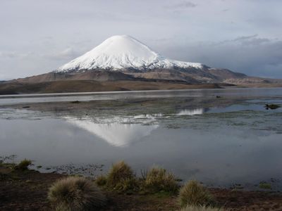
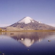
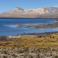
Chungará Lake, High mountain lake in Arica y Parinacota Region, Chile.
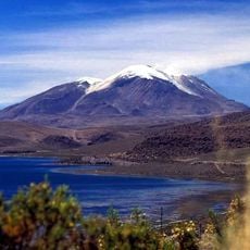
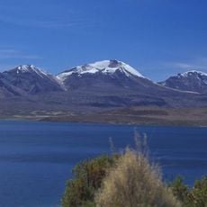
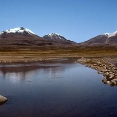
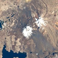
Chungará Lake sits within Lauca National Park at 4,517 meters elevation, a substantial body of water surrounded by snow-capped volcanic peaks. The lake reaches depths of 33 meters and occupies a significant portion of the protected park's landscape.
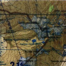
The lake formed between 8,000 and 17,000 years ago when debris from the Parinacota volcano's collapse dammed the Lauca River. This geological event shaped the landscape that visitors see today in this mountain region.
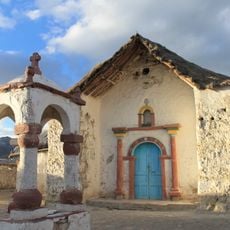
The lake's name comes from the Aymara language, where Chunkha means bearded, reflecting indigenous roots in this high mountain region. Local communities have long recognized this water source as central to their way of life in the altiplano.
Fill your fuel tank in Arica before heading out, as no gas stations exist along the route to the lake. Take time to acclimatize to the high altitude and bring warm layers, as weather conditions change rapidly at this elevation.
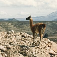
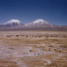
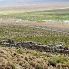
The lake serves as a rare refuge for Chilean flamingos and harbors wild guanacos, vicuñas, and pumas at this extreme altitude. These animals surprise visitors who expect such high mountain elevations to be completely barren.
Location: Arica y Parinacota Region
Elevation above the sea: 4,570 m
GPS coordinates: -18.24250,-69.15250
Latest update: December 20, 2025 13:40
Chile stretches over 2,670 miles (4,300 kilometers) from north to south, crossing some of South America's most varied landscapes. The north features the Atacama Desert with its salt flats, geysers at El Tatio, and astronomical observatories such as Paranal. The coastal city of Valparaíso displays...
Lauca National Park
15 km
Parinacota
8.9 km
Guallatiri, Chile
20.9 km
Pomerape
13 km
Acotango
19.1 km
Parinacota church
13 km
Volcán Capurata
22.4 kmChoquelimpie
15 km
Uqi Uqini
15.1 km
Umurata
15.4 km
Tambo de Chungará
5.7 km
Qullqi Warani
21.2 km
Phaq'u Q'awa (Sajama)
18.9 km
Kunturiri
23.8 kmPhaq'u Q'awa (La Paz)
24.5 km
Wila Qullu (Curahuara de Carangas)
16 kmChachakumani
21.2 km
Pueblo de Parinacota
13 kmViscachas
23.9 kmScenic viewpoint
24 kmViscachas
22.1 kmHorned coot
21.7 kmMirador Huallaqueri
20.5 kmCavario de Parinacota
12.9 kmMirador deLaguna Cotacotani y Volcán Parinacota
9.7 kmLaguna Cotacotani
8.5 kmScenic viewpoint
19.2 kmScenic viewpoint
2.7 kmVisited this place? Tap the stars to rate it and share your experience / photos with the community! Try now! You can cancel it anytime.
Discover hidden gems everywhere you go!
From secret cafés to breathtaking viewpoints, skip the crowded tourist spots and find places that match your style. Our app makes it easy with voice search, smart filtering, route optimization, and insider tips from travelers worldwide. Download now for the complete mobile experience.
A unique approach to discovering new places❞
— Le Figaro
All the places worth exploring❞
— France Info
A tailor-made excursion in just a few clicks❞
— 20 Minutes