Enable Location

We need your location to show you interesting places around you

Discover nearby places

Find interesting locations and hidden gems around you

Precise directions

Get accurate directions and distances to places

Your location is never shared with other users. It's only used when you tap the location button.

Pomerape

Log in to your account

Start exploring — it's free

Trusted by 66,177 travelers worldwide

Continue with Google
Continue with Apple
or

We will send you a code to connect

By continuing, you accept our Terms and Conditions and our Privacy Policy

Check your inbox

We've sent a pincode in your inbox. Please enter the code below.

Pomerape
Discussion Reviews 1 Photos
4.5k Popularity

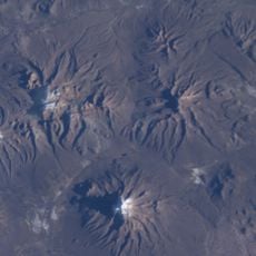
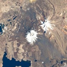
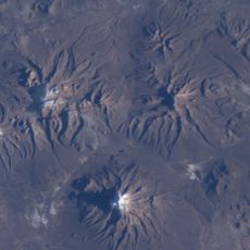
Pomerape, Stratovolcano at Chilean-Bolivian border

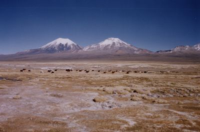
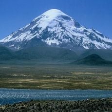
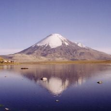
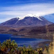
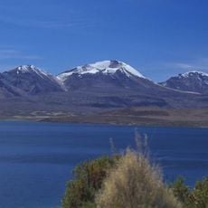
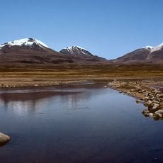
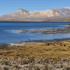
Pomerape is a stratovolcano sitting on the border between Chile and Bolivia, forming a symmetrical cone with steep slopes that reaches about 6,282 meters. It stands alongside the neighboring Parinacota volcano, and together they make up the Payachata volcanic complex on the Altiplano.

Pomerape formed through repeated eruptions over a very long period, with its last known volcanic activity dating back roughly 106,000 years. The cone shape visible today is the result of this long sequence of lava flows and ash deposits building up over time.

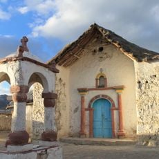
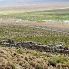
The Aymara people of the region refer to Pomerape and its neighbor Parinacota together as the Payachata, a name that roughly means "twin peaks." For local communities, these two summits are considered sacred places tied closely to their identity and oral traditions.

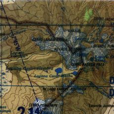
The most common route to the top follows the east ridge, with a base camp set up at the col between Pomerape and Parinacota. The dry season brings the most stable weather conditions, so planning a climb during that period gives a better chance of a clear summit day.

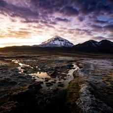
The northern face of Pomerape carries noticeably smaller glaciers than the other sides of the mountain, while the southern face presents steeper snow slopes that require more technical descents. This difference makes the two sides of the peak very different experiences for climbers approaching from each direction.

The community of curious travelers

AroundUs brings together thousands of curated places, local tips, and hidden gems, enriched daily by 60,000 contributors worldwide.

Start exploring
GPS coordinates
-18.12814,-69.12917
Latest update
March 3, 2026 08:12
Reviews
Share your experience

No review yet

Discussions
Start a discussion...

No discussion yet

« Pomerape - Stratovolcano at Chilean-Bolivian border » is provided by Around Us (aroundus.com). Images and texts are derived from Wikimedia project under a Creative Commons license. You are allowed to copy, distribute, and modify copies of this page, under the conditions set by the license, as long as this note is clearly visible.

Discover hidden gems everywhere you go!

From secret cafés to breathtaking viewpoints, skip the crowded tourist spots and find places that match your style. Our app makes it easy with voice search, smart filtering, route optimization, and insider tips from travelers worldwide. Download now for the complete mobile experience.

Around Us App Screenshot

A unique approach to discovering new places

Le Figaro

All the places worth exploring

France Info

A tailor-made excursion in just a few clicks

20 Minutes

Around Us
Travel Guide & Maps
Download

Send to your phone

QR Code
1

Open the camera app on your mobile.

2

Point at the QR code with your camera. A notification will appear.

3

Tap the notification to open the link.