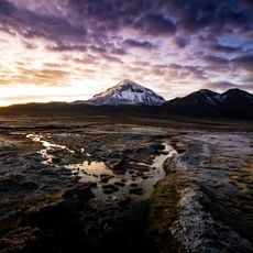
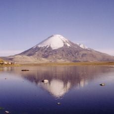
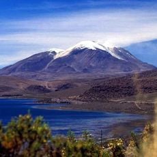
Nevado Sajama, Extinct stratovolcano in Sajama National Park, Bolivia
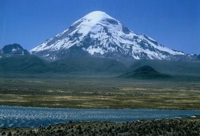
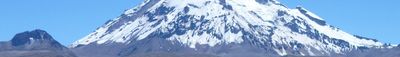
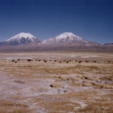
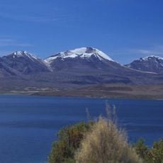
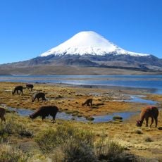
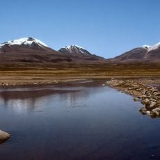
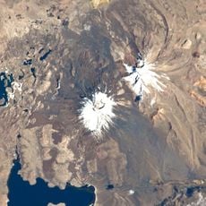
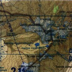
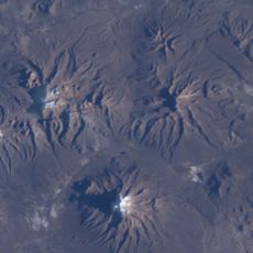
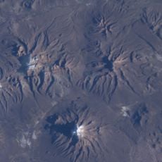
Nevado Sajama is an extinct stratovolcano in Sajama National Park, Bolivia, reaching 6,542 meters above sea level. Its cone-shaped summit carries several lava flows and permanent ice fields that begin around 5,600 meters elevation.
Joseph Prem and Wilfrid Kuehm reached the summit in August 1939 as the first climbers via the southeast flank. Later expeditions explored different routes and documented the volcanic structure built from andesite rock.
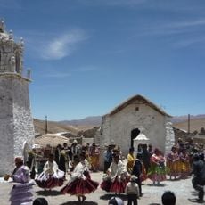
Local Aymara people refer to this peak as a sacred mountain and still perform offerings at its base. Visitors can see these ceremonial sites where families leave coca leaves and small tokens before climbing.
Most climbs take two to three days from the base village of Sajama and require acclimatization along with warm clothing for the ice fields. Crampons and ropes are necessary for the upper section where wind can become strong.
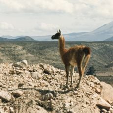
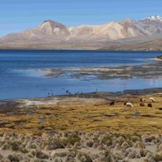
The queñoa forests on the lower slopes grow up to 5,200 meters elevation, forming the highest forest zone on Earth. These gnarled trees survive thanks to their thick bark and slow growth rate in the thin air.
Location: Sajama Province
Elevation above the sea: 6,542 m
Made from material: andesite
GPS coordinates: -18.10811,-68.88304
Latest update: December 5, 2025 22:25
Bolivia sits in the central Andes, linking mountain ranges, high plateau lands, and lowland rainforests in a landlocked country. The changes in altitude create different climate zones and landscapes, from snow-covered peaks to tropical vegetation. Many visitors start in La Paz, a city that clings to...
Sajama National Park
4.5 km
Lauca National Park
46.7 km
Sajama Lines
26 km
Parinacota
28.5 km
Guallatiri, Chile
41.1 km
Pomerape
26.1 km
Acotango
35.2 km
Parinacota church
42.1 km
Chua Chuani
20.1 km
Lauca
47 km
Volcán Capurata
38.3 km
Uqi Uqini
29 km
Mount Laram Q'awa
29.2 km
Suni Q'awa
28.7 km
Umurata
31.7 km
Tambo de Chungará
33.7 km
Qullqi Warani
20 km
Phaq'u Q'awa (Sajama)
19.8 km
Kunturiri
21.5 km
Iglesia de la Virgen de la Inmaculada Concepción de Guallatire
52 km
Jisk'a Kunturiri
18.2 km
Pukara (Pacajes)
35.2 km
Ch'uxña Quta (Pacajes)
27.4 km
Urqipi
37.4 km
Churi Willk'i
36.5 km
Wila Qullu (Curahuara de Carangas)
21.7 km
Pichaqa
33.3 km
Pumuta
16.9 kmVisited this place? Tap the stars to rate it and share your experience / photos with the community! Try now! You can cancel it anytime.
Discover hidden gems everywhere you go!
From secret cafés to breathtaking viewpoints, skip the crowded tourist spots and find places that match your style. Our app makes it easy with voice search, smart filtering, route optimization, and insider tips from travelers worldwide. Download now for the complete mobile experience.
A unique approach to discovering new places❞
— Le Figaro
All the places worth exploring❞
— France Info
A tailor-made excursion in just a few clicks❞
— 20 Minutes