Lauca National Park, National park in Parinacota Province, Chile.
Description
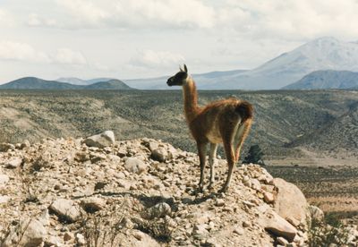
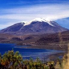
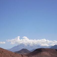
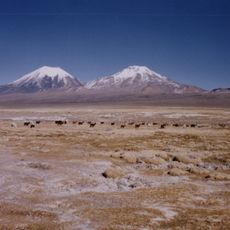
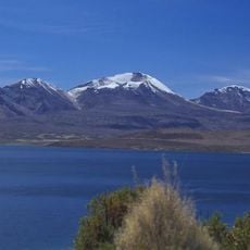
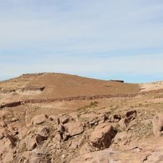
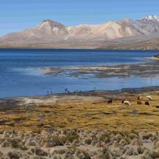
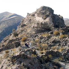
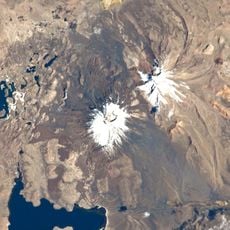
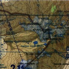
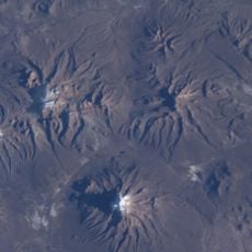
Lauca National Park is a nature reserve in the Andes between 3,200 and 6,342 meters (10,500 and 20,800 feet) elevation with volcanoes, lakes, and lagoons spread across 137,883 hectares (340,400 acres). The landscape shows dark volcanic terrain, high-altitude grasslands, and clear mountain waters shaped by geological forces.
History
The area was first established as a forest reserve in 1965 and became a national park in 1970. International recognition followed when it was designated a UNESCO Biosphere Reserve in 1981.
Culture
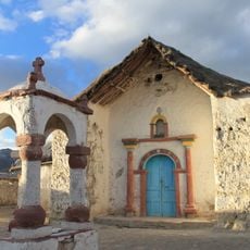
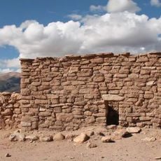
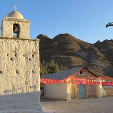
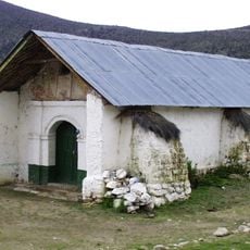
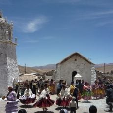
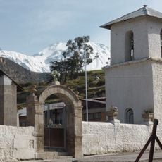
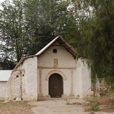
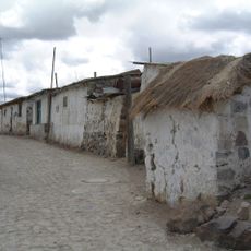
The Aymara communities who live in this region maintain their traditional practices and connection to the highlands. The village of Parinacota, within the park area, shows colonial-era buildings and a church that reflect indigenous and Spanish influences from centuries past.
Practical
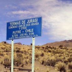
The park can be reached via the international highway CH-11 from Arica, with the town of Putre serving as the nearest supply point about 14 kilometers away. The thin mountain air and changing weather require proper acclimatization and suitable gear for high-altitude conditions.
Did you know?
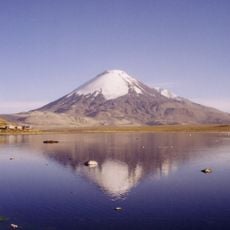
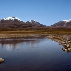
Lake Chungará sits at the base of the Payachata volcanoes and counts among the world's highest lakes. The water body supports over 130 bird species, including rare flamingos and Andean geese that gather on its shores.
AroundUs brings together thousands of curated places, local tips, and hidden gems, enriched daily by 60,000 contributors worldwide. Discover all places nearby (Provincia de Parinacota).
Chile stretches over 2,670 miles (4,300 kilometers) from north to south, crossing some of South America's most varied landscapes. The north features the Atacama Desert with its salt flats, geysers at El Tatio, and astronomical observatories such as Paranal. The coastal city of Valparaíso displays...
Inca road system
31.8 km
Parinacota
19.3 km
Guallatiri, Chile
27.3 km
Taapaca
28.6 km
Pomerape
23.1 km
Acotango
28.8 km
Parinacota church
7.7 km
Pukará de Copaquilla
39.6 km
Tambo de Zapahuira
35.8 km
Volcán Capurata
30.8 km
Mount Laram Q'awa
31.8 km
Uqi Uqini
27.5 km
Umurata
26.7 km
Pucará de Belén
35 km
Tambo de Chungará
16.7 km
Iglesia de San Santiago, Belén
32.5 km
Qullqi Warani
32.3 km
Phaq'u Q'awa (Sajama)
30.5 km
Iglesia de San Andrés Apostol de Pachama
30.8 km
Kunturiri
34 km
Iglesia de la Virgen de la Inmaculada Concepción de Guallatire
29.6 km
Pucará de Saxamar
38.8 km
Jisk'a Kunturiri
37.1 km
Iglesia de San Ildefonso, Putre
29.4 km
Wila Qullu (Curahuara de Carangas)
27.5 km
Iglesia de la Virgen de la Asunción de Ticnámar
41.3 km
Termes de Jurasi
24.1 km
Pueblo de Parinacota
7.7 kmDiscover hidden gems everywhere you go!
From secret cafés to breathtaking viewpoints, skip the crowded tourist spots and find places that match your style. Our app makes it easy with voice search, smart filtering, route optimization, and insider tips from travelers worldwide. Download now for the complete mobile experience.
A unique approach to discovering new places❞
— Le Figaro
All the places worth exploring❞
— France Info
A tailor-made excursion in just a few clicks❞
— 20 Minutes