Enable Location

We need your location to show you interesting places around you

Discover nearby places

Find interesting locations and hidden gems around you

Precise directions

Get accurate directions and distances to places

Your location is never shared with other users. It's only used when you tap the location button.

Lake Kari

Log in to your account

Start exploring — it's free

Trusted by 61,983 travelers worldwide

Continue with Google
Continue with Apple
or

We will send you a code to connect

By continuing, you accept our Terms and Conditions and our Privacy Policy

Check your inbox

We've sent a pincode in your inbox. Please enter the code below.

Lake Kari

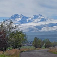
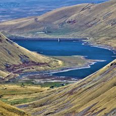
Lake Kari, High-altitude lake on Mount Aragats, Aragatsotn Region, Armenia.

Lake Kari rests at an elevation of approximately 10,449 feet (3,185 meters) on the slopes of Mount Aragats, covering about 0.046 square miles (0.12 square kilometers) with a maximum depth of 26 feet (8 meters) and perimeter of roughly 3,773 feet (1,150 meters).

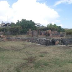
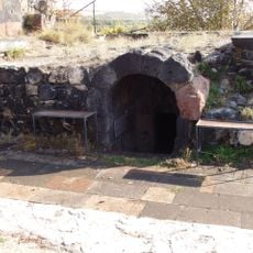
Historical accounts suggest that Lake Kari may have been created through human activity during the pre-Urartian period to serve irrigation needs, and in the 17th century, Catholicos Pilippos I directed efforts to divert its waters to the Amberd River through a canal that later vanished.

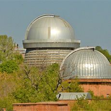
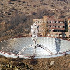
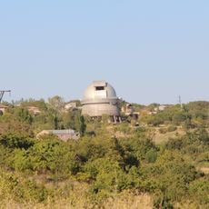
In 1943, physicists Abraham and Artem Alikhanyan established a cosmic ray research station adjacent to Lake Kari, which has contributed substantially to scientific studies of cosmic radiation and continues to operate today for ongoing research in high-altitude physics.

Access to Lake Kari is typically available through roads from Agarak village and a route connecting to the Armenian alphabet monument, though these roads remain closed during winter due to heavy snowfall that can persist into late May, making travel highly seasonal.

The lake remains frozen for approximately eight to nine months each year due to its extreme elevation, and despite the artificial introduction of Sevan trout in 1963, the fish displayed faster growth rates than their counterparts in Lake Sevan, revealing notable ecological adaptations.

The community of curious travelers

AroundUs brings together thousands of curated places, local tips, and hidden gems, enriched daily by 60,000 contributors worldwide.

Start exploring
Elevation above the sea
3,190 m
GPS coordinates
40.47355,44.18109
Latest update
November 28, 2025 15:21
Visit Armenia: medieval monasteries, archaeological sites, and mountain scenery

Armenia hosts a collection of archaeological, religious, and natural sites that testify to several millennia of rich human occupation. The country's mountainous territory features medieval monasteries perched on rocky plateaus, such as Tatev which overlooks gorges from 5,250 feet (1600 meters), or...

« Lake Kari - High-altitude lake on Mount Aragats, Aragatsotn Region, Armenia » is provided by Around Us (aroundus.com). Images and texts are derived from Wikimedia project under a Creative Commons license. You are allowed to copy, distribute, and modify copies of this page, under the conditions set by the license, as long as this note is clearly visible.

Discover hidden gems everywhere you go!

From secret cafés to breathtaking viewpoints, skip the crowded tourist spots and find places that match your style. Our app makes it easy with voice search, smart filtering, route optimization, and insider tips from travelers worldwide. Download now for the complete mobile experience.

Around Us App Screenshot

A unique approach to discovering new places

Le Figaro

All the places worth exploring

France Info

A tailor-made excursion in just a few clicks

20 Minutes

Around Us
Travel Guide & Maps
Download

Send to your phone

QR Code
1

Open the camera app on your mobile.

2

Point at the QR code with your camera. A notification will appear.

3

Tap the notification to open the link.