Curacautín, Administrative commune in Malleco Province, Chile
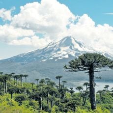
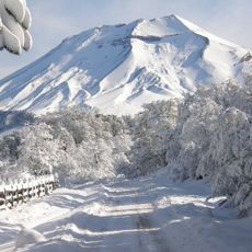
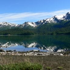
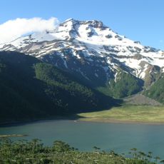
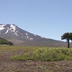
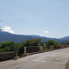
Curacautín is a commune in Malleco Province located at approximately 540 meters elevation. The town sits in a valley surrounded by three volcanoes that shape its distinctive landscape and define its geographical character.
Gregorio Urrutia established the fort of Curacautín in 1882, marking the start of organized settlement in this region. This founding was part of the broader expansion into southern territories during that period.
The name Curacautín comes from the Mapudungun language and refers to Gathering Stone, reflecting the deep indigenous roots of this region. Local communities continue to practice traditional customs, and Mapuche settlements remain an integral part of the surrounding area.
The town is reachable by bus from Temuco in roughly two to three hours, with regular connections departing from the main terminal. It is helpful to check current schedules beforehand, as frequency can vary depending on the season.
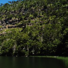
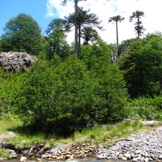
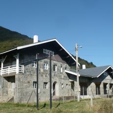
The Curacautín Valley was home to forestry operations that produced goods certified by major international sustainability standards. This economic activity brought regional recognition to the area.
Location: Malleco Province
Inception: March 12, 1882
Elevation above the sea: 542 m
Website: http://mcuracautin.cl
GPS coordinates: -38.43333,-71.88333
Latest update: December 23, 2025 10:41
Photo license: CC BY 3.0
Conguillío National Park
33 km
Las Raíces Tunnel
33.3 km
Lonquimay
26.3 km
Tolhuaca National Park
25.6 km
Sierra Nevada
30.3 km
Tolhuaca
24.3 km
Malalcahuello National Reserve
27.2 km
Nalcas National Reserve
45.9 kmMalalcahuello-Nalcas
30.5 km
Cordillera de Las Raíces
37.6 kmCerro La Mona
26.4 kmCerro Rampahuen
12.1 kmCerro Nueve
36.6 kmCerro Casa de Piedra
21.6 kmVolcán Trolguaca
24.4 km
Estación Ferroviaria El Manzanar
16.8 kmAraucaria Madre Milenaria
29.7 kmCentro De Ski Corralco
29.1 kmCima cuesta las raíces
36.3 kmCentro de esquí
37.8 kmRukaJaus
1.4 kmEntrada Parque Nacional Conguillio
22.1 kmAraucaria Milenaria
29.1 kmPatachoike Lookout
35.7 kmCaballo de Malalcahuello
26.7 kmSenderos Laguna Negra Don Noro
17.2 kmCaballo en acero
1.7 kmArtesanía en Pieles Curacautín
1.6 kmVisited this place? Tap the stars to rate it and share your experience / photos with the community! Try now! You can cancel it anytime.
Discover hidden gems everywhere you go!
From secret cafés to breathtaking viewpoints, skip the crowded tourist spots and find places that match your style. Our app makes it easy with voice search, smart filtering, route optimization, and insider tips from travelers worldwide. Download now for the complete mobile experience.
A unique approach to discovering new places❞
— Le Figaro
All the places worth exploring❞
— France Info
A tailor-made excursion in just a few clicks❞
— 20 Minutes