Enable Location

We need your location to show you interesting places around you

Discover nearby places

Find interesting locations and hidden gems around you

Precise directions

Get accurate directions and distances to places

Your location is never shared with other users. It's only used when you tap the location button.

Awkiwatu

Log in to your account

Start exploring — it's free

Trusted by 61,594 travelers worldwide

Continue with Google
Continue with Apple
or

We will send you a code to connect

By continuing, you accept our Terms and Conditions and our Privacy Policy

Check your inbox

We've sent a pincode in your inbox. Please enter the code below.

Awkiwatu

Awkiwatu, Volcanic formation in Paucar del Sara Sara Province, Peru.

Description

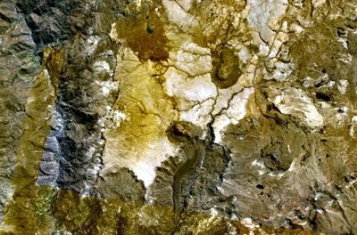
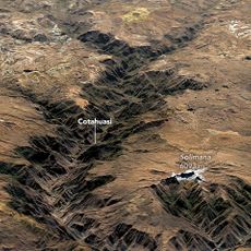
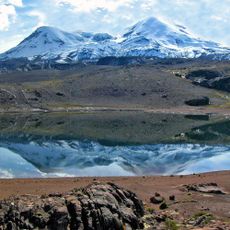
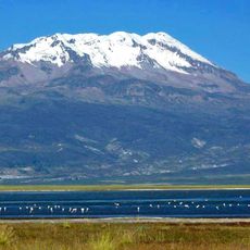
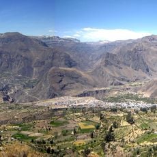
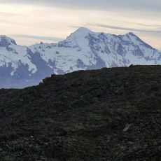
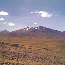
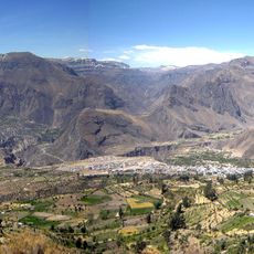
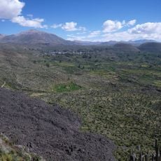
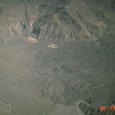
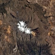
Awkiwatu is a volcanic mountain in Paucar del Sara Sara Province that rises to about 5000 meters elevation with a distinct cone shape. The formation developed on the southern margin of an older volcanic plateau and displays geological features typical of the high Andes.

History

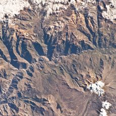
The Geophysical Institute of Peru began systematic monitoring activities at Awkiwatu in 2019 to document its geological features and any potential seismic activity. This monitoring program is part of a broader effort to track volcanic behavior across the region.

Culture

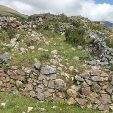
The communities living near this volcano have maintained a long-standing relationship with the mountain through local stories and knowledge passed down over generations. This connection reflects how the landscape shapes the identity and daily awareness of people in the region.

Practical

Visiting requires good preparation for high-altitude conditions and coordination with local authorities because of its remote mountain location. Travelers should expect rough weather and challenging terrain when planning a visit.

Did you know?

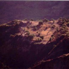
An ancient lava flow extends many kilometers southward from the crater and displays distinctive surface textures studied by volcanologists. These distinctive features provide clues about the mountain's eruptive past.

Elevation above the sea
4,980 m
Part of
Централноандийска планинска земя
GPS coordinates
-15.07278,-73.19028
Latest update
December 14, 2025 13:05

AroundUs brings together thousands of curated places, local tips, and hidden gems, enriched daily by 60,000 contributors worldwide. Discover all places nearby (Ayacucho Department).

« Awkiwatu - Volcanic formation in Paucar del Sara Sara Province, Peru » is provided by Around Us (aroundus.com). Images and texts are derived from Wikimedia project under a Creative Commons license. You are allowed to copy, distribute, and modify copies of this page, under the conditions set by the license, as long as this note is clearly visible.

Discover hidden gems everywhere you go!

From secret cafés to breathtaking viewpoints, skip the crowded tourist spots and find places that match your style. Our app makes it easy with voice search, smart filtering, route optimization, and insider tips from travelers worldwide. Download now for the complete mobile experience.

Around Us App Screenshot

A unique approach to discovering new places

Le Figaro

All the places worth exploring

France Info

A tailor-made excursion in just a few clicks

20 Minutes

Around Us
Travel Guide & Maps
Download

Send to your phone

QR Code
1

Open the camera app on your mobile.

2

Point at the QR code with your camera. A notification will appear.

3

Tap the notification to open the link.