Amazonas Department, Administrative division in southern Colombia
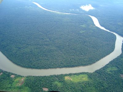
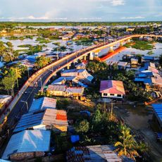
Amazonas Department is an administrative division in southern Colombia that extends across wide rainforest areas with numerous river channels and wetlands. The capital Leticia lies on the Amazon River at the border with Brazil and Peru and serves as the main urban center of the region.
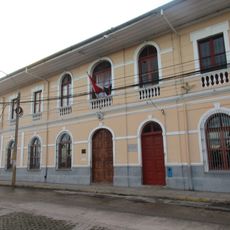
The territory belonged for a long time to the sparsely populated parts of Colombia until it was recognized as an independent department in the late 20th century. This change took place during the constitutional reorganization in the early 1990s.
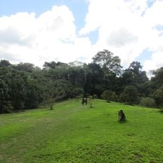
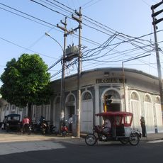
Names such as Leticia recall earlier Colombian figures, while several indigenous groups continue to speak their own languages and follow their customs in daily life. Visitors can see at markets and in small settlements how fishing and crafts are practiced using methods passed down over generations.
Travel within the department takes place mainly via waterways and the airport in Leticia, as continuous road connections are absent. Visitors planning to explore the region should expect high humidity and warm temperatures year-round.
The so-called Amazon Trapeze is a narrow strip of land that gives Colombia direct access to the Amazon and borders two other countries. Here three nations meet, giving the border region a special position.
Location: Colombia
Inception: 1993
Capital city: Leticia
Elevation above the sea: 97 m
Shares border with: Vaupés Department, Caquetá Department, Putumayo Department, Loreto Department, Amazonas
Website: http://amazonas.gov.co
GPS coordinates: -1.50000,-71.50000
Latest update: December 15, 2025 08:13
Chiribiquete National Park
284.8 km
Amacayacu National Park
263.9 km
Casa de Fierro
316.8 km
Puente Nanay
312.7 km
Complejo Turistico de Quistococha
329.1 km
Allpahuayo-Mishana National Reserve
354 km
Yaigojé-Apaporis National Park
148.5 kmCahuinarí National Natural Park
43.6 km
Cathedral of Iquitos
316.8 km
Ex Hotel Palace
316.8 kmParque nacional natural Río Puré
164.4 km
Centro histórico de Iquitos
314.6 km
Estadio Max Augustín
316.8 km
Santa Rosa Island
348.8 km
Tamshiyacu Tahuayo Regional Conservation Area
366 km
Casa Morey
316.4 kmAiro Pai Communal Reserve
385.7 km
Bellavista-Nanay
313 km
BAP América
314.9 km
Casa Pinasco
316.7 km
Antiguos Edificios del Seguro Social de Salud del Perú
316.7 kmHuimeki Communal Reserve
403.9 kmPilpintuwasi butterfly can and wildlife rescue center
315.5 km
Pampachica beach
319.6 km
Paraíso bridge
406.2 km
Casa Cohen
317.1 km
Museo Amazónico
317 kmAmpiyacu-Apayacu Regional Conservation Area
211.1 kmVisited this place? Tap the stars to rate it and share your experience / photos with the community! Try now! You can cancel it anytime.
Discover hidden gems everywhere you go!
From secret cafés to breathtaking viewpoints, skip the crowded tourist spots and find places that match your style. Our app makes it easy with voice search, smart filtering, route optimization, and insider tips from travelers worldwide. Download now for the complete mobile experience.
A unique approach to discovering new places❞
— Le Figaro
All the places worth exploring❞
— France Info
A tailor-made excursion in just a few clicks❞
— 20 Minutes