Rancho Queimado, Mountain municipality in Santa Catarina, Brazil
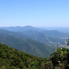
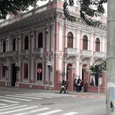
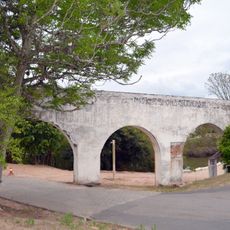
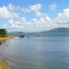
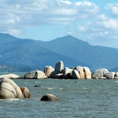
Rancho Queimado is a mountain municipality in southern Brazil's Santa Catarina state, situated at an elevation of roughly 800 meters. The terrain here is characterized by rolling hills and agricultural land spread across the countryside.
The municipality developed as an administrative division to serve the growing population in Santa Catarina's interior regions. Settlement in this mountain area grew gradually through farming and land use expansion.
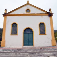
Residents here maintain strong community connections through local celebrations and traditions that mark the seasons. These gatherings form an important part of daily life in this small mountain town.
This location operates in the UTC-3 time zone and connects to nearby towns through a network of roads. Visitors should bring a vehicle or arrange local transportation, as it is a rural mountain setting without major public transit.
This area maintains a very low population density, preserving open landscapes and a sense of space throughout the region. Such an environment is fairly uncommon in many other settled parts of Brazil.
Location: Santa Catarina
Elevation above the sea: 810 m
Shares border with: Águas Mornas, Alfredo Wagner, Angelina, Anitápolis, Leoberto Leal
Website: http://ranchoqueimado.sc.gov.br
GPS coordinates: -27.67278,-49.02194
Latest update: December 7, 2025 20:44
Hercilio Luz Bridge
45.8 km
Colombo Salles Bridge
45.8 km
Pedro Ivo Campos bridge
45.8 km
Serra do Tabuleiro State Park
37.8 km
Mercado Público de Florianópolis
47 km
Fortaleza de Nossa Senhora da Conceição de Araçatuba
47.9 km
Santa Catarina's Historical Museum
47.3 km
Museu Homem do Sambaqui
47.1 km
Praia da Tapera
44.8 km
Forte de Santana do Estreito
46 km
Museo Etnográfico Casa de las Azores
44.9 km
São Miguel Aqueduct
45.4 km
Edifício da Alfândega
47.1 km
Igreja Matriz de São José
39.4 km
Forte de Santa Bárbara da Vila
47.3 km
Antiga Casa de Câmara e Cadeia
47.3 kmPraia do Cedro
40.8 km
Fuerte de San Francisco Javier
46.9 km
Iglesia de Nuestra Señora de Fátima y Santa Filomena
39.6 km
Forte de Nossa Senhora da Lapa do Ribeirão da Ilha
45.4 km
Ecclesiastical Historical Archive of Santa Catarina
47.1 km
Praia do Itaguaçu
43 km
Conjunto do Centro Histórico
47.3 km
Estádio Renato Silveira
35.4 km
Grutas de Botuverá
51.6 km
Vila de São Miguel
44.9 km
Igreja São Sebastião
47.3 km
Antiga Casa do Bispo
47.1 kmVisited this place? Tap the stars to rate it and share your experience / photos with the community! Try now! You can cancel it anytime.
Discover hidden gems everywhere you go!
From secret cafés to breathtaking viewpoints, skip the crowded tourist spots and find places that match your style. Our app makes it easy with voice search, smart filtering, route optimization, and insider tips from travelers worldwide. Download now for the complete mobile experience.
A unique approach to discovering new places❞
— Le Figaro
All the places worth exploring❞
— France Info
A tailor-made excursion in just a few clicks❞
— 20 Minutes