Monte Verde, Mountain district in Camanducaia, Brazil.
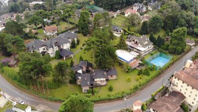
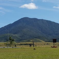
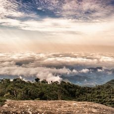
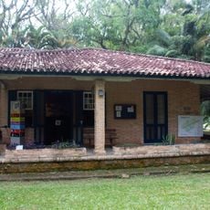
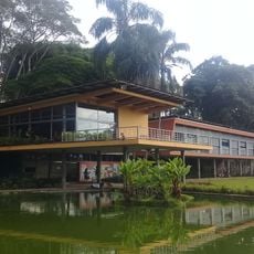
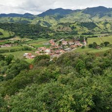
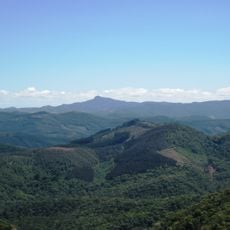
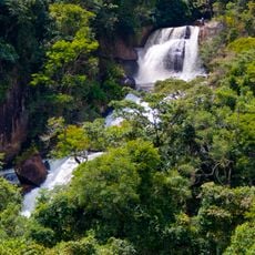
Monte Verde spreads across the southern slopes of the Mantiqueira range in Minas Gerais state, built from clusters of small settlements scattered along gentle ridges and narrow valleys. Atlantic rainforest covers the surroundings, and cobblestone lanes link guesthouses, restaurants, and small shops together.
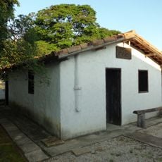
In the middle of the 20th century, a Latvian immigrant named Verner Grinberg bought a fazenda in this remote area and founded a settlement. His family built the first houses and paths, and over the following decades more German and Latvian families moved in, shaping the place.
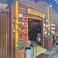
Many restaurants here speak German, and interiors echo Alpine chalets, with timber beams and heavy tables that nod to Central European traditions. Visitors meet families who keep recipes and crafts from Latvia and Germany alive, from handmade sausage to stews that recall colder latitudes.
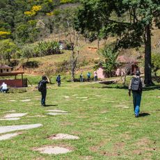
Visitors reach the area via the Fernão Dias highway, from which narrow paved roads climb into the settlement; winter months can bring fog that limits views. Most hiking trails begin at marked access points along the main road, and sturdy footwear is advisable because ground is often damp.
A small airstrip sits at roughly 1,560 meters (5,118 ft) elevation, making it the highest in the country; on clear days private planes land amid forests and fog banks. Winter temperatures occasionally drop below zero, and residents light wood stoves to warm their rooms.
Location: Camanducaia
GPS coordinates: -22.86040,-46.03529
Latest update: December 12, 2025 17:54
Southeast Brazil spans the states of São Paulo, Rio de Janeiro, Minas Gerais and Espírito Santo, offering coastal landscapes, mountain villages, caves and waterfalls. The region preserves colonial-era trails, grottos with underground formations and islands with light visitor traffic. Sites show how...
Estádio Martins Pereira
40.2 km
Pico Agudo
39.4 km
Pedra de São Domingos
20.3 km
Pico do Selado
4.4 km
Museum of Folklore of São José dos Campos
37.9 km
Residência de Olívio Gomes e Parque Ajardinado
37.8 km
Estádio ADC Parahyba
36.9 km
O Verdadeiro Sítio do Picapau Amarelo
28.5 km
Casa de Cultura Zé Mira
37.5 km
Sapucaí Mirim Environmental Protection Area
39.7 km
Fernão Dias Environmental Protection Area
12.5 km
Parada da Fonte
9.5 km
Cine Santana
36.5 km
Museu Interativo de Ciências
40.1 km
Henriques waterfall
31.6 km
Museu do Folclore de São José dos Campos
37.7 km
Conjunto da Tecelagem Parahyba
37.9 km
Museu de Esportes de São José dos Campos
40.1 km
Praça Da Matriz
39.6 km
Igreja Matriz de São Bento do Sapucaí
36.6 km
Antigo Cine Teatro São José
38.8 km
Sanatório Vicentina Aranha
40.2 km
E.E. Sant'Anna do Parnaíba
36.2 km
Capelinha de Mosaico
36.1 km
Paço Municipal
39.2 km
Mother Curch of Our Lady of Sorrows
28.9 km
Capela de São Miguel
39.3 km
Cassiano Ricardo City Public Library
38.8 kmVisited this place? Tap the stars to rate it and share your experience / photos with the community! Try now! You can cancel it anytime.
Discover hidden gems everywhere you go!
From secret cafés to breathtaking viewpoints, skip the crowded tourist spots and find places that match your style. Our app makes it easy with voice search, smart filtering, route optimization, and insider tips from travelers worldwide. Download now for the complete mobile experience.
A unique approach to discovering new places❞
— Le Figaro
All the places worth exploring❞
— France Info
A tailor-made excursion in just a few clicks❞
— 20 Minutes