See the monuments around you in AROpen chests in the app
Around Us is built for your phone — point your camera at the streets and discover the monuments and places around you in augmented reality.Around Us is built for your phone — chests unlock when you walk, explore and capture nearby places.
Natural sites and cultural places in Southeast Brazil
Southeast Brazil spans the states of São Paulo, Rio de Janeiro, Minas Gerais and Espírito Santo, offering coastal landscapes, mountain villages, caves and waterfalls. The region preserves colonial-era trails, grottos with underground formations and islands with light visitor traffic. Sites show how Brazil developed from colonial times to the present, with 18th-century buildings, gold mining routes and gardens that maintain tropical plant species.
Locations include Gruta Luminosa with limestone formations, Praia do Bonete, a remote beach without road access, and Casa da Glória in Diamantina, which displays colonial architecture. Parque Nacional do Caparaó protects mountain elevations with temperate climate, while Sítio Burle Marx in Rio de Janeiro combines landscape architecture and native vegetation. The coast includes quiet bays such as Praia da Fazenda in Ubatuba and rocky formations at Mirante do Pontal do Atalaia. Inland, trails like Caminho dos Escravos pass through historical territory, and Capitólio Canyons offer rock walls over freshwater lakes. The region combines nature and history across different altitudes and climate zones.
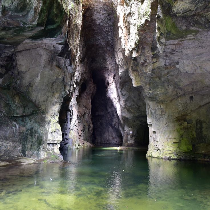
This cave lies in southern Iporanga and displays limestone formations whose mineral deposits create natural light effects on the walls. Gruta Luminosa forms part of the region's underground landscape and offers insight into geological processes that took place over centuries. Visitors experience a quiet environment here, where the interplay of light and stone shapes the setting.
This beach lies within a nature reserve and alternates between sandy and rocky sections. A mangrove belt lines the inland area and protects the shore. The calm water attracts visitors who look for a sheltered spot away from larger resorts. Vegetation reaches the waterline and merges with the tidal zones.
This park sits on a plateau with granite rocks and natural water basins. Caves cross the area with underground water streams flowing through them. Trails lead through open grasslands and forest sections to waterfalls and viewpoints. The rocks form basins where rainwater collects. The stone shows weathering patterns with rounded edges and smooth surfaces. Visitors hike between rock formations and sometimes walk through the cave systems. Vegetation changes from low growth on the rocks to denser forest in the valleys. The park offers access to rock pools and streams.
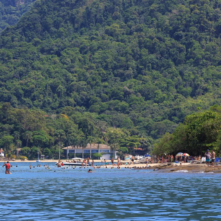
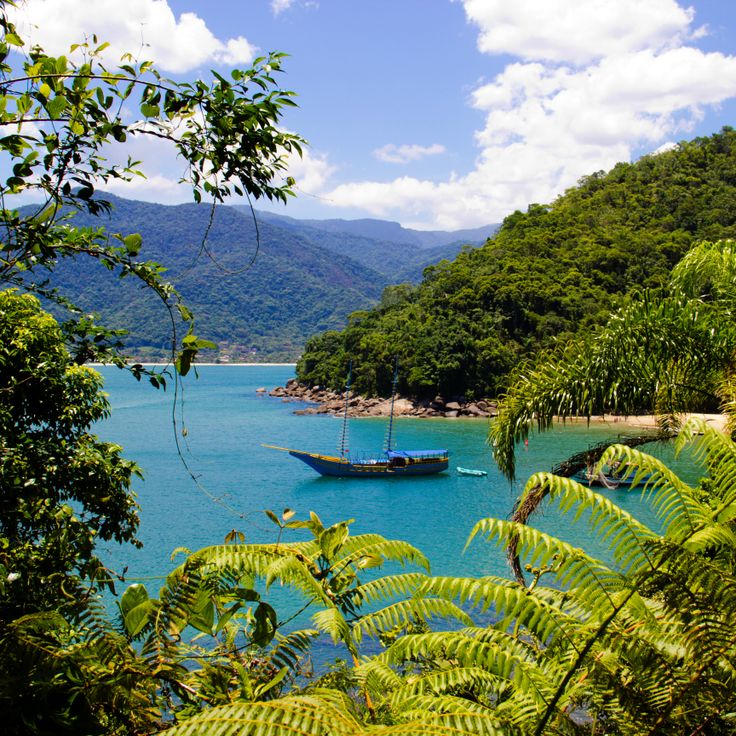
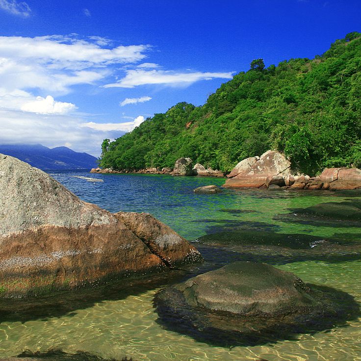
This island sits off the coast of Angra dos Reis and requires boat transport to reach. The surrounding waters are home to different species of fish and sea turtles. The shoreline is edged with natural formations. Visiting here offers encounters with marine fauna in their natural habitat. The island forms part of the natural areas of Southeast Brazil.
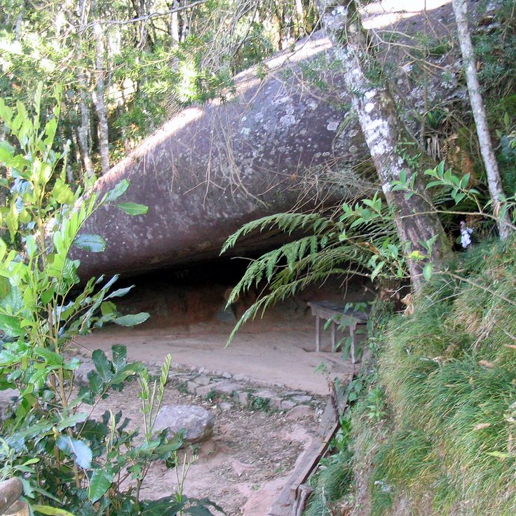
This cave preserves rock art from the time before Portuguese colonization. The walls show drawings made by people who lived here centuries ago. Archaeological findings confirm the presence of native inhabitants. Located in the mountain region of Campos do Jordão, this site offers insight into the history of the area. The cave connects nature with the cultural past of Southeast Brazil.
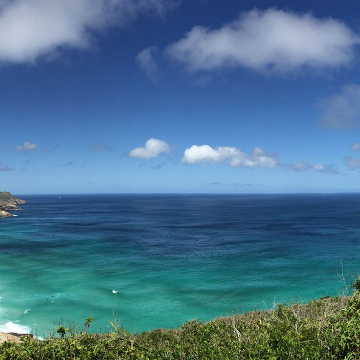
This viewpoint stands on a hill at 660 feet (200 meters) elevation and offers a full panorama of beaches, bays and the Atlantic. From here you can see the coastline of Arraial do Cabo with its clear water and rock formations extending into the ocean. The location shows the nature of Southeast Brazil in its original form and connects the mountain landscape with the coastal area. Visitors reach the point through a path across low vegetation.
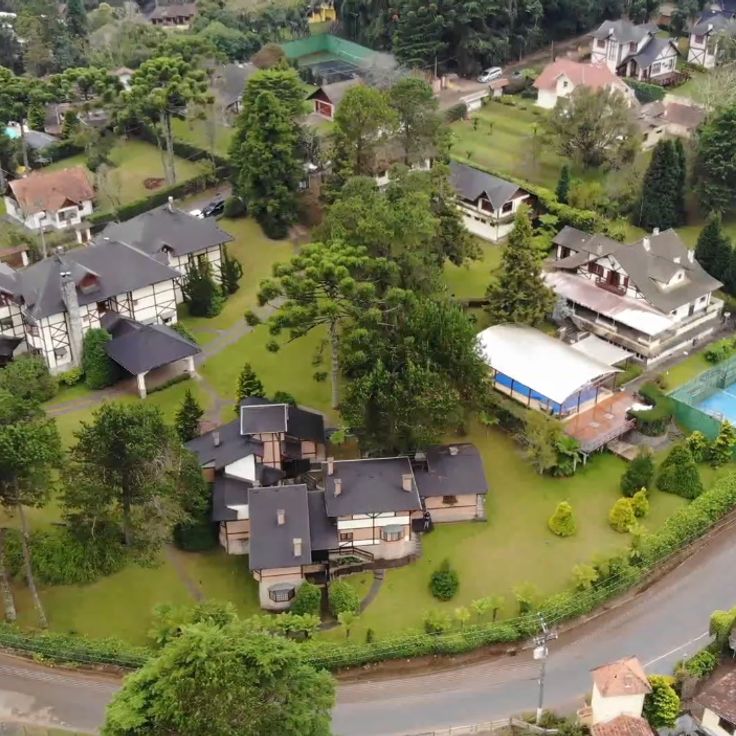
This town sits at 1,500 meters (4,920 feet) elevation in the southern Brazilian mountains and combines German-Swiss style buildings with pine forests. Monte Verde shows European architecture mixed with Brazilian mountain landscape. Streets run between houses with wooden facades and steep roofs. Visitors find restaurants, small shops and lodging that recall alpine traditions. Temperature often drops below freezing in winter. Fog moves through the valleys and wraps around the trees. Hiking trails lead through the forests and open views toward the surrounding hills.
This beach stretches for 800 meters and is framed by granite rocks. The ocean brings high waves that roll in regularly onto the white sand. The current is strong, the water moves with force. Surfers come here to ride the waves. The rocks form natural boundaries at both ends. The sand is light and fine. The water has a deep blue color. Fishermen sometimes work in the early morning. The wind often comes from the sea. The surroundings are quiet, with few buildings in sight.
This observation point stands at 1200 meters in elevation and offers open views across the mountain landscape of the region. Pedra Bela Vista shows valleys and forested hills that extend to the horizon. Visitors come here to see the expanse and enjoy a moment of quiet. The site is among the less known natural points in Southeast Brazil and combines elevation with open views of the surroundings.
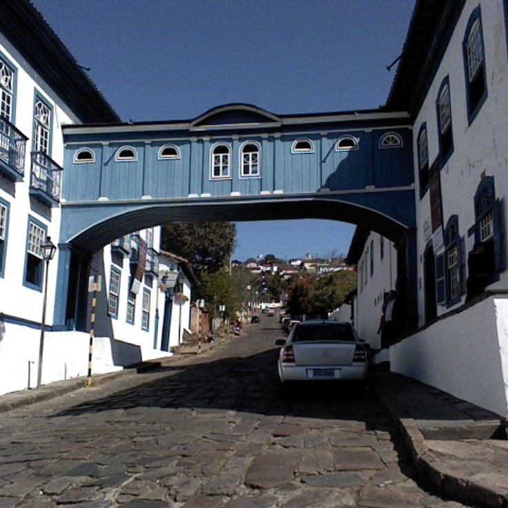
This colonial building from the 18th century stands in a mountain town once known for its diamond mines. Casa da Glória now serves as a university museum displaying geological collections and scientific exhibitions about the region. The architecture reflects Portuguese colonial style, with white walls and dark wooden beams. A covered passageway connects two parts of the building across the street. Visitors see minerals, rocks and exhibits on mining history in this area, which was once one of the world's richest diamond sources.
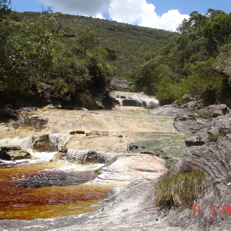
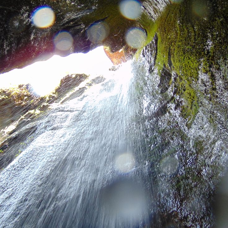
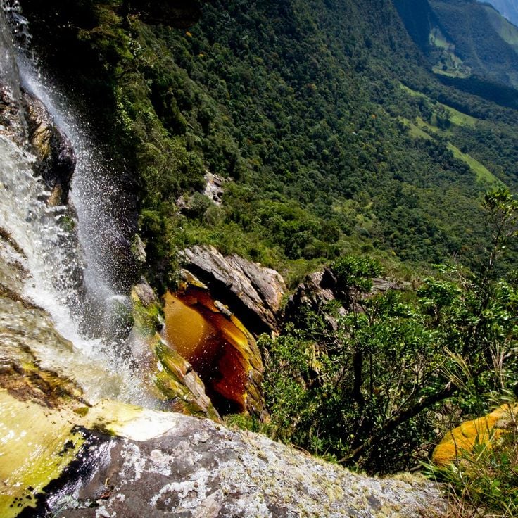
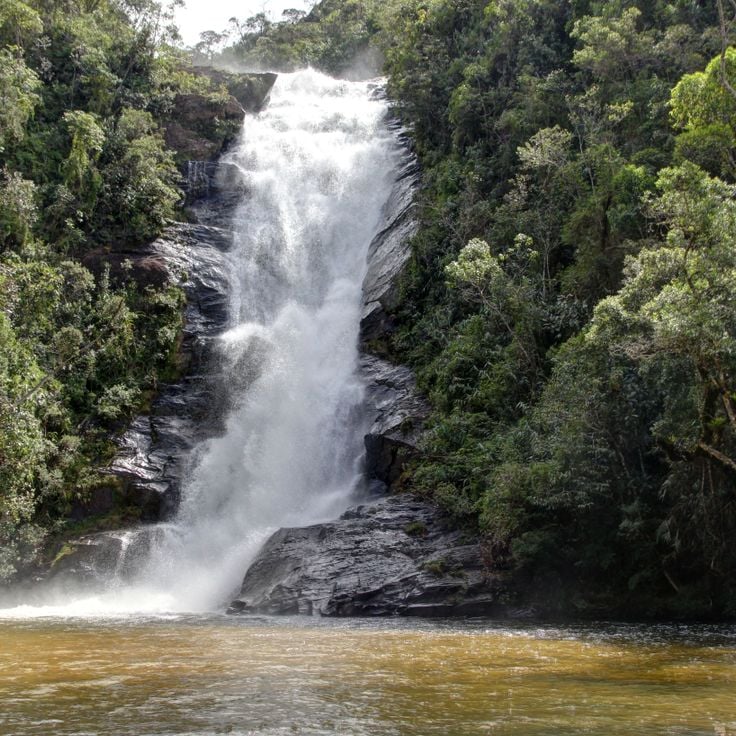
This waterfall drops about 50 feet (15 meters) into a natural basin where swallows build their nests and circle over the surface. The water falls between rocks, and the birds fly close to the pool below. The place shows a quiet side of nature in Southeast Brazil, where water and wildlife come together.
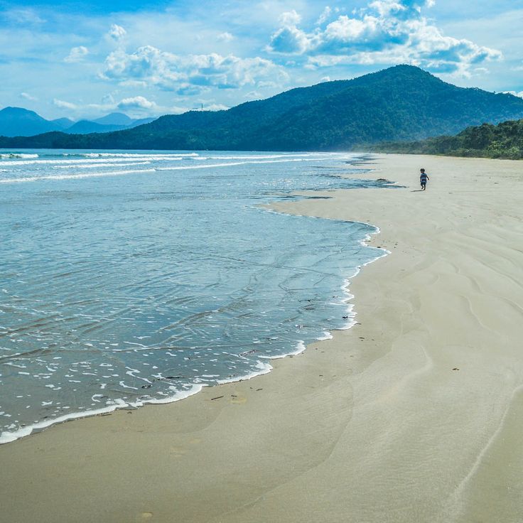
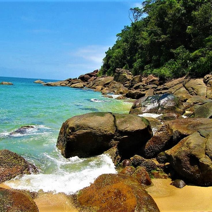
This beach stretches between Atlantic rainforest and open ocean. The pale sand runs for about 600 meters (approximately 1,970 feet). Its position on the exposed coast brings regular waves suitable for surfing and other water sports. Dense forest reaches close to the shore and provides shade in some sections. The surroundings remain undeveloped, without paved roads or larger buildings. Fishermen live in scattered houses along the bay. In fair weather, hikers arrive over the coastal trail or by small boats from the sea.
This garden spreads across a large property south of Rio de Janeiro and preserves more than three thousand tropical plant species. Roberto Burle Marx started developing this place as a studio and laboratory for his landscape architecture in the 1940s. The site now displays his collection of rare Brazilian plants, which he gathered from different regions. Visitors walk through paths that connect various vegetation types, from rainforest sections to beds of cacti and succulents. The architect's former residence stands among the gardens and contains artworks and personal objects. The atmosphere is quiet, with bird calls and the sound of leaves moving in the wind.
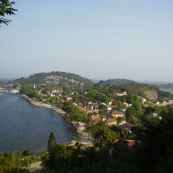
This island sits in Guanabara Bay, where no cars are allowed. Mansions from the 19th century stand among paths that lead to sand beaches. Fishermen live here and go about their work, while visitors explore the quiet streets on foot or by bicycle. Old trees provide shade, and small squares invite people to rest. Life moves slowly, far from the traffic of the nearby city.
This protected forest lies in the Atlantic rainforest zone and covers more than six thousand hectares (around fifteen thousand acres). The park includes research facilities and education programs focused on preserving the natural environment. Marked trails lead through thick vegetation where visitors can experience the damp air and tall trees. The site serves to protect regional wildlife and plant species and offers insight into the ecosystems of Southeast Brazil.
This national park preserves mountain rainforest between São Paulo and Rio de Janeiro across 104000 hectares. The terrain rises from the coast to peaks reaching 2088 meters in elevation. Waterfalls run through dense vegetation while over 300 bird species inhabit the forest. Trails lead through valleys and over ridges, passing old-growth trees and ferns. Mist often hangs between the slopes, and the climate shifts with altitude. The paths connect historic routes that once enabled trade and travel between the coast and the interior.
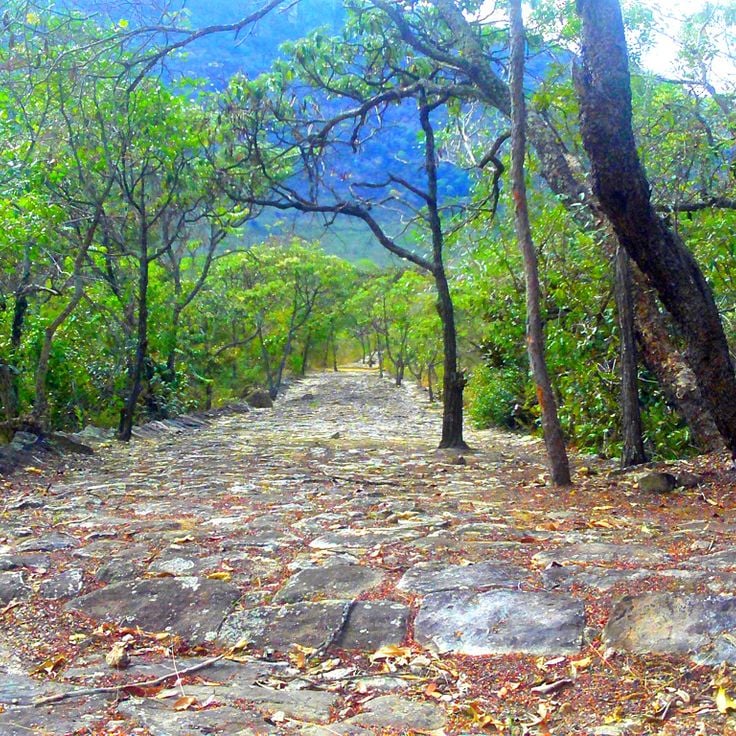
This 18th-century path winds through the mountains near Diamantina. The stone pavement was once a transport route for diamonds. The trail runs through forested slopes and shows traces of Brazil's colonial past. Hikers follow the curves between rocks and old vegetation as the route connects the history of the region with its natural surroundings.
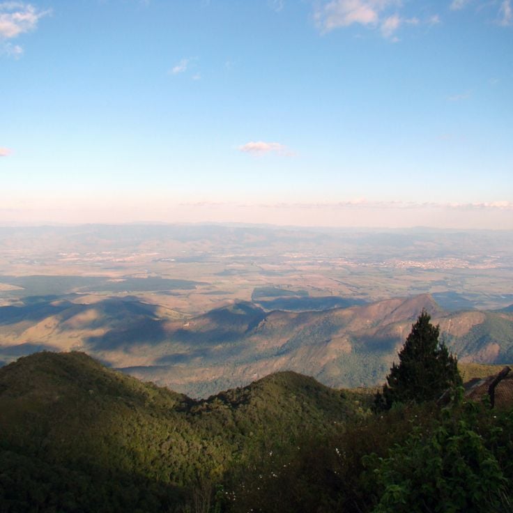
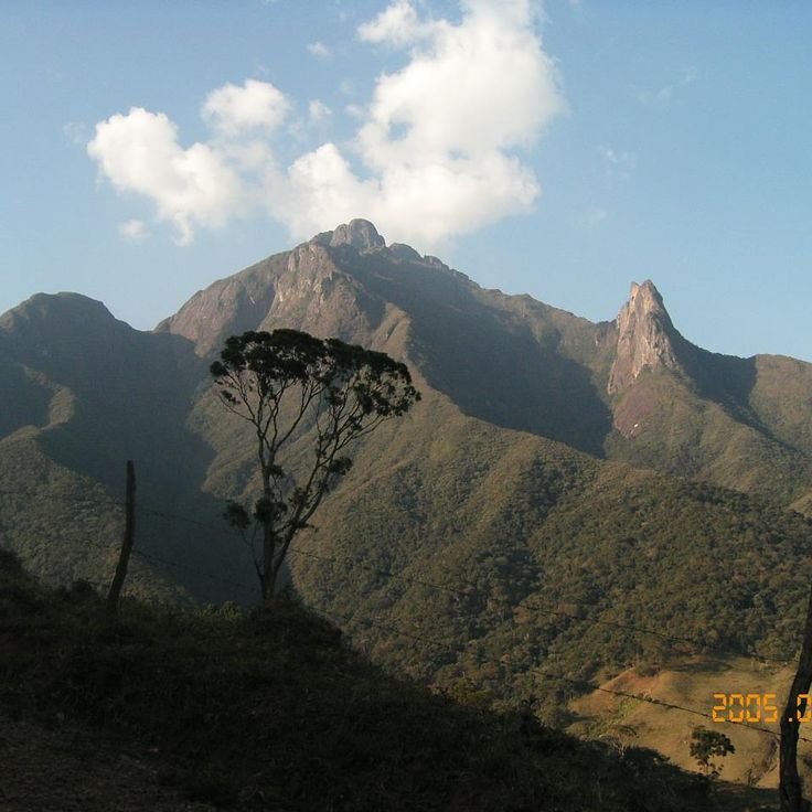
This mountain rises to 6647 feet (2025 meters). The viewpoints overlook Paraíba Valley and the Serra da Mantiqueira range. Early morning often brings fog that settles in the lower areas while the peaks catch sunlight. Trails lead through grassland and low vegetation typical of this altitude. On clear days the view extends across several mountain ranges. Temperature can drop quickly, especially when wind picks up. Visitors come for photography, hiking or simply to take in the views. The access road ends near the summit, from where short paths lead to different lookout points.
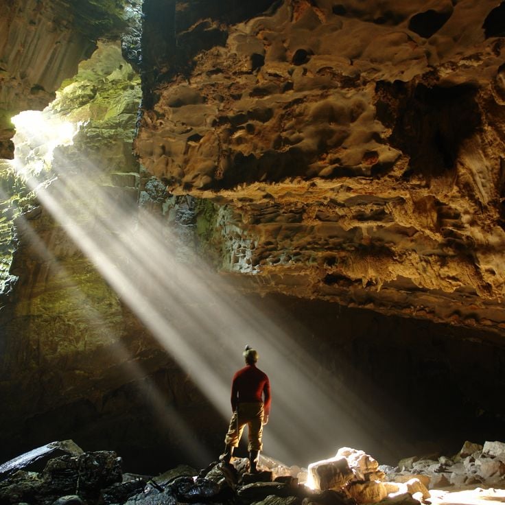
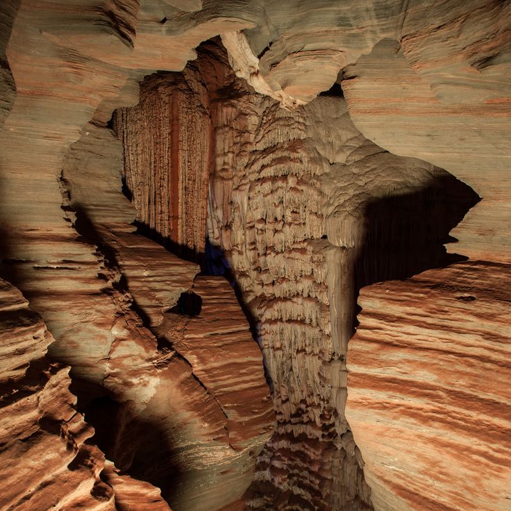
The Gruta da Lapinha is a limestone cave north of Belo Horizonte, with interiors extending over 500 meters (1,640 feet). Narrow passages lead through chambers where stalactites and stalagmites form around underground pools that reflect the porous rock. Visitors follow lit paths along the cave walls, where dripping formations show different shapes. The temperature remains cool, and humidity leaves moisture on the stone surfaces. This cave is among the accessible natural sites in the Lagoa Santa region, where limestone has been shaped by water over thousands of years.
This observation point in Ibitipoca State Park sits at 1500 meters above sea level and opens to views of the Serra da Mantiqueira mountains. The name translates to Window to the Sky and describes the clear sight across peaks, valleys and forests. Hikers reach the spot through narrow paths crossing grasslands and rock formations typical of the park.
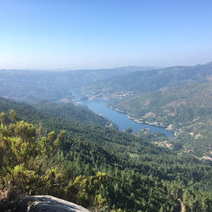
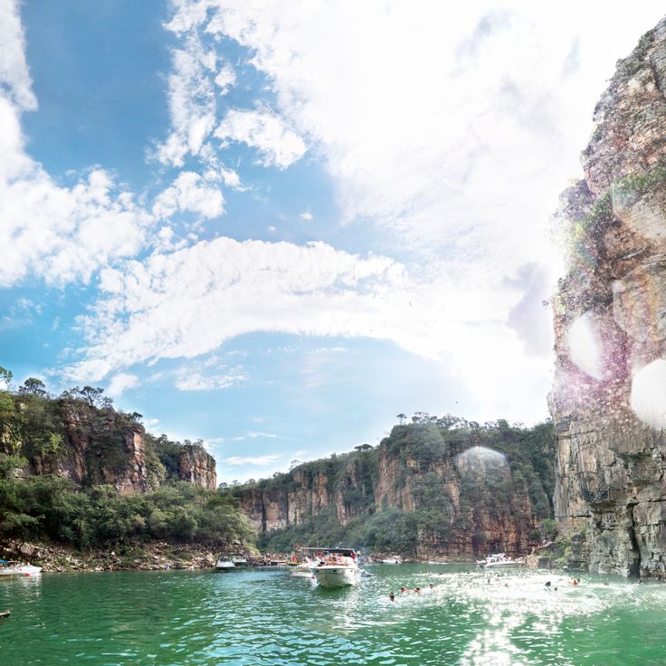
These rock formations rise about 20 meters (65 feet) above the water of Lake Furnas. The sandstone walls stand close together, forming passages for small boats. The stone shows marks left by wind and water over decades of shaping its surface. The cliffs drop straight into the lake, which was created by building a dam. Visitors travel by boat between the rock walls, passing caves and fissures in the stone. The water stays calm most of the time, changing color with the light. From certain points you can climb onto the formations and look out over the lake from above.
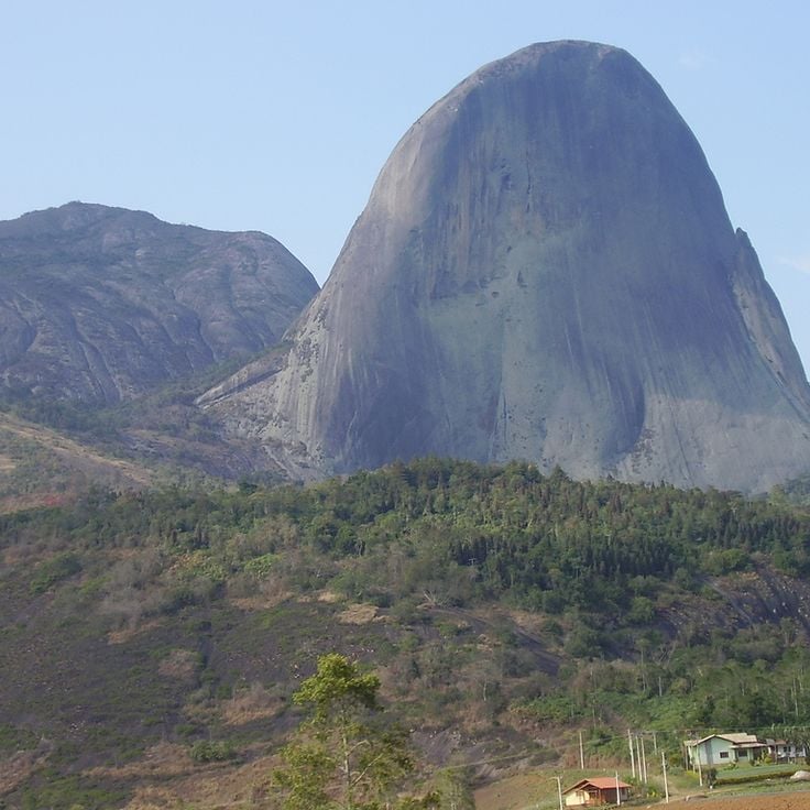
This granite peak rises to 1822 meters and shows a bluish coloring that comes from algae and minerals on the rock surface. Pedra Azul stands within a mountain range in southeastern Brazil and marks a central point in the region. The rock changes color throughout the day as sunlight hits the surface from different angles. The area combines mountain landscapes with cultural heritage and natural habitats typical of this part of Brazil. Trails run around the base of the rock and allow visitors to explore the surroundings. Vegetation ranges from Atlantic rainforest to open grasslands. Villages and farms sit in the valleys below the summit.
This island off the coast of São Paulo features rainforest, mangroves and long sandy beaches with no buildings. Ilha do Cardoso sits between the ocean and Trapandé Bay. Small trails wind through the forest to quiet coves, while fishermen live in villages by the water. The island is part of a park and remains largely untouched by tourism.
This national park protects an area that includes Pico da Bandeira, which rises to about 9482 feet (2890 meters) and ranks among the highest peaks in Brazil. The landscape extends across mountain slopes, where you find forests at different elevations and a wide variety of plants. Trails lead through the terrain, and you can see valleys, streams and rock formations. The climate changes with altitude, and early in the morning mist often covers the summits.
This mountain rises to 2000 meters (6600 feet) and offers climbing routes on granite rocks, surrounded by mountain vegetation. The landscape around Pico dos Marins displays typical flora of the Serra da Mantiqueira range, with grasses, ferns and low shrubs. Hikers find marked trails through open terrain with wide views over the surrounding valleys. The granite formations formed through millennia of erosion and create natural walls for climbers of different skill levels. Morning fog often moves through the valleys while the summit area provides clear visibility.
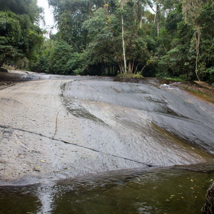
This natural water channel cuts through the rainforest along smooth rocks. The current flows down through the narrow groove before emptying into a small pool below. Visitors can slide with the water or walk around the area between trees and ferns. Cachoeira do Tobogã shows nature in its original form in Southeast Brazil, where rainforests and waterways come together in one place.
This beach sits between forested slopes and the open Atlantic. Praia do Sono attracts visitors who want to combine coastal forest walks with swimming. The sand offers basic camping options, and local boats arrive regularly from neighboring Paraty. The site forms a quiet gateway to the natural areas of the southeastern Brazilian coast, with trails through tropical vegetation and access to further hidden coves nearby.
This coastal section on Ilhabela extends for 300 meters along the Atlantic. The sand is gray and fine, the water usually calm. Behind the beach the rainforest begins, dense and green. A short path leads to a waterfall that drops about 5 meters. The water is clear and cold, the path through the forest shady. Praia da Feiticeira sits on the southern coast of the island, reachable by road or by boat. Few houses stand nearby, and most of the time it remains quiet here.
This waterfall flows down granite rocks in several levels, forming a pool at the bottom. Tall rock walls surround the spot where the water lands. The rocks are smooth from the water, and the current moves through natural channels. You can hear the water before you reach Cachoeira de Santo Isidro. The place is set in Atlantic rainforest and is one of the less visited waterfalls in São José do Barreiro. The area is green and damp, with ferns and mosses growing on the stones.
This limestone cave contains a shallow water basin. The entrance reaches two meters in height (6.5 feet), and the water stands knee-deep. Gruta do Anjo sits in the mountains of the region, where several other natural formations can be found. Visitors may explore the cool interior and see the clear water of the basin. The cave belongs to the geological formations that developed over centuries.
This cave lies in southern Iporanga and displays limestone formations whose mineral deposits create natural light effects on the walls. Gruta Luminosa forms part of the region's underground landscape and offers insight into geological processes that took place over centuries. Visitors experience a quiet environment here, where the interplay of light and stone shapes the setting.
This beach lies within a nature reserve and alternates between sandy and rocky sections. A mangrove belt lines the inland area and protects the shore. The calm water attracts visitors who look for a sheltered spot away from larger resorts. Vegetation reaches the waterline and merges with the tidal zones.
This park sits on a plateau with granite rocks and natural water basins. Caves cross the area with underground water streams flowing through them. Trails lead through open grasslands and forest sections to waterfalls and viewpoints. The rocks form basins where rainwater collects. The stone shows weathering patterns with rounded edges and smooth surfaces. Visitors hike between rock formations and sometimes walk through the cave systems. Vegetation changes from low growth on the rocks to denser forest in the valleys. The park offers access to rock pools and streams.
This island sits off the coast of Angra dos Reis and requires boat transport to reach. The surrounding waters are home to different species of fish and sea turtles. The shoreline is edged with natural formations. Visiting here offers encounters with marine fauna in their natural habitat. The island forms part of the natural areas of Southeast Brazil.
This cave preserves rock art from the time before Portuguese colonization. The walls show drawings made by people who lived here centuries ago. Archaeological findings confirm the presence of native inhabitants. Located in the mountain region of Campos do Jordão, this site offers insight into the history of the area. The cave connects nature with the cultural past of Southeast Brazil.
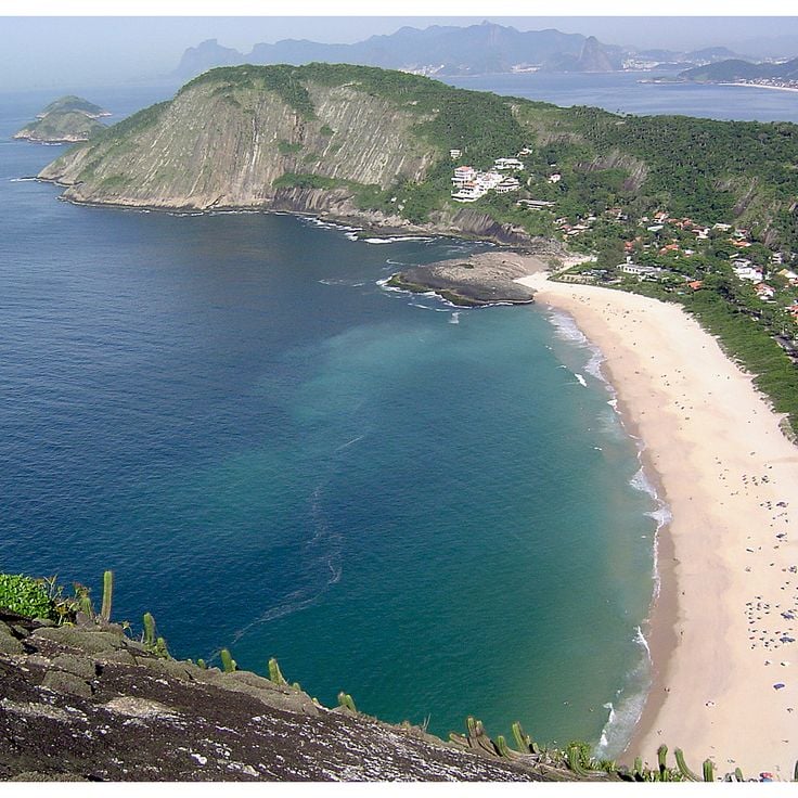
This viewpoint stands on a hill at 660 feet (200 meters) elevation and offers a full panorama of beaches, bays and the Atlantic. From here you can see the coastline of Arraial do Cabo with its clear water and rock formations extending into the ocean. The location shows the nature of Southeast Brazil in its original form and connects the mountain landscape with the coastal area. Visitors reach the point through a path across low vegetation.
This town sits at 1,500 meters (4,920 feet) elevation in the southern Brazilian mountains and combines German-Swiss style buildings with pine forests. Monte Verde shows European architecture mixed with Brazilian mountain landscape. Streets run between houses with wooden facades and steep roofs. Visitors find restaurants, small shops and lodging that recall alpine traditions. Temperature often drops below freezing in winter. Fog moves through the valleys and wraps around the trees. Hiking trails lead through the forests and open views toward the surrounding hills.
This beach stretches for 800 meters and is framed by granite rocks. The ocean brings high waves that roll in regularly onto the white sand. The current is strong, the water moves with force. Surfers come here to ride the waves. The rocks form natural boundaries at both ends. The sand is light and fine. The water has a deep blue color. Fishermen sometimes work in the early morning. The wind often comes from the sea. The surroundings are quiet, with few buildings in sight.
This observation point stands at 1200 meters in elevation and offers open views across the mountain landscape of the region. Pedra Bela Vista shows valleys and forested hills that extend to the horizon. Visitors come here to see the expanse and enjoy a moment of quiet. The site is among the less known natural points in Southeast Brazil and combines elevation with open views of the surroundings.
This colonial building from the 18th century stands in a mountain town once known for its diamond mines. Casa da Glória now serves as a university museum displaying geological collections and scientific exhibitions about the region. The architecture reflects Portuguese colonial style, with white walls and dark wooden beams. A covered passageway connects two parts of the building across the street. Visitors see minerals, rocks and exhibits on mining history in this area, which was once one of the world's richest diamond sources.
This waterfall drops about 50 feet (15 meters) into a natural basin where swallows build their nests and circle over the surface. The water falls between rocks, and the birds fly close to the pool below. The place shows a quiet side of nature in Southeast Brazil, where water and wildlife come together.
This beach stretches between Atlantic rainforest and open ocean. The pale sand runs for about 600 meters (approximately 1,970 feet). Its position on the exposed coast brings regular waves suitable for surfing and other water sports. Dense forest reaches close to the shore and provides shade in some sections. The surroundings remain undeveloped, without paved roads or larger buildings. Fishermen live in scattered houses along the bay. In fair weather, hikers arrive over the coastal trail or by small boats from the sea.
This garden spreads across a large property south of Rio de Janeiro and preserves more than three thousand tropical plant species. Roberto Burle Marx started developing this place as a studio and laboratory for his landscape architecture in the 1940s. The site now displays his collection of rare Brazilian plants, which he gathered from different regions. Visitors walk through paths that connect various vegetation types, from rainforest sections to beds of cacti and succulents. The architect's former residence stands among the gardens and contains artworks and personal objects. The atmosphere is quiet, with bird calls and the sound of leaves moving in the wind.
This island sits in Guanabara Bay, where no cars are allowed. Mansions from the 19th century stand among paths that lead to sand beaches. Fishermen live here and go about their work, while visitors explore the quiet streets on foot or by bicycle. Old trees provide shade, and small squares invite people to rest. Life moves slowly, far from the traffic of the nearby city.
This protected forest lies in the Atlantic rainforest zone and covers more than six thousand hectares (around fifteen thousand acres). The park includes research facilities and education programs focused on preserving the natural environment. Marked trails lead through thick vegetation where visitors can experience the damp air and tall trees. The site serves to protect regional wildlife and plant species and offers insight into the ecosystems of Southeast Brazil.
This national park preserves mountain rainforest between São Paulo and Rio de Janeiro across 104000 hectares. The terrain rises from the coast to peaks reaching 2088 meters in elevation. Waterfalls run through dense vegetation while over 300 bird species inhabit the forest. Trails lead through valleys and over ridges, passing old-growth trees and ferns. Mist often hangs between the slopes, and the climate shifts with altitude. The paths connect historic routes that once enabled trade and travel between the coast and the interior.
This 18th-century path winds through the mountains near Diamantina. The stone pavement was once a transport route for diamonds. The trail runs through forested slopes and shows traces of Brazil's colonial past. Hikers follow the curves between rocks and old vegetation as the route connects the history of the region with its natural surroundings.
This mountain rises to 6647 feet (2025 meters). The viewpoints overlook Paraíba Valley and the Serra da Mantiqueira range. Early morning often brings fog that settles in the lower areas while the peaks catch sunlight. Trails lead through grassland and low vegetation typical of this altitude. On clear days the view extends across several mountain ranges. Temperature can drop quickly, especially when wind picks up. Visitors come for photography, hiking or simply to take in the views. The access road ends near the summit, from where short paths lead to different lookout points.
The Gruta da Lapinha is a limestone cave north of Belo Horizonte, with interiors extending over 500 meters (1,640 feet). Narrow passages lead through chambers where stalactites and stalagmites form around underground pools that reflect the porous rock. Visitors follow lit paths along the cave walls, where dripping formations show different shapes. The temperature remains cool, and humidity leaves moisture on the stone surfaces. This cave is among the accessible natural sites in the Lagoa Santa region, where limestone has been shaped by water over thousands of years.
This observation point in Ibitipoca State Park sits at 1500 meters above sea level and opens to views of the Serra da Mantiqueira mountains. The name translates to Window to the Sky and describes the clear sight across peaks, valleys and forests. Hikers reach the spot through narrow paths crossing grasslands and rock formations typical of the park.
These rock formations rise about 20 meters (65 feet) above the water of Lake Furnas. The sandstone walls stand close together, forming passages for small boats. The stone shows marks left by wind and water over decades of shaping its surface. The cliffs drop straight into the lake, which was created by building a dam. Visitors travel by boat between the rock walls, passing caves and fissures in the stone. The water stays calm most of the time, changing color with the light. From certain points you can climb onto the formations and look out over the lake from above.
This granite peak rises to 1822 meters and shows a bluish coloring that comes from algae and minerals on the rock surface. Pedra Azul stands within a mountain range in southeastern Brazil and marks a central point in the region. The rock changes color throughout the day as sunlight hits the surface from different angles. The area combines mountain landscapes with cultural heritage and natural habitats typical of this part of Brazil. Trails run around the base of the rock and allow visitors to explore the surroundings. Vegetation ranges from Atlantic rainforest to open grasslands. Villages and farms sit in the valleys below the summit.
This island off the coast of São Paulo features rainforest, mangroves and long sandy beaches with no buildings. Ilha do Cardoso sits between the ocean and Trapandé Bay. Small trails wind through the forest to quiet coves, while fishermen live in villages by the water. The island is part of a park and remains largely untouched by tourism.
This national park protects an area that includes Pico da Bandeira, which rises to about 9482 feet (2890 meters) and ranks among the highest peaks in Brazil. The landscape extends across mountain slopes, where you find forests at different elevations and a wide variety of plants. Trails lead through the terrain, and you can see valleys, streams and rock formations. The climate changes with altitude, and early in the morning mist often covers the summits.
This mountain rises to 2000 meters (6600 feet) and offers climbing routes on granite rocks, surrounded by mountain vegetation. The landscape around Pico dos Marins displays typical flora of the Serra da Mantiqueira range, with grasses, ferns and low shrubs. Hikers find marked trails through open terrain with wide views over the surrounding valleys. The granite formations formed through millennia of erosion and create natural walls for climbers of different skill levels. Morning fog often moves through the valleys while the summit area provides clear visibility.
This natural water channel cuts through the rainforest along smooth rocks. The current flows down through the narrow groove before emptying into a small pool below. Visitors can slide with the water or walk around the area between trees and ferns. Cachoeira do Tobogã shows nature in its original form in Southeast Brazil, where rainforests and waterways come together in one place.
This beach sits between forested slopes and the open Atlantic. Praia do Sono attracts visitors who want to combine coastal forest walks with swimming. The sand offers basic camping options, and local boats arrive regularly from neighboring Paraty. The site forms a quiet gateway to the natural areas of the southeastern Brazilian coast, with trails through tropical vegetation and access to further hidden coves nearby.
This coastal section on Ilhabela extends for 300 meters along the Atlantic. The sand is gray and fine, the water usually calm. Behind the beach the rainforest begins, dense and green. A short path leads to a waterfall that drops about 5 meters. The water is clear and cold, the path through the forest shady. Praia da Feiticeira sits on the southern coast of the island, reachable by road or by boat. Few houses stand nearby, and most of the time it remains quiet here.
This waterfall flows down granite rocks in several levels, forming a pool at the bottom. Tall rock walls surround the spot where the water lands. The rocks are smooth from the water, and the current moves through natural channels. You can hear the water before you reach Cachoeira de Santo Isidro. The place is set in Atlantic rainforest and is one of the less visited waterfalls in São José do Barreiro. The area is green and damp, with ferns and mosses growing on the stones.
This limestone cave contains a shallow water basin. The entrance reaches two meters in height (6.5 feet), and the water stands knee-deep. Gruta do Anjo sits in the mountains of the region, where several other natural formations can be found. Visitors may explore the cool interior and see the clear water of the basin. The cave belongs to the geological formations that developed over centuries.
This cave lies in southern Iporanga and displays limestone formations whose mineral deposits create natural light effects on the walls. Gruta Luminosa forms part of the region's underground landscape and offers insight into geological processes that took place over centuries. Visitors experience a quiet environment here, where the interplay of light and stone shapes the setting.
This beach lies within a nature reserve and alternates between sandy and rocky sections. A mangrove belt lines the inland area and protects the shore. The calm water attracts visitors who look for a sheltered spot away from larger resorts. Vegetation reaches the waterline and merges with the tidal zones.
This park sits on a plateau with granite rocks and natural water basins. Caves cross the area with underground water streams flowing through them. Trails lead through open grasslands and forest sections to waterfalls and viewpoints. The rocks form basins where rainwater collects. The stone shows weathering patterns with rounded edges and smooth surfaces. Visitors hike between rock formations and sometimes walk through the cave systems. Vegetation changes from low growth on the rocks to denser forest in the valleys. The park offers access to rock pools and streams.
This island sits off the coast of Angra dos Reis and requires boat transport to reach. The surrounding waters are home to different species of fish and sea turtles. The shoreline is edged with natural formations. Visiting here offers encounters with marine fauna in their natural habitat. The island forms part of the natural areas of Southeast Brazil.
This cave preserves rock art from the time before Portuguese colonization. The walls show drawings made by people who lived here centuries ago. Archaeological findings confirm the presence of native inhabitants. Located in the mountain region of Campos do Jordão, this site offers insight into the history of the area. The cave connects nature with the cultural past of Southeast Brazil.
This viewpoint stands on a hill at 660 feet (200 meters) elevation and offers a full panorama of beaches, bays and the Atlantic. From here you can see the coastline of Arraial do Cabo with its clear water and rock formations extending into the ocean. The location shows the nature of Southeast Brazil in its original form and connects the mountain landscape with the coastal area. Visitors reach the point through a path across low vegetation.
This town sits at 1,500 meters (4,920 feet) elevation in the southern Brazilian mountains and combines German-Swiss style buildings with pine forests. Monte Verde shows European architecture mixed with Brazilian mountain landscape. Streets run between houses with wooden facades and steep roofs. Visitors find restaurants, small shops and lodging that recall alpine traditions. Temperature often drops below freezing in winter. Fog moves through the valleys and wraps around the trees. Hiking trails lead through the forests and open views toward the surrounding hills.
This beach stretches for 800 meters and is framed by granite rocks. The ocean brings high waves that roll in regularly onto the white sand. The current is strong, the water moves with force. Surfers come here to ride the waves. The rocks form natural boundaries at both ends. The sand is light and fine. The water has a deep blue color. Fishermen sometimes work in the early morning. The wind often comes from the sea. The surroundings are quiet, with few buildings in sight.
This observation point stands at 1200 meters in elevation and offers open views across the mountain landscape of the region. Pedra Bela Vista shows valleys and forested hills that extend to the horizon. Visitors come here to see the expanse and enjoy a moment of quiet. The site is among the less known natural points in Southeast Brazil and combines elevation with open views of the surroundings.
This colonial building from the 18th century stands in a mountain town once known for its diamond mines. Casa da Glória now serves as a university museum displaying geological collections and scientific exhibitions about the region. The architecture reflects Portuguese colonial style, with white walls and dark wooden beams. A covered passageway connects two parts of the building across the street. Visitors see minerals, rocks and exhibits on mining history in this area, which was once one of the world's richest diamond sources.
This waterfall drops about 50 feet (15 meters) into a natural basin where swallows build their nests and circle over the surface. The water falls between rocks, and the birds fly close to the pool below. The place shows a quiet side of nature in Southeast Brazil, where water and wildlife come together.
This beach stretches between Atlantic rainforest and open ocean. The pale sand runs for about 600 meters (approximately 1,970 feet). Its position on the exposed coast brings regular waves suitable for surfing and other water sports. Dense forest reaches close to the shore and provides shade in some sections. The surroundings remain undeveloped, without paved roads or larger buildings. Fishermen live in scattered houses along the bay. In fair weather, hikers arrive over the coastal trail or by small boats from the sea.
This garden spreads across a large property south of Rio de Janeiro and preserves more than three thousand tropical plant species. Roberto Burle Marx started developing this place as a studio and laboratory for his landscape architecture in the 1940s. The site now displays his collection of rare Brazilian plants, which he gathered from different regions. Visitors walk through paths that connect various vegetation types, from rainforest sections to beds of cacti and succulents. The architect's former residence stands among the gardens and contains artworks and personal objects. The atmosphere is quiet, with bird calls and the sound of leaves moving in the wind.
This island sits in Guanabara Bay, where no cars are allowed. Mansions from the 19th century stand among paths that lead to sand beaches. Fishermen live here and go about their work, while visitors explore the quiet streets on foot or by bicycle. Old trees provide shade, and small squares invite people to rest. Life moves slowly, far from the traffic of the nearby city.
This protected forest lies in the Atlantic rainforest zone and covers more than six thousand hectares (around fifteen thousand acres). The park includes research facilities and education programs focused on preserving the natural environment. Marked trails lead through thick vegetation where visitors can experience the damp air and tall trees. The site serves to protect regional wildlife and plant species and offers insight into the ecosystems of Southeast Brazil.
This national park preserves mountain rainforest between São Paulo and Rio de Janeiro across 104000 hectares. The terrain rises from the coast to peaks reaching 2088 meters in elevation. Waterfalls run through dense vegetation while over 300 bird species inhabit the forest. Trails lead through valleys and over ridges, passing old-growth trees and ferns. Mist often hangs between the slopes, and the climate shifts with altitude. The paths connect historic routes that once enabled trade and travel between the coast and the interior.
This 18th-century path winds through the mountains near Diamantina. The stone pavement was once a transport route for diamonds. The trail runs through forested slopes and shows traces of Brazil's colonial past. Hikers follow the curves between rocks and old vegetation as the route connects the history of the region with its natural surroundings.
This mountain rises to 6647 feet (2025 meters). The viewpoints overlook Paraíba Valley and the Serra da Mantiqueira range. Early morning often brings fog that settles in the lower areas while the peaks catch sunlight. Trails lead through grassland and low vegetation typical of this altitude. On clear days the view extends across several mountain ranges. Temperature can drop quickly, especially when wind picks up. Visitors come for photography, hiking or simply to take in the views. The access road ends near the summit, from where short paths lead to different lookout points.
The Gruta da Lapinha is a limestone cave north of Belo Horizonte, with interiors extending over 500 meters (1,640 feet). Narrow passages lead through chambers where stalactites and stalagmites form around underground pools that reflect the porous rock. Visitors follow lit paths along the cave walls, where dripping formations show different shapes. The temperature remains cool, and humidity leaves moisture on the stone surfaces. This cave is among the accessible natural sites in the Lagoa Santa region, where limestone has been shaped by water over thousands of years.
This observation point in Ibitipoca State Park sits at 1500 meters above sea level and opens to views of the Serra da Mantiqueira mountains. The name translates to Window to the Sky and describes the clear sight across peaks, valleys and forests. Hikers reach the spot through narrow paths crossing grasslands and rock formations typical of the park.
These rock formations rise about 20 meters (65 feet) above the water of Lake Furnas. The sandstone walls stand close together, forming passages for small boats. The stone shows marks left by wind and water over decades of shaping its surface. The cliffs drop straight into the lake, which was created by building a dam. Visitors travel by boat between the rock walls, passing caves and fissures in the stone. The water stays calm most of the time, changing color with the light. From certain points you can climb onto the formations and look out over the lake from above.
This granite peak rises to 1822 meters and shows a bluish coloring that comes from algae and minerals on the rock surface. Pedra Azul stands within a mountain range in southeastern Brazil and marks a central point in the region. The rock changes color throughout the day as sunlight hits the surface from different angles. The area combines mountain landscapes with cultural heritage and natural habitats typical of this part of Brazil. Trails run around the base of the rock and allow visitors to explore the surroundings. Vegetation ranges from Atlantic rainforest to open grasslands. Villages and farms sit in the valleys below the summit.
This island off the coast of São Paulo features rainforest, mangroves and long sandy beaches with no buildings. Ilha do Cardoso sits between the ocean and Trapandé Bay. Small trails wind through the forest to quiet coves, while fishermen live in villages by the water. The island is part of a park and remains largely untouched by tourism.
This national park protects an area that includes Pico da Bandeira, which rises to about 9482 feet (2890 meters) and ranks among the highest peaks in Brazil. The landscape extends across mountain slopes, where you find forests at different elevations and a wide variety of plants. Trails lead through the terrain, and you can see valleys, streams and rock formations. The climate changes with altitude, and early in the morning mist often covers the summits.
This mountain rises to 2000 meters (6600 feet) and offers climbing routes on granite rocks, surrounded by mountain vegetation. The landscape around Pico dos Marins displays typical flora of the Serra da Mantiqueira range, with grasses, ferns and low shrubs. Hikers find marked trails through open terrain with wide views over the surrounding valleys. The granite formations formed through millennia of erosion and create natural walls for climbers of different skill levels. Morning fog often moves through the valleys while the summit area provides clear visibility.
This natural water channel cuts through the rainforest along smooth rocks. The current flows down through the narrow groove before emptying into a small pool below. Visitors can slide with the water or walk around the area between trees and ferns. Cachoeira do Tobogã shows nature in its original form in Southeast Brazil, where rainforests and waterways come together in one place.
This beach sits between forested slopes and the open Atlantic. Praia do Sono attracts visitors who want to combine coastal forest walks with swimming. The sand offers basic camping options, and local boats arrive regularly from neighboring Paraty. The site forms a quiet gateway to the natural areas of the southeastern Brazilian coast, with trails through tropical vegetation and access to further hidden coves nearby.
This coastal section on Ilhabela extends for 300 meters along the Atlantic. The sand is gray and fine, the water usually calm. Behind the beach the rainforest begins, dense and green. A short path leads to a waterfall that drops about 5 meters. The water is clear and cold, the path through the forest shady. Praia da Feiticeira sits on the southern coast of the island, reachable by road or by boat. Few houses stand nearby, and most of the time it remains quiet here.
This waterfall flows down granite rocks in several levels, forming a pool at the bottom. Tall rock walls surround the spot where the water lands. The rocks are smooth from the water, and the current moves through natural channels. You can hear the water before you reach Cachoeira de Santo Isidro. The place is set in Atlantic rainforest and is one of the less visited waterfalls in São José do Barreiro. The area is green and damp, with ferns and mosses growing on the stones.
This limestone cave contains a shallow water basin. The entrance reaches two meters in height (6.5 feet), and the water stands knee-deep. Gruta do Anjo sits in the mountains of the region, where several other natural formations can be found. Visitors may explore the cool interior and see the clear water of the basin. The cave belongs to the geological formations that developed over centuries.