Castelo, Historic municipality in Espírito Santo, Brazil
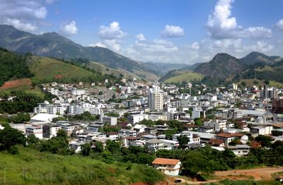
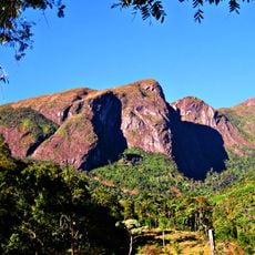
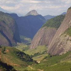
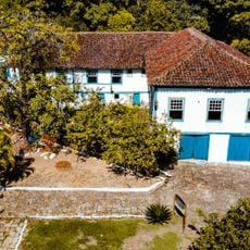
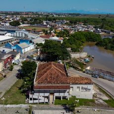
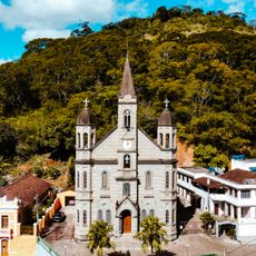
Castelo is a municipality in southwestern Espírito Santo surrounded by mountains and forested areas. The settlement sits at a significant elevation where green hills dominate the landscape around the urban center.
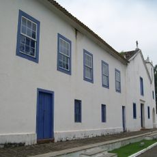
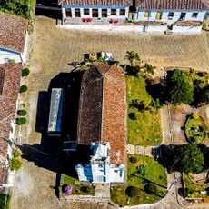
The region was originally inhabited by indigenous peoples before prospectors arrived in the 18th century seeking gold. The area was formally established as a municipality in a later period, marking a significant shift in how the land was organized.
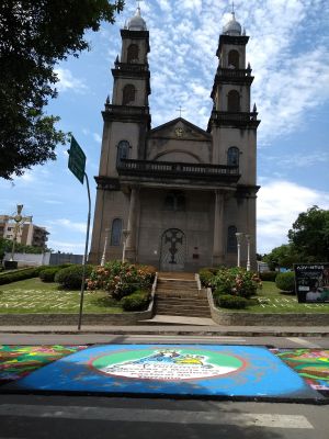
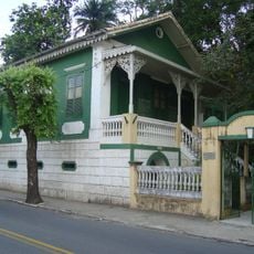
Italian settlers arrived in the region and their traditions remain woven into local celebrations and social gatherings. You can see this heritage in the way residents honor their roots through festivals and community events.
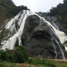
The location connects to nearby regions by road and sits at an elevation where the climate tends to be cooler and damper. Visitors should be prepared for hilly terrain and bring clothing suitable for variable weather conditions.
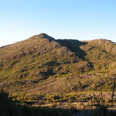
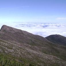
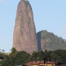
Within the municipality rises a notable peak that ranks among the highest elevations in the state. Reaching this summit offers hikers a challenging journey rewarded by expansive views across the region.
Location: Espírito Santo
Elevation above the sea: 540 m
Shares border with: Cachoeiro de Itapemirim, Alegre, Conceição do Castelo, Domingos Martins, Muniz Freire, Vargem Alta, Venda Nova do Imigrante
Address: Castelo, ES, 29360-000, Brazil
GPS coordinates: -20.60389,-41.18500
Latest update: December 7, 2025 10:06
Pico da Bandeira
66.4 km
Pedra Azul State Park
27.1 km
Frade e a Freira Natural Monument
35.6 km
Caparaó National Park
64.6 km
Pico do Cristal
67.7 km
Casa de Cultura Roberto Carlos
28.3 km
Santuário Nacional de São José de Anchieta
60.3 km
Praia dos Padres
69.3 km
Casa dos Braga
28.8 km
Forno Grande State Park
12.6 km
Cachoeira da Fumaça State Park
43.9 km
Monument to Christ the Redeemer
54.1 km
Maurílio Coelho Hunting Hoot Factory
26.9 km
Museu do Tropeiro José Salomão Fadlalah
53.3 km
Mata das Flores State Park
1.7 km
Itabira Natural Monument
29.6 km
Fazenda do Centro
8.3 km
Teatro Municipal Rubem Braga
27.7 km
Cine Ritz Piúma
53.7 km
Santa Rita Farm
46.5 km
Igreja de Nossa Senhora da Penha
2 km
Trapiche e Palácio das Águias
59.6 km
Main Church of Saint John the Baptist
42.2 km
Cine Ritz Perim Center
26.7 km
Sítio Histórico de Muqui
42.1 km
Núcleo Histórico de São Pedro de Itabapoana
61.7 km
Palácio Bernardino Monteiro
28.2 km
Cine Unimed
29 kmVisited this place? Tap the stars to rate it and share your experience / photos with the community! Try now! You can cancel it anytime.
Discover hidden gems everywhere you go!
From secret cafés to breathtaking viewpoints, skip the crowded tourist spots and find places that match your style. Our app makes it easy with voice search, smart filtering, route optimization, and insider tips from travelers worldwide. Download now for the complete mobile experience.
A unique approach to discovering new places❞
— Le Figaro
All the places worth exploring❞
— France Info
A tailor-made excursion in just a few clicks❞
— 20 Minutes