Fort Prince of Beira, Portuguese colonial fort in Costa Marques, Brazil
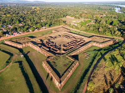
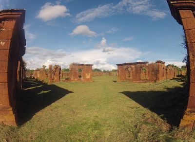
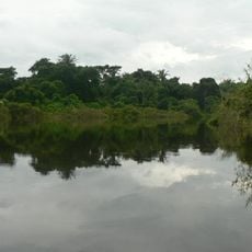
Forte Príncipe da Beira is a colonial military complex in Costa Marques on the banks of the Guaporé River, near the border with Bolivia. The fortification consists of four angular corner bastions linked by thick stone walls that enclose a large central courtyard, once used as a parade ground and assembly point for the garrison.
Between 1776 and 1783, the Portuguese crown built the fortress as a defensive line against Spanish advances from western colonial territories. The garrison remained active into the 19th century and lost its military function only after Brazil's independence and the stabilization of the border region.
The name honours Dom Pedro Carlos de Bragança e Bourbon, a Portuguese prince, and reflects the monarchy's claim over these remote borderlands. Visitors see European military design blended with tropical building methods, particularly in the vaulted chambers and open courtyards that allowed air to circulate in the humid forest climate.
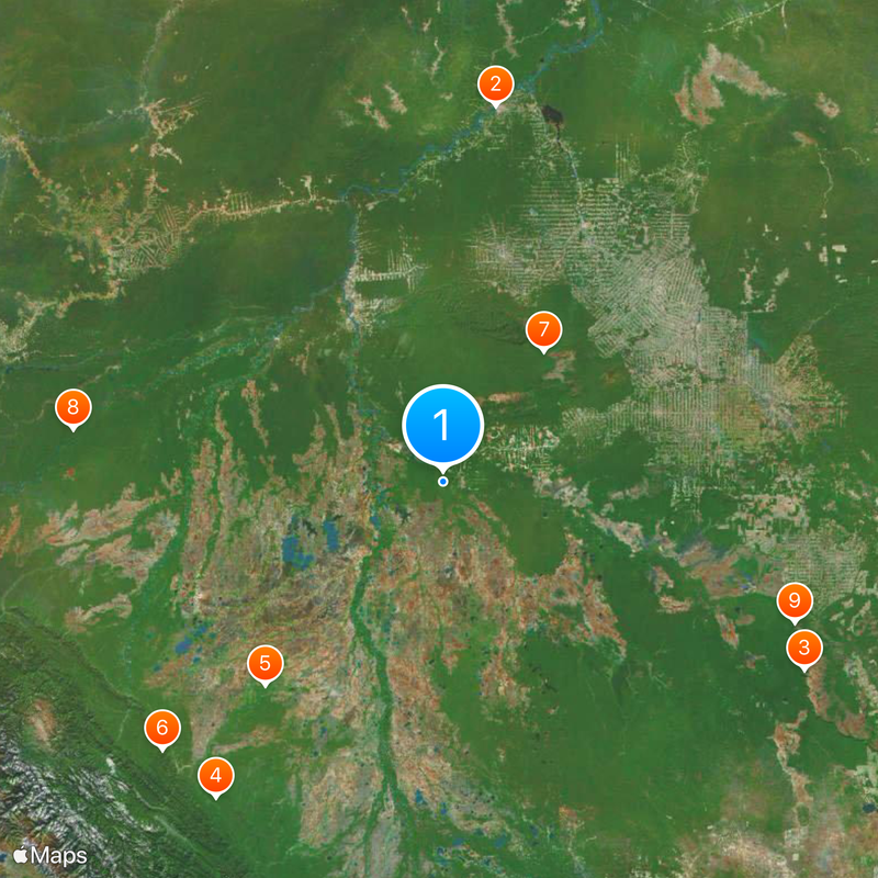
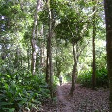
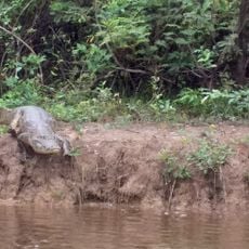
The site lies several kilometers outside Costa Marques and is reached by an unpaved road that can become difficult to navigate during heavy rains. Those exploring the walls and bastions should wear sturdy footwear, as the ground is uneven in places and overgrown with vegetation.
The complex was one of the few Portuguese fortifications built far from the Atlantic coast in Brazil's interior. Construction required transporting heavy stones and brickloads over hundreds of kilometers through dense rainforest and along the river, a logistical achievement for the time.
Location: Costa Marques
Inception: 1783
Part of: Conjunto de Fortificações do Brasil, Forts of Brazil
GPS coordinates: -12.42722,-64.42306
Latest update: December 5, 2025 22:25
Northern Brazil holds a range of natural areas and historical sites away from the usual tourist paths. The region stretches from the Amazon basin to the wide plateaus of the Cerrado, offering waterfalls, clear springs, sand dunes, canyons, and caves. Protected areas such as Jalapão State Park and Anavilhanas National Park shelter rare animals and native plants. Rivers wind through dense forests, and in some springs, mineral-rich water pushes swimmers to the surface. The landscape shifts between tropical rainforest, open grasslands, and rock formations shaped over thousands of years. Notable places include the golden sand dunes of Jalapão, the tall waterfalls of Cachoeira da Velha and Cachoeira do Lajeado, and the natural pools known as fervedouros, where visitors can float effortlessly. Pedra Furada, a natural stone arch, and Canyon Encantado show the geological variety of the region. Ilha do Bananal, one of the largest river islands in the world, sits in the Araguaia River and provides habitat for many bird species. Further north, the Amazon rainforest spreads out with its branching rivers and islands. The colonial Fort Príncipe da Beira, built in the 18th century, recalls early European settlement. In Natividade, the small church of Nossa Senhora do Rosário stands as a modest example of colonial architecture. These places combine nature and history, inviting travelers to discover a less familiar side of Brazil.
Madeira-Mamoré Railroad
411.2 km
Noel Kempff Mercado National Park
436.3 km
Isiboro Sécure National Park and Indigenous Territory
414.7 km
Beni Biological Station Biosphere Reserve
288.9 km
Pilón Lajas Biosphere Reserve and Communal Lands
415 km
Pacaás Novos National Park
177.8 km
Manuripi-Heath Amazonian Wildlife National Reserve
402.3 km
Catarata Arco Iris
405.9 km
Iturralde Crater
353.9 km
Ríos Blanco y Negro Wildlife Reserve
331.9 km
Mapinguari National Park
436.8 km
Municipal Protected Area Pampas of the Yacuma River
299.4 km
Casarabe culture
272.1 km
Bajo Paraguá Municipal Protected Area
376.3 km
Ibare-Mamoré
281.9 km
Rio Cautário Federal Extractive Reserve
69.4 km
Aquariquara Extractive Reserve
393.2 km
Association of Machadinho Rubber Tappers
426.5 km
Federico Ahlfeld Falls
401.7 km
Rio Cautário State Extractive Reserve
44.5 km
Rio Ouro Preto Extractive Reserve
188.2 km
Isla Cumprida
238.9 km
Madeira-Mamoré Railroad, rail yard
411.4 km
Castanheira do Estádio Aluízio Pinheiro Ferreira
412.3 km
Capela de Santo Antônio de Pádua
406.2 km
Três Caixas d'Água
411.8 km
José Ballivián
273 km
Prédio da Administração Central da EFMM
411.5 kmVisited this place? Tap the stars to rate it and share your experience / photos with the community! Try now! You can cancel it anytime.
Discover hidden gems everywhere you go!
From secret cafés to breathtaking viewpoints, skip the crowded tourist spots and find places that match your style. Our app makes it easy with voice search, smart filtering, route optimization, and insider tips from travelers worldwide. Download now for the complete mobile experience.
A unique approach to discovering new places❞
— Le Figaro
All the places worth exploring❞
— France Info
A tailor-made excursion in just a few clicks❞
— 20 Minutes