Pacaás Novos National Park, National park in Rondônia, Brazil
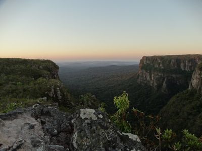
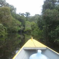
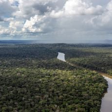
Pacaás Novos National Park protects 764,000 hectares of Western Amazon forest with mountains, rivers, and vegetation spanning elevations from 100 to 1,230 meters. The terrain displays a transition between different ecosystems and contains diverse habitats for wildlife.
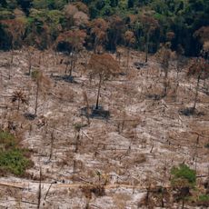
Brazil established this protected area in 1979 to safeguard the border region between Cerrado grassland and Amazon rainforest. This creation was part of broader efforts to preserve threatened ecosystems in the country.
Indigenous peoples have long inhabited this territory and developed profound knowledge of its forests and resources. Their presence continues to shape how this land is valued and protected today.
The managing agency facilitates scientific research, environmental education, and ecological tourism activities throughout the park. Visitors should expect challenging conditions and consider joining official programs or hiring local guides.
Monte Tracoá reaches 1,126 meters and stands as the highest point in the entire state of Rondônia. This peak draws visitors who wish to experience the landscape from a dramatically different vantage point.
Location: Rondônia
Inception: 1979
Elevation above the sea: 300 m
Operator: Instituto Chico Mendes de Conservação da Biodiversidade
GPS coordinates: -11.16000,-63.43000
Latest update: December 10, 2025 16:26
Madeira-Mamoré Railroad
271.3 km
Fort Prince of Beira
177.8 km
Noel Kempff Mercado National Park
442.1 km
Samuel Hydroelectric Dam
268.1 km
Catarata Arco Iris
397.5 kmUrubichá
430 km
Campos Amazônicos National Park
427.1 kmRíos Blanco y Negro Wildlife Reserve
412.2 km
Mapinguari National Park
314.1 km
Casarabe culture
428.5 km
Bajo Paraguá Municipal Protected Area
417.6 km
Ituxi Extractive Reserve
413.6 km
Rio Cautário Federal Extractive Reserve
113.6 km
Aquariquara Extractive Reserve
216.1 km
Association of Machadinho Rubber Tappers
248.8 km
Iquiri National Forest
422.3 km
Lago do Cuniã Extractive Reserve
317.8 km
Federico Ahlfeld Falls
393.2 km
Rio Cautário State Extractive Reserve
136.4 km
Rio Ouro Preto Extractive Reserve
145.5 km
Isla Cumprida
248.1 km
Madeira-Mamoré Railroad, rail yard
271.6 km
Castanheira do Estádio Aluízio Pinheiro Ferreira
272.5 km
Capela de Santo Antônio de Pádua
267.8 km
José Ballivián
439.2 km
Três Caixas d'Água
272 km
Indigenous Territory Tenharim do Igarapé Preto
366.2 km
Prédio da Administração Central da EFMM
271.6 kmVisited this place? Tap the stars to rate it and share your experience / photos with the community! Try now! You can cancel it anytime.
Discover hidden gems everywhere you go!
From secret cafés to breathtaking viewpoints, skip the crowded tourist spots and find places that match your style. Our app makes it easy with voice search, smart filtering, route optimization, and insider tips from travelers worldwide. Download now for the complete mobile experience.
A unique approach to discovering new places❞
— Le Figaro
All the places worth exploring❞
— France Info
A tailor-made excursion in just a few clicks❞
— 20 Minutes