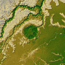
Fuerte de Braganza, Colonial fortress in Costa Marques, Brazil
Forte de Bragança is a fortress near Costa Marques situated on elevated ground close to Brazil's border with Bolivia, featuring thick stone walls and defensive positions. The interior contains military barracks, storage areas, and gun emplacements arranged for colonial-era defense.
The fortress was established during Brazil's territorial expansion to protect trade routes and secure border control. It served as a symbol of Portuguese authority in this remote region and helped maintain order along the frontier.
The fortress layout reflects Portuguese military building practices visible in its watchtower placement and barrack organization. Visitors can observe how space was arranged for soldiers and their daily functions.
The site is reachable from Costa Marques by local routes but can be challenging to access due to limited infrastructure and remote location. Hiring a local guide is advisable to navigate the grounds and gain insight into the various sections.
Archaeological work at the fortress continues to reveal artifacts that shed light on soldiers' daily routines and living conditions. These discoveries help understand how military personnel actually lived in this remote colonial outpost.
Location: Costa Marques
GPS coordinates: -12.41278,-64.43750
Latest update: December 14, 2025 18:08
Madeira-Mamoré Railroad
409.8 km
Fort Prince of Beira
2.2 km
Isiboro Sécure National Park and Indigenous Territory
415.1 km
Chalalan
437.8 km
Beni Biological Station Biosphere Reserve
289.1 km
Pilón Lajas Biosphere Reserve and Communal Lands
415 km
Pacaás Novos National Park
177.5 km
Manuripi-Heath Amazonian Wildlife National Reserve
400.6 km
Catarata Arco Iris
408 km
Iturralde Crater
352.4 kmRíos Blanco y Negro Wildlife Reserve
334.1 km
Mapinguari National Park
435.2 km
Municipal Protected Area Pampas of the Yacuma River
299 km
Casarabe culture
273.7 km
Bajo Paraguá Municipal Protected Area
378.5 km
Ibare-Mamoré
283.1 km
Rio Cautário Federal Extractive Reserve
68.5 km
Aquariquara Extractive Reserve
393.1 km
Association of Machadinho Rubber Tappers
426.3 km
Federico Ahlfeld Falls
403.8 km
Rio Cautário State Extractive Reserve
43.6 km
Rio Ouro Preto Extractive Reserve
186.4 kmIsla Cumprida
240.9 km
Madeira-Mamoré Railroad, rail yard
410 km
Castanheira do Estádio Aluízio Pinheiro Ferreira
410.9 km
Capela de Santo Antônio de Pádua
404.8 km
Três Caixas d'Água
410.4 km
José Ballivián
274.3 kmVisited this place? Tap the stars to rate it and share your experience / photos with the community! Try now! You can cancel it anytime.
Discover hidden gems everywhere you go!
From secret cafés to breathtaking viewpoints, skip the crowded tourist spots and find places that match your style. Our app makes it easy with voice search, smart filtering, route optimization, and insider tips from travelers worldwide. Download now for the complete mobile experience.
A unique approach to discovering new places❞
— Le Figaro
All the places worth exploring❞
— France Info
A tailor-made excursion in just a few clicks❞
— 20 Minutes