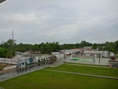
Carauari, Municipality in Amazonas, Brazil.
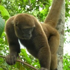
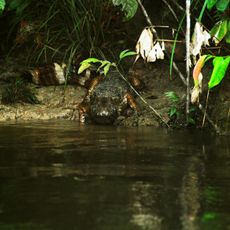
Carauari is a municipality in Amazonas state, Brazil, spanning approximately 25,767 square kilometers of rainforest terrain. The area sits within a landscape dominated by dense forest and abundant plant and animal life.
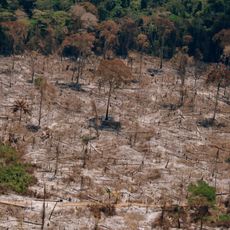
The municipality was established with its current boundaries in the late 19th century and includes portions of the Tefé National Forest. This forest received protected status as a conservation area in 1989.
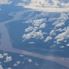
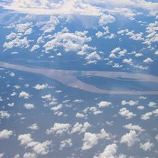
Daily life here revolves around fishing and small-scale farming along the Juruá River, practices that shape how residents relate to their surroundings. These traditions remain central to how the community operates today.
Getting there relies mainly on water routes and the local airport, as road connections to other areas are limited. Travelers should expect longer journey times and need to adapt to local transportation conditions.
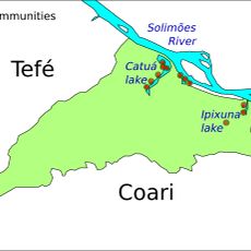
The area contains two major protected reserves: the Médio Juruá Extractive Reserve and the Uacari Sustainable Development Reserve. Together these reserves protect over 880,000 hectares of forest and demonstrate a commitment to sustainable resource management.
Location: Amazonas
Elevation above the sea: 116 m
Shares border with: Itamarati, Juruá, Jutaí, Tapauá, Tefé
GPS coordinates: -4.88278,-66.89583
Latest update: December 10, 2025 15:53
Madeira-Mamoré Railroad
544.1 km
Amacayacu National Park
398.5 km
Santa Rosa Island
347.4 km
Mamirauá Sustainable Development Reserve
321.7 km
Yaguas National Park
558.4 km
Chico Mendes' house
571.8 km
Mapinguari National Park
488.7 km
Central Amazon Ecological Corridor
206.9 km
Médio Juruá Extractive Reserve
118.2 km
Ituxi Extractive Reserve
382.8 km
Tefé National Forest
262.1 km
Iquiri National Forest
405.8 km
Catuá-Ipixuna Extractive Reserve
322.1 km
Chineria Island
351.8 km
Lago do Cuniã Extractive Reserve
535.7 km
Uacari Sustainable Development Reserve
128.6 km
Natural Reserve Palmari
382.7 km
Auatí-Paraná Extractive Reserve
279 km
Yaguas River
429.9 km
Ilha Aramacá
340.7 km
Seringal Bom Destino
540.2 km
Madeira-Mamoré Railroad, rail yard
543.9 km
Castanheira do Estádio Aluízio Pinheiro Ferreira
543 km
Ilhas Arariá
310.7 km
Capela de Santo Antônio de Pádua
545.3 km
Três Caixas d'Água
543.7 km
Cathedral of St. Ann and St. Sebastian, Coari
426 km
Prédio da Administração Central da EFMM
543.9 kmVisited this place? Tap the stars to rate it and share your experience / photos with the community! Try now! You can cancel it anytime.
Discover hidden gems everywhere you go!
From secret cafés to breathtaking viewpoints, skip the crowded tourist spots and find places that match your style. Our app makes it easy with voice search, smart filtering, route optimization, and insider tips from travelers worldwide. Download now for the complete mobile experience.
A unique approach to discovering new places❞
— Le Figaro
All the places worth exploring❞
— France Info
A tailor-made excursion in just a few clicks❞
— 20 Minutes