Central Amazon Ecological Corridor, Protected ecological area in Amazonas and Pará, Brazil
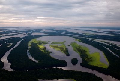
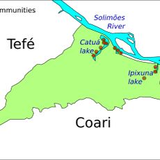
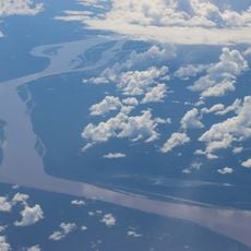
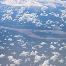
This corridor stretches across about 31.6 million hectares in the Solimões and Rio Negro river basins, linking many protected areas throughout the Amazon rainforest. Major rivers like the Jutaí, Japurá, Juruá, Tefé, and others form an interconnected network across this vast region.
This protection zone was established in 1997 as part of a strategy to create several major ecological zones across Brazil. It came about through work by specialists collaborating with the Brazilian Ministry of the Environment.
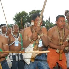
People and indigenous groups living here maintain traditional ways of life while taking part in environmental protection through cooperative management. You can observe these practices in daily activities like sustainable fishing and the careful use of forest resources.
The area includes the cities of Manaus, Manacapuru, and Tefé, where visitors can find visitor centers and accommodation. The best time to explore is during the dry season, when trails and waterways are easier to navigate.
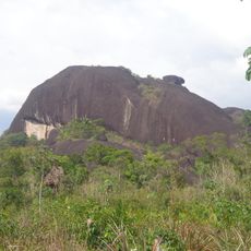
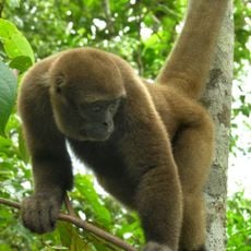
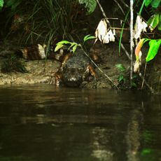
The area features a complex system of blackwater streams and flooded forests that shift dramatically with the seasons. This shifting landscape creates specialized habitats for plants and animals found nowhere else in the world.
GPS coordinates: -3.33000,-67.92000
Latest update: December 14, 2025 14:26
Pico da Neblina
506.5 km
Javari Valley
543 km
Amacayacu National Park
253.9 km
Piedra del Cocuy
523.1 km
Pico da Neblina National Park
461.8 km
Pico 31 de Março
507.2 km
Serranía La Neblina National Park
520.2 km
Piedra del Cocuy Natural Monument
523.1 km
Yaigojé-Apaporis National Park
422 km
Santa Rosa Island
247.3 km
Mamirauá Sustainable Development Reserve
276.1 km
Yaguas National Park
402.9 km
Tamshiyacu Tahuayo Regional Conservation Area
600.1 km
Morro dos Seis Lagos Biological Reserve
428.5 km
Médio Juruá Extractive Reserve
249.9 km
Forte de São José de Marabitanas
503.9 km
Tefé National Forest
327.5 km
Cué-cué/Marabitanas Indigenous Territory
478.5 km
Catuá-Ipixuna Extractive Reserve
419.8 km
Chineria Island
249.3 km
Uacari Sustainable Development Reserve
273.2 km
Natural Reserve Palmari
284.3 km
Auatí-Paraná Extractive Reserve
173.2 km
Parroquia de Santa Rosa de Lima (Mazán)
574.8 kmYaguas River
253.9 km
Ilha Aramacá
248.3 km
Ilhas Arariá
221.8 km
Cathedral of St. Ann and St. Sebastian, Coari
537.4 kmVisited this place? Tap the stars to rate it and share your experience / photos with the community! Try now! You can cancel it anytime.
Discover hidden gems everywhere you go!
From secret cafés to breathtaking viewpoints, skip the crowded tourist spots and find places that match your style. Our app makes it easy with voice search, smart filtering, route optimization, and insider tips from travelers worldwide. Download now for the complete mobile experience.
A unique approach to discovering new places❞
— Le Figaro
All the places worth exploring❞
— France Info
A tailor-made excursion in just a few clicks❞
— 20 Minutes