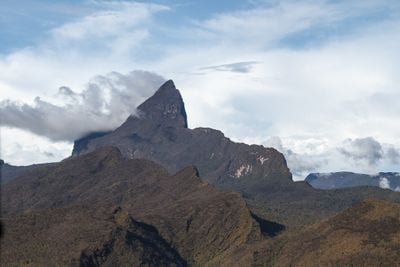
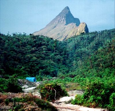
Pico da Neblina, Mountain summit in Amazonas, Brazil
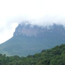
Pico da Neblina is a mountain summit in Amazonas, Brazil, rising 2,994 meters above sea level and forming the border with Venezuela. The mountain lies within the Imeri range and is surrounded by dense rainforest that extends to its upper slopes.
The mountain was discovered in 1962 during a border survey expedition and replaced Pico da Bandeira as the highest point in Brazil. The first documented climb took place in 1965 by a Brazilian military expedition that traveled through the jungle for several weeks.
The region around the summit is home to the Yanomami, who have inhabited this area for centuries and give it its cultural meaning. Expeditions to the mountain are often accompanied by members of this community, who share their knowledge of trails and forest areas.
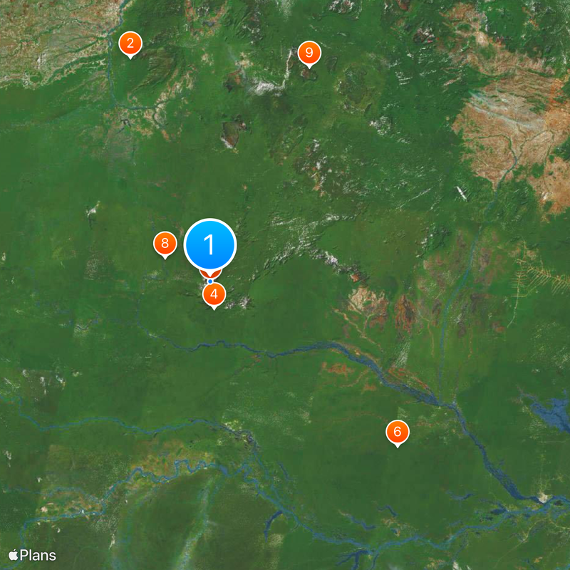
Access to the summit requires authorization from Brazilian authorities and coordination with local Yanomami communities. Visitors should plan several days for the journey, as flights to São Gabriel da Cachoeira and subsequent boat trips are necessary.
The slopes of the summit harbor carnivorous plant species like Heliamphora neblinae that have adapted to the high altitude. These species are found only on this mountain and live among the rock formations and moss areas of the upper zones.
Location: Amazonas
Elevation above the sea: 2,994 m
GPS coordinates: 0.79999,-66.00902
Latest update: December 12, 2025 17:58
Cerro Autana
479 km
Piedra del Cocuy
102.7 km
Pico da Neblina National Park
54.1 km
Pico 31 de Março
618 m
Jaú National Park
501.8 km
Serranía La Neblina National Park
16.8 km
Piedra del Cocuy Natural Monument
102.7 km
Jaua-Sarisariñama National Park
475.6 km
Parima-Tapirapecó National Park
316.8 km
Yapacana National Park
332.5 km
Duida-Marahuaca National Park
324.2 km
Mamirauá Sustainable Development Reserve
342.6 km
Cachoeira do El Dorado
297.2 km
Cerro Duida
293.4 km
Morro dos Seis Lagos Biological Reserve
93.1 km
Serra da Mocidade National Park
463.6 km
Serra do Aracá State Park
305.7 km
Forte de São José de Marabitanas
95.3 km
Tefé National Forest
493.3 km
Cué-cué/Marabitanas Indigenous Territory
97.6 km
Auatí-Paraná Extractive Reserve
362.5 km
Parú-Euaja Massif Natural Monument
409.9 km
Cerros Vinilla y Aratitiyope Natural Monument
163.9 km
Cuao-Sipapo y Moriche Massif Natural Monument
500.9 km
Monumento Natural Cerro Autana
479 km
Sierra Unturan Natural Monument
124.2 km
Sierra Marutani Natural Monument
471.4 km
Cerros Tapirapecó y Tamacuari Natural Monument
149.5 kmVisited this place? Tap the stars to rate it and share your experience / photos with the community! Try now! You can cancel it anytime.
Discover hidden gems everywhere you go!
From secret cafés to breathtaking viewpoints, skip the crowded tourist spots and find places that match your style. Our app makes it easy with voice search, smart filtering, route optimization, and insider tips from travelers worldwide. Download now for the complete mobile experience.
A unique approach to discovering new places❞
— Le Figaro
All the places worth exploring❞
— France Info
A tailor-made excursion in just a few clicks❞
— 20 Minutes