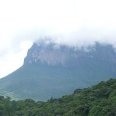
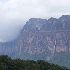
Cerro Duida, Mountain summit in Amazonas, Venezuela.
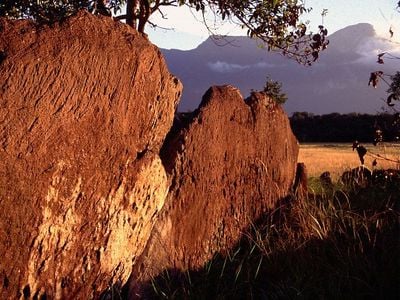
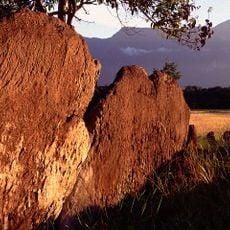
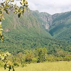
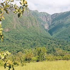
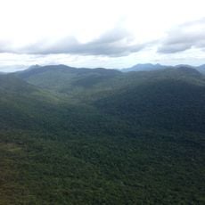
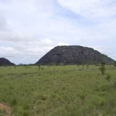
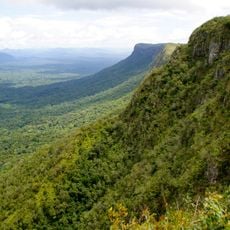
Cerro Duida is a mountain summit in the Venezuelan Amazon with an uneven plateau at its top. The structure rises above the surrounding rainforest and features varied geological formations across its expanse.
The first recorded expedition to the summit occurred in 1928-1929 led by George Henry Hamilton Tate, marking a milestone in regional exploration. Subsequent explorations built upon this initial achievement to document the mountain further.
The Ye'kuana people call this mountain Yennamadi and view it as central to their stories and spiritual beliefs about the land. The peak holds meaning in how local communities understand and relate to the wider landscape around them.
The settlement of La Esmeralda at the mountain base serves as the main starting point for treks up to the plateau. Visitors should prepare for humid tropical conditions and difficult terrain when planning the journey.
The Duida frog species was discovered during the early expedition and exists only on this mountain. It remains closely tied to the plateau and its specialized ecological setting.
Location: Amazonas
Elevation above the sea: 2,358 m
GPS coordinates: 3.41321,-65.66633
Latest update: December 13, 2025 11:41
Pico da Neblina
293.4 km
Cerro Autana
254.9 km
Piedra del Cocuy
274.1 km
Pico 31 de Março
292.8 km
Serranía La Neblina National Park
277.6 km
Piedra del Cocuy Natural Monument
274.1 km
Jaua-Sarisariñama National Park
213.7 km
Parima-Tapirapecó National Park
107.3 km
Yapacana National Park
128.3 km
Duida-Marahuaca National Park
38 km
Yutaje Falls
262 km
Cerro Yaví Natural Monument
257.5 km
Forte de São José de Marabitanas
291.6 km
Cerros Camani y Morrocoy Natural Monument
223.2 km
Parú-Euaja Massif Natural Monument
116.5 km
Cerros Vinilla y Aratitiyope Natural Monument
138.1 km
Cuao-Sipapo y Moriche Massif Natural Monument
268.5 km
Monumento Natural Cerro Autana
254.9 km
Sipapo Forest Reserve
274.6 km
Sierra Unturan Natural Monument
186.6 km
Sierra Marutani Natural Monument
303.6 km
El Caura Forest Reserve
268.1 km
Serranía Yutajé y Coro-coro Natural Monument
266.8 km
Cerros Tapirapecó y Tamacuari Natural Monument
255.6 km
Sierra Maigualida Natural Monument
257.2 km
Piedra Pintada Natural Monument
315.4 km
Cerro Guanay Natural Monument
279.5 km
Cerros Ichúm y Guanacoco Natural Monument
249.1 kmVisited this place? Tap the stars to rate it and share your experience / photos with the community! Try now! You can cancel it anytime.
Discover hidden gems everywhere you go!
From secret cafés to breathtaking viewpoints, skip the crowded tourist spots and find places that match your style. Our app makes it easy with voice search, smart filtering, route optimization, and insider tips from travelers worldwide. Download now for the complete mobile experience.
A unique approach to discovering new places❞
— Le Figaro
All the places worth exploring❞
— France Info
A tailor-made excursion in just a few clicks❞
— 20 Minutes