Amazonas, Administrative division in southern Venezuela
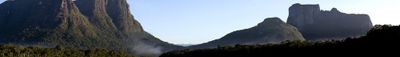
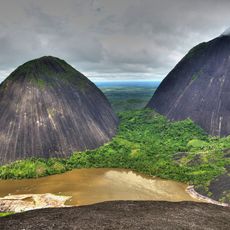
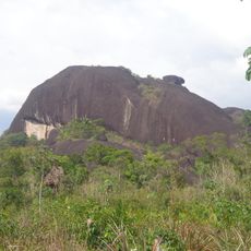
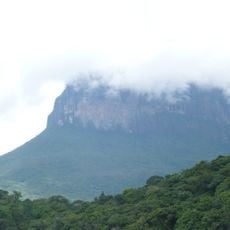
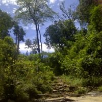
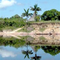
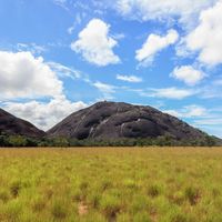
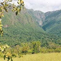
Amazonas is a state in southern Venezuela that stretches across large portions of rainforest and multiple river systems. The region borders Brazil and Colombia, covering dense vegetation and remote areas along the Orinoco and its tributaries.
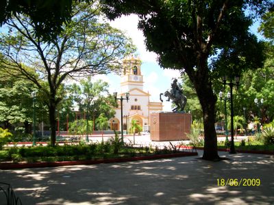
The territory was explored by Spanish expeditions in the 1750s and became part of the new republic after independence. The formal creation as a federal state occurred in the late 19th century, following multiple revisions of administrative structures.
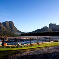
Twenty different indigenous ethnic groups represent half of the state population, maintaining their traditional languages, customs, and ways of life in the forest.
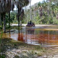
Most locations are accessible only by boat, as few roads exist and rivers serve as the main travel routes. Visitors should expect long travel times and prepare for humid tropical conditions.
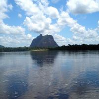
A natural canal connects the Orinoco and Amazon river systems here over more than 186 miles (300 km). This geological feature creates a continuous waterway link between two major South American watersheds.
Location: Venezuela
Inception: 1994
Capital city: Puerto Ayacucho
Shares border with: Bolívar, Apure, Vichada Department
Website: http://amazonas.gob.ve
GPS coordinates: 3.50000,-66.00000
Latest update: December 4, 2025 23:01
Canaima National Park
463.6 km
Pico da Neblina
300.6 km
Auyantepui
467.6 km
Santos Luzardo National Park
398.2 km
Cerro Autana
220.6 km
Piedra del Cocuy
267.8 km
Pico da Neblina National Park
354.2 km
Pico 31 de Março
300 km
Serranía La Neblina National Park
284.2 km
Piedra del Cocuy Natural Monument
267.8 km
Jaua-Sarisariñama National Park
237.3 km
Parima-Tapirapecó National Park
152.8 km
Yapacana National Park
90 km
Piedra La Tortuga Natural Monument
290.2 km
Serra do Tepequém
472.5 km
Duida-Marahuaca National Park
66.3 km
Casa sobre La Piedra
298.7 km
Cueva Charles Brewer - Carías
449 km
Para Falls
354.5 km
Cachoeira do El Dorado
416 km
Cerro Duida
38.3 km
Yutaje Falls
247.4 km
Morro dos Seis Lagos Biological Reserve
362.5 km
Sapo Falls
465.8 km
Serra do Aracá State Park
363.1 km
Aprada-tepui
447.9 km
Estadio Antonio José de Sucre
300.9 km
Galeras del Cinaruco
379.1 kmReviews
Visited this place? Tap the stars to rate it and share your experience / photos with the community! Try now! You can cancel it anytime.
Discover hidden gems everywhere you go!
From secret cafés to breathtaking viewpoints, skip the crowded tourist spots and find places that match your style. Our app makes it easy with voice search, smart filtering, route optimization, and insider tips from travelers worldwide. Download now for the complete mobile experience.
A unique approach to discovering new places❞
— Le Figaro
All the places worth exploring❞
— France Info
A tailor-made excursion in just a few clicks❞
— 20 Minutes