Cerros de Mavecure, Sacred mountain formation in Guainía, Colombia
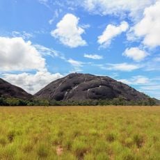
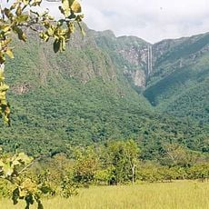
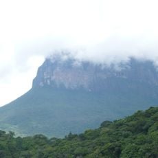
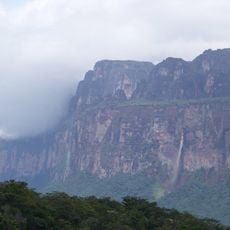
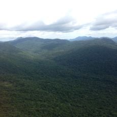
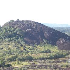
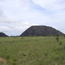
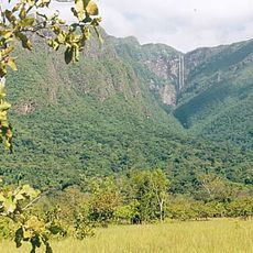
Cerros de Mavecure consists of three granite peaks rising from tropical forest near the Inírida River, with varying elevations that create a striking geological formation. These summits stand out distinctly against the flat forest landscape of the surrounding region.
These peaks belong to the Guiana Shield, a geological formation over 1.7 billion years old and among the oldest rock structures in South America. This ancient origin makes them witnesses to the continent's deep geological past.
The Puinave people view these peaks as sacred places, and their name comes from an indigenous language referring to traditional hunting tools. This spiritual connection shapes how visitors and locals experience the landscape today.
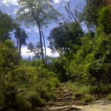
Access is by speedboat along the Inírida River from Puerto Inírida, requiring several hours of travel. Plan your visit during the dry season when river conditions are safer and more comfortable for the journey.
These peaks gained international attention after appearing in the film 'Embrace of the Serpent', which brought the region's natural features and indigenous stories to audiences worldwide. This cinematic presence introduced the location to travelers who might otherwise never have heard of it.
GPS coordinates: 3.46550,-67.97581
Latest update: December 7, 2025 20:43
Cerro Autana
165.3 kmEl Tuparro National Natural Park
171.3 km
Piedra del Cocuy
279.2 km
Serranía La Neblina National Park
353.5 km
Piedra del Cocuy Natural Monument
279.2 km
Yapacana National Park
134.1 km
Piedra La Tortuga Natural Monument
237.6 km
Duida-Marahuaca National Park
284.4 km
Casa sobre La Piedra
246.3 km
Cerro Duida
256.7 km
Yutaje Falls
322.6 km
Estadio Antonio José de Sucre
248.4 km
Cerro Yaví Natural Monument
339.9 km
Forte de São José de Marabitanas
296.6 km
Cué-cué/Marabitanas Indigenous Territory
316.2 km
Cathedral of Mary Help of Christians, Puerto Ayacucho
248.1 km
Gran Hotel Amazonas
248.3 km
Cerros Camani y Morrocoy Natural Monument
276.5 km
Parú-Euaja Massif Natural Monument
291.7 km
Cerros Vinilla y Aratitiyope Natural Monument
309.6 km
Cuao-Sipapo y Moriche Massif Natural Monument
189.3 km
Monumento Natural Cerro Autana
165.3 km
Sipapo Forest Reserve
226.5 km
Parguaza Forest Reserve
310.3 km
Piedra La Tortuga
237.6 km
Piedra Pintada Natural Monument
235.5 km
Serranía Yutajé y Coro-coro Natural Monument
322.2 km
Cerro Guanay Natural Monument
317.4 kmVisited this place? Tap the stars to rate it and share your experience / photos with the community! Try now! You can cancel it anytime.
Discover hidden gems everywhere you go!
From secret cafés to breathtaking viewpoints, skip the crowded tourist spots and find places that match your style. Our app makes it easy with voice search, smart filtering, route optimization, and insider tips from travelers worldwide. Download now for the complete mobile experience.
A unique approach to discovering new places❞
— Le Figaro
All the places worth exploring❞
— France Info
A tailor-made excursion in just a few clicks❞
— 20 Minutes