Colombia travel destinations: mountains, deserts, waterfalls, and colonial towns
Colombia presents geographic diversity that spans Caribbean coastlines, Andean highlands, Pacific forests, and eastern plains. The country encompasses colonial architecture in towns like Barichara and Mompox, where centuries-old stone buildings and churches reflect Spanish heritage. Natural formations include the Tatacoa Desert with its red sandstone canyons, the seasonal colors of Caño Cristales river, and the coastal dunes at Punta Gallinas marking South America's northernmost point. Coffee-growing regions such as Jardín preserve traditional Antioquian architecture, while islands like Providencia and Gorgona protect coral reefs and marine ecosystems in both Caribbean and Pacific waters.
From the arid landscapes of La Guajira Desert inhabited by Wayuu communities to the neo-Gothic architecture of Las Lajas Sanctuary bridging a river canyon, these locations demonstrate the country's contrasts. Visitors can explore mountain trails, observe astronomical phenomena in clear desert skies, discover colonial goldsmithing traditions, and witness humpback whale migrations. Each destination contributes to understanding Colombia's environmental and cultural range, offering experiences that vary from remote wilderness areas to well-preserved historical settlements across different elevations and climates.
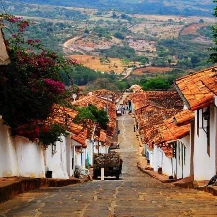
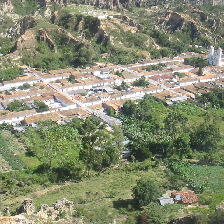
Barichara displays typical 18th-century colonial architecture with stone houses, paved streets, and a white church. This town in the Colombian Andes preserves its original structure and represents colonial construction using local materials. The stone facades and traditional roofs form part of Colombia's cultural contrasts, ranging from coastal areas to mountain regions.
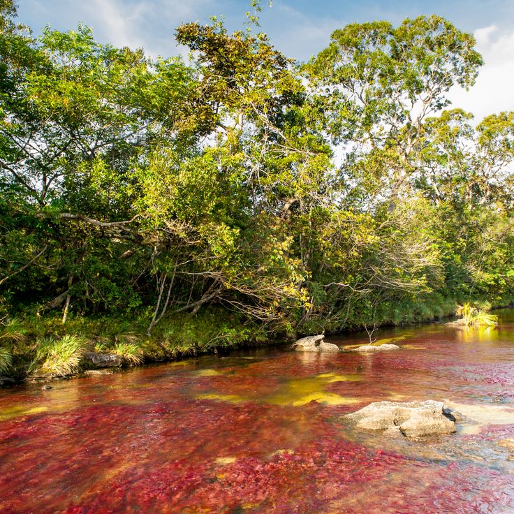
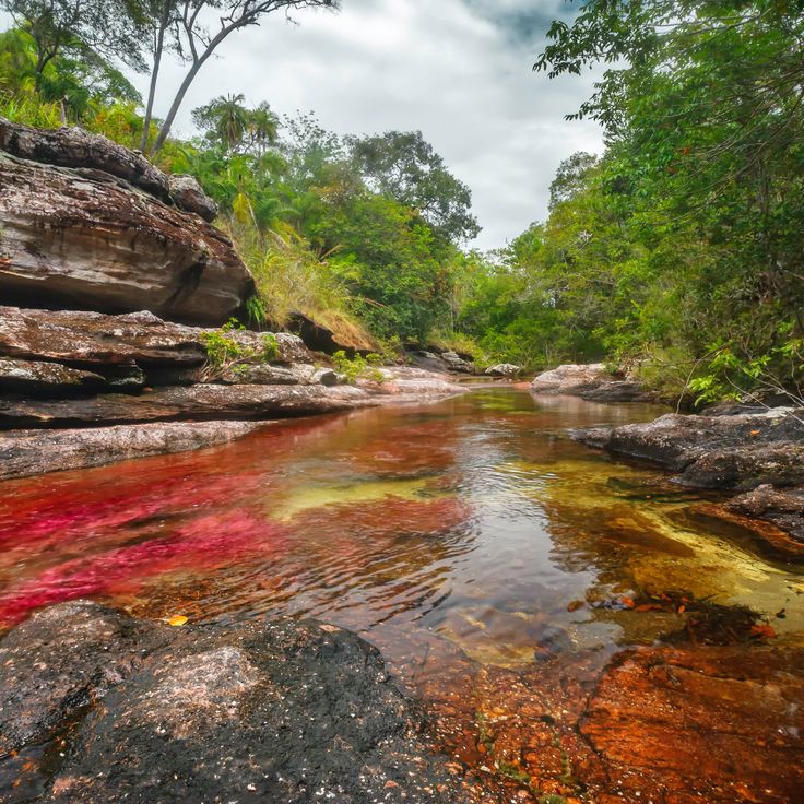
Caño Cristales displays red, yellow, green, blue, and black hues between July and November due to the aquatic plant Macarenia clavigera. This river flows through the Serranía de la Macarena and forms part of Colombia's natural contrasts. The phenomenon depends on water levels and sunlight exposure. The colors emerge from the endemic plant that grows on the riverbed. The river connects with other waterways in the region and demonstrates the ecological diversity between the Andes and the Orinoco basin.
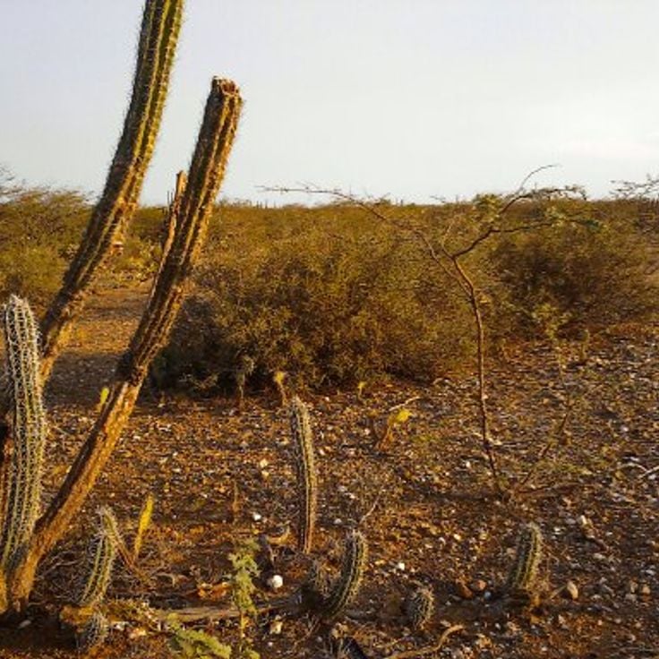
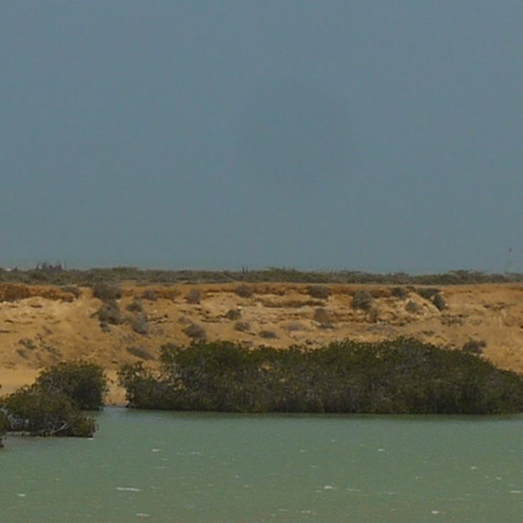
This desert borders the Caribbean Sea and hosts indigenous Wayuu communities in traditional Rancheria settlements. La Guajira Desert extends across the northernmost peninsula of Colombia and forms a contrast between barren dune landscapes and coastal stretches. The region experiences extreme climatic conditions with temperatures exceeding 104 degrees Fahrenheit (40 degrees Celsius) and less than 12 inches (300 millimeters) of rainfall annually. The Wayuu have inhabited this area for centuries and maintain their cultural traditions despite the harsh environmental conditions.
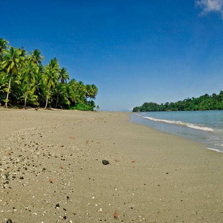
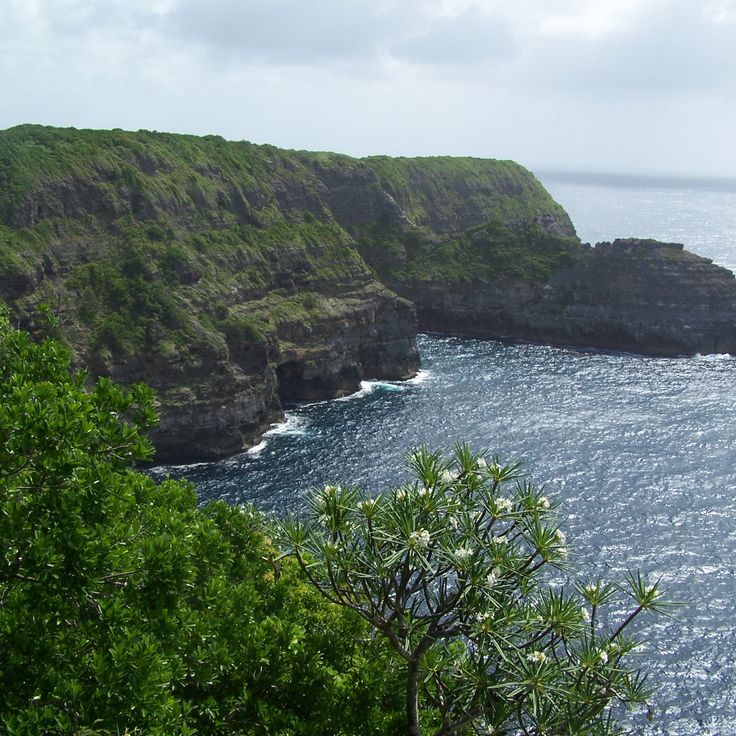
Gorgona Island sits in the Pacific Ocean off Colombia's coast and demonstrates the contrast between its history as a maximum security prison from 1959 to 1984 and its current role as a protected natural area. This island contains coral reefs, various whale species during their migrations, and a significant population of endemic snakes. The marine environment around Gorgona serves as an important habitat for humpback whales that arrive to calve between July and October. The tropical vegetation and surrounding waters provide habitat for numerous marine and terrestrial species, making the island an important example of the natural diversity that characterizes Colombia's Pacific region.
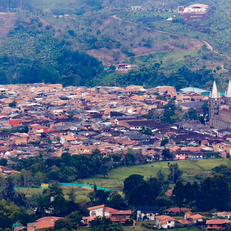
Jardín sits among mountain ranges and coffee plantations in the Antioquia department. This town preserves traditional houses with wooden balconies painted in red, blue and green. The main streets lead to the central park where the colonial heritage of the region remains visible. The surrounding mountains provide access to hiking trails and waterfalls. The architecture of this municipality represents the building style that prevails in Colombia's coffee-growing regions. The plantations around Jardín produce Arabica coffee at elevations ranging from 4,265 feet to 6,560 feet (1,300 to 2,000 meters) above sea level.
Punta Gallinas marks the northernmost point of South America at the Caribbean coast. Tall sand dunes extend to the sea, forming a landscape of golden slopes and turquoise waters. This region is inhabited by the Wayuu community, whose territory spans the La Guajira Peninsula. The Taroa dunes stand among the highest coastal dunes on the continent. Visitors reach this remote location after a journey of several hours through the desert from Riohacha. The area lies beyond paved roads and requires suitable vehicles for access.
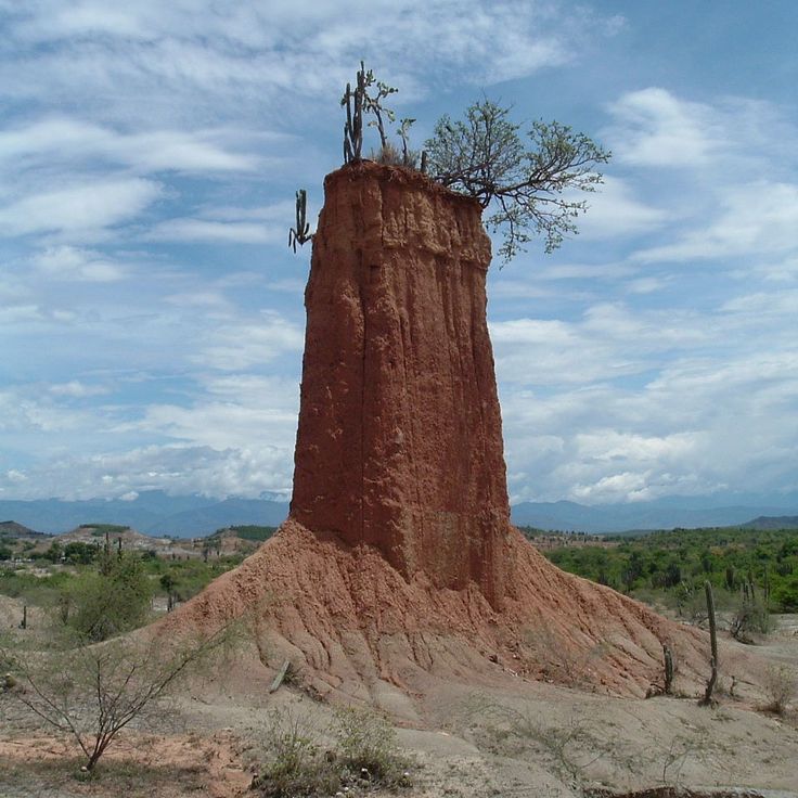
This desert landscape in Huila presents geological formations of sandstone and clay in reddish tones. The Tatacoa Desert features temperatures that reach 104 degrees Fahrenheit (40 degrees Celsius) and houses an observatory for nighttime sky observations. The geological structures show millions of years of erosion and form contrasts with the surrounding green regions of Colombia. This dry zone serves as an astronomical observation point due to low light pollution and clear night skies.
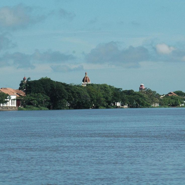
This colonial town on the banks of Río Magdalena preserves buildings from the 16th century established by Spanish settlers. The cobblestone streets of Mompox lead to several historic churches with white facades. Local artisans produce traditional gold jewelry, a craft that has continued since colonial times. The town represents Colombia's colonial contrasts between the Andes and the Caribbean coast.
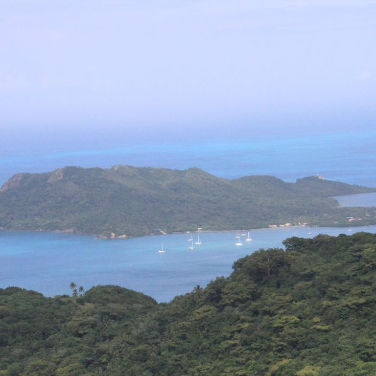
This island lies 450 miles (720 kilometers) from the Colombian mainland and demonstrates the natural and cultural contrasts that define Colombia. Providencia Island offers coral reefs in clear Caribbean waters, sand beaches and traditional Caribbean architecture. The island forms part of the Seaflower UNESCO Biosphere Reserve and preserves the Creole heritage of the region. The destination represents the Caribbean side of Colombia and complements the diversity of Andean landscapes, deserts and colonial towns found throughout the country.
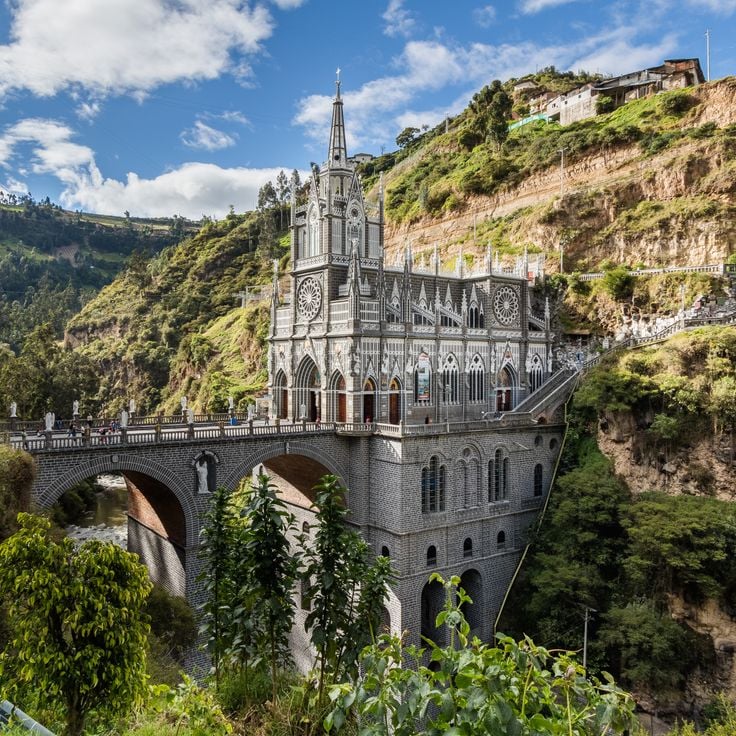
The Las Lajas Sanctuary is a neo-Gothic basilica in Nariño built between 1916 and 1949 that spans the Guáitara River at a height of 328 feet (100 meters). This church rises from a canyon and connects both sides of the cliff through a stone bridge leading to the sanctuary. The pilgrimage site attracts visitors who appreciate the architectural achievement and religious significance of this church built at a dramatic natural location. The sanctuary represents the cultural and religious traditions of Colombia in one of the country's most geologically diverse regions, connecting the Andean highlands with spiritual heritage.
This natural reserve in Valle del Cauca provides habitat for more than 300 bird species and 80 mammal species, making it a significant destination for nature observation in Colombia. San Cipriano is surrounded by tropical vegetation and clear rivers that invite swimming and exploration of regional biodiversity. The reserve is accessed through an unusual transportation method: wooden platforms that run on railroad tracks, carrying visitors through the forest to the reserve. This connection between Andean landscape and Pacific coast demonstrates the natural contrasts that characterize Colombia.
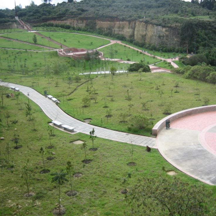
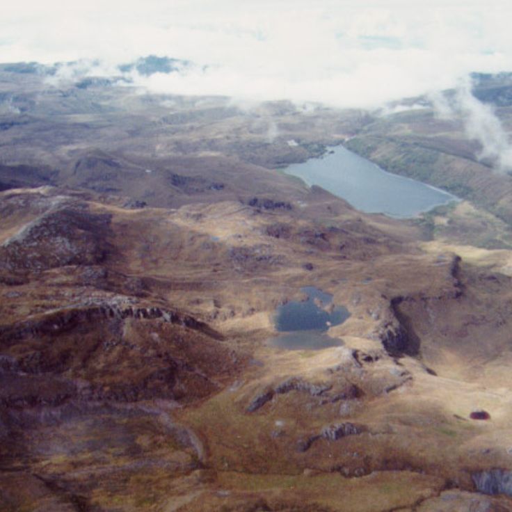
This national park supplies 80 percent of Bogotá's drinking water and spans elevations from 2,625 to 13,189 feet (800 to 4,020 meters) above sea level. Chingaza encompasses páramo ecosystems, cloud forests, and glacial lakes within the eastern Andes mountain range. The protected area covers more than 188,000 acres (76,000 hectares) and safeguards water sources vital to the capital city. Visitors can observe spectacled bears, white-tailed deer, and over 380 bird species while hiking through diverse climate zones ranging from tropical mountain rainforests to alpine grasslands.
Quebrada Las Gachas in Santander presents a geological feature along a riverbed containing multiple round, reddish depressions filled with clear water. These natural pools formed through erosion of the bedrock over thousands of years, creating an unusual formation within the Colombian landscape. The pools demonstrate the volcanic and sedimentary processes of the region and provide insight into the geological development of Santander. River water flows between the depressions and continues to shape these landscape structures. The red coloring comes from mineral deposits in the rock. Guadalupe offers access to this natural formation, which forms part of the diverse contrasts found throughout Colombia.
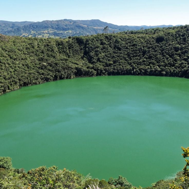
This circular lake sits in a crater at an elevation of approximately 10,000 feet (3,000 meters) in the eastern Andes of Colombia. The Muisca indigenous people conducted religious ceremonies here, including offerings of gold and emeralds. Laguna de Guatavita is considered a possible origin of the El Dorado legend. Access is by a walking trail that leads from the park entrance to the lake. The area provides views of the surrounding highland landscapes and páramo vegetation. This lake is part of a protected area that preserves the natural and cultural values of the region.
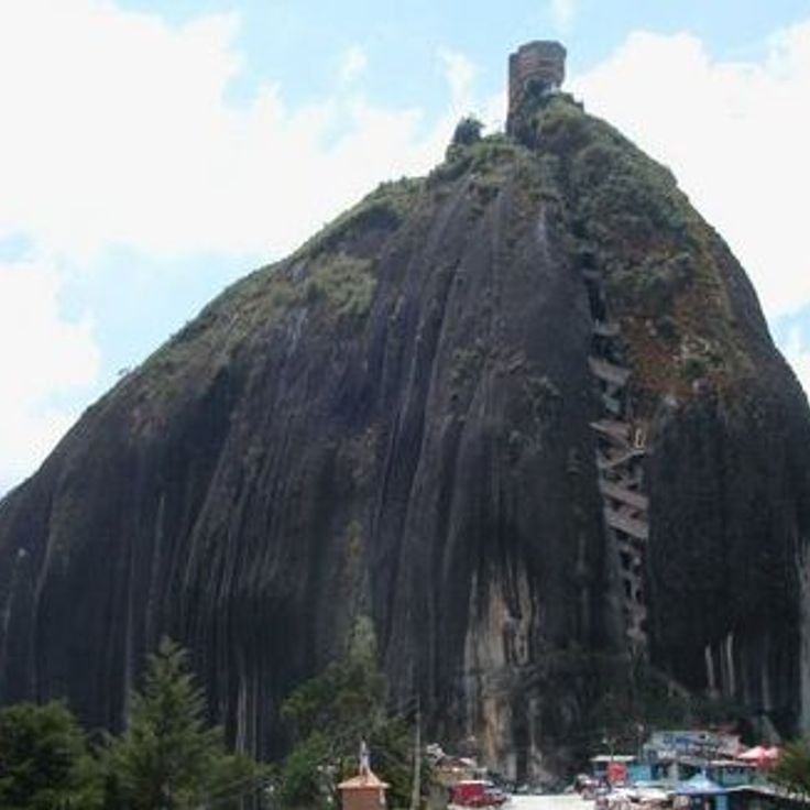
This granite rock rises 200 meters (656 feet) from the ground near the Guatapé reservoir and provides a viewpoint over the surrounding Andean landscape. El Peñón de Guatapé is located in the Antioquia region and can be accessed via a staircase of 740 steps built into the rock face. The climb leads to a platform at the summit from which visitors can observe the lake and green hills. The monolith is part of Colombia's natural contrasts that extend from mountain regions to coastal areas. The formation stands isolated in the landscape and represents a geological feature of the area. Access is from the nearby town of Guatapé, known for its colorful houses.
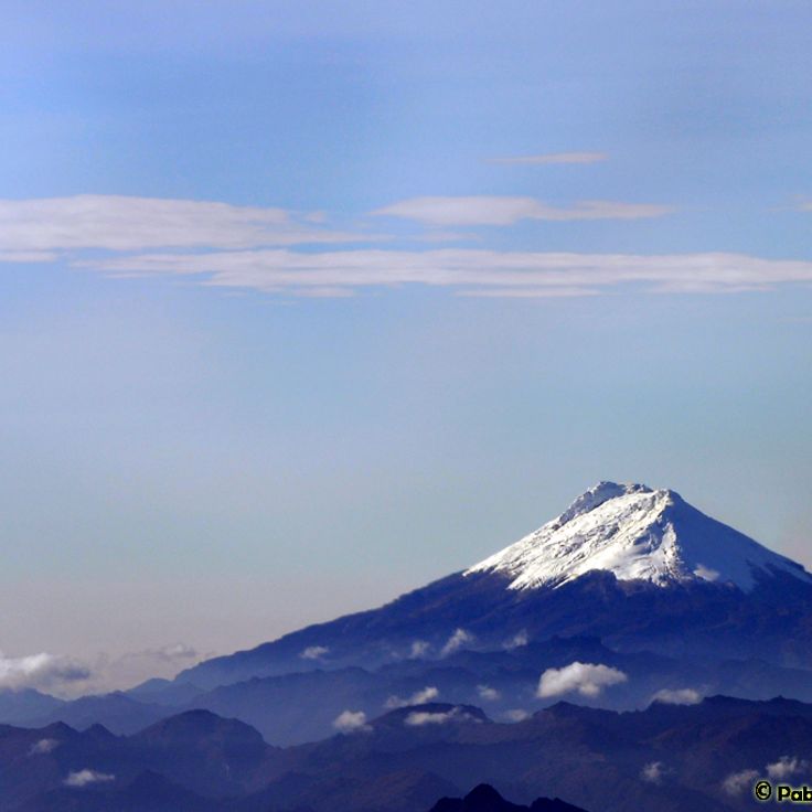
This stratovolcano reaches a height of 17598 feet (5364 meters) and forms the highest point of the Central Cordillera. The four peaks of Nevado del Huila remain covered in ice throughout the year. The active volcano lies in the Colombian Andes and belongs to the most significant geological formations of the region. This summit massif marks an important reference point in Colombia's natural geography between the Caribbean coast and the Andean region.
The Otun Quimbaya Wildlife Sanctuary protects 489 hectares (1,209 acres) of Andean mountain forest in Colombia's coffee region. Visitors to this sanctuary can observe over 300 bird species and various native mammals including howler monkeys, capuchin monkeys, and white-tailed deer. This protected area ranges from 5,905 to 7,382 feet (1,800 to 2,250 meters) in elevation and preserves cloud forest and river ecosystems along the Otún River. Trails lead through different vegetation zones and provide views of the biological diversity found in Colombia's central Andes.
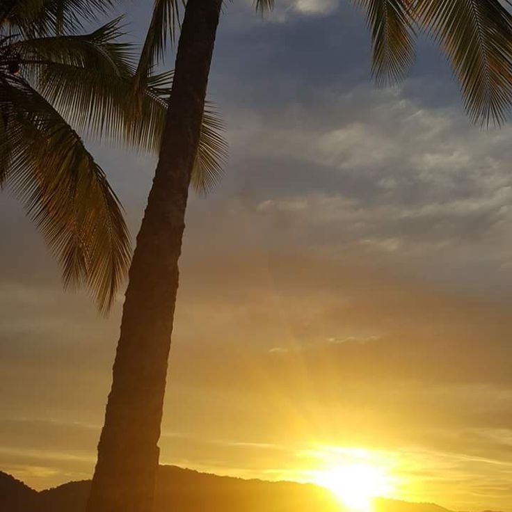
This Pacific coastal municipality covers 1667 square miles (4319 square kilometers) in a region where humpback whales migrate through tropical waters from July to October. Bahia Solano provides access to rainforests, waterfalls, and beaches reachable only by plane or boat. The remote location has helped preserve natural habitats with minimal development. Fishing communities and small settlements characterize life along the coast, while tourism focuses on whale watching and nature exploration. The area receives substantial rainfall throughout the year, supporting dense vegetation and diverse wildlife.
This mountain range contains the Caño Cristales river system with its red aquatic plants and numerous waterfalls across 75 miles (120 kilometers). La Macarena Mountain Range forms a geological formation that represents part of Colombia's natural contrasts from the Caribbean to the Andes. The system extends through Meta Department and connects different ecosystems between the Amazon basin and the Llanos. The rivers and waterfalls of this range are among the natural features between Ciudad Perdida and the Tatacoa Desert.
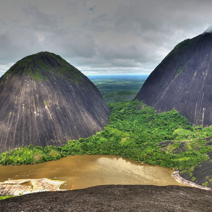
These granite formations in Guainía rise 170 meters (558 feet) above the Inírida River and form part of the Guiana Shield, a geological formation from Precambrian times. The Mavecure Hills rank among Colombia's least visited natural sites, located in a remote region of the Amazon basin. The three distinct peaks emerge from tropical rainforest and provide access to trails that pass through indigenous Puinave territory. The area surrounding these rock formations allows observation of the river landscape and surrounding vegetation. The climb to the summits takes approximately 45 minutes and requires good physical condition.
Playa Belén is located in Norte de Santander and displays geological formations amid fields and farmland. The stone structures define the landscape of this village and provide insight into Colombia's natural contrasts between the Andes and other regions. These geological features formed through natural processes over thousands of years and create a characteristic environment that differs from the country's coastal areas and desert landscapes. The formations extend across the agricultural land and form distinctive points in the rural region.
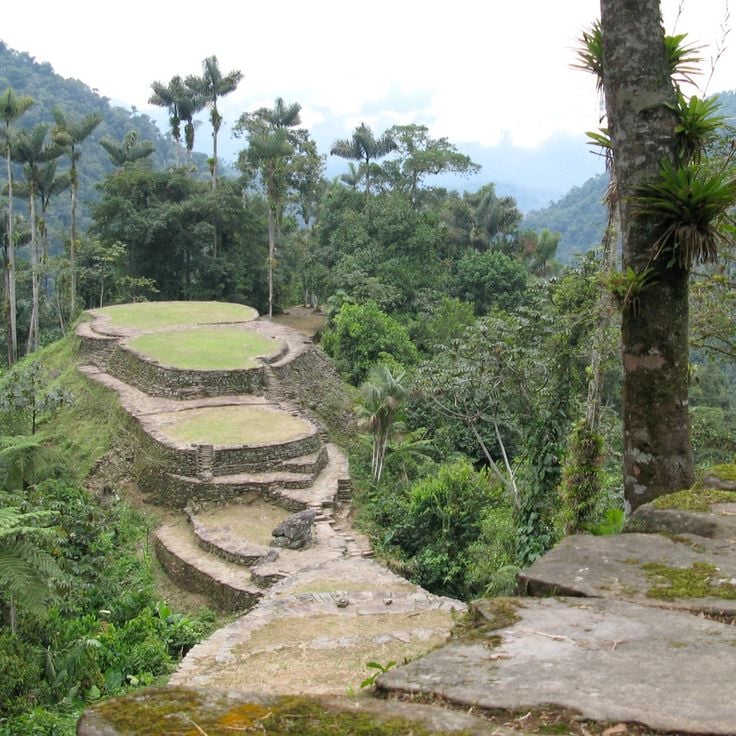
This archaeological site sits in the Sierra Nevada de Santa Marta at 3940 feet (1200 meters) elevation and ranks among Colombia's most significant pre-Columbian settlements. Ciudad Perdida was built by the Tayrona people between the 8th and 14th centuries and consists of more than 170 stone terraces carved into the mountainside. The ascent to this site takes several days through dense rainforest and passes through different climate zones of the Sierra Nevada. The terraces, staircases, and plazas demonstrate the advanced construction knowledge of the Tayrona culture and provide insight into their settlement patterns.
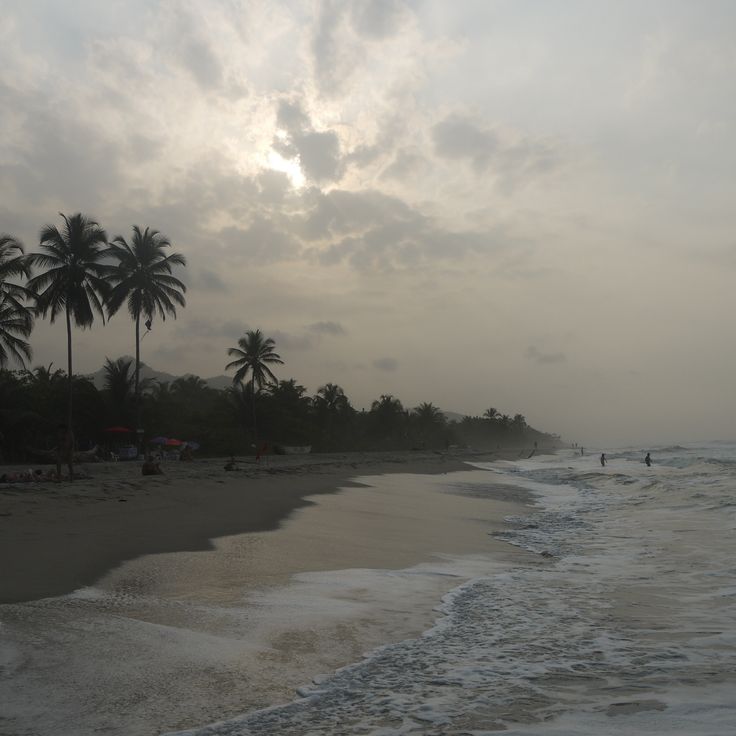
Palomino sits at the Caribbean Sea where the Palomino River reaches the ocean after flowing from the Sierra Nevada through tropical forest. This coastal location connects Caribbean beaches with the natural diversity of the adjacent mountain region. The area shows the contrast between the river course from the high mountains and the flat coastal zone. The natural environment provides access to different ecosystems, from mountain forest to sea, and represents the geographic diversity of Colombia between mountains and Caribbean coast.
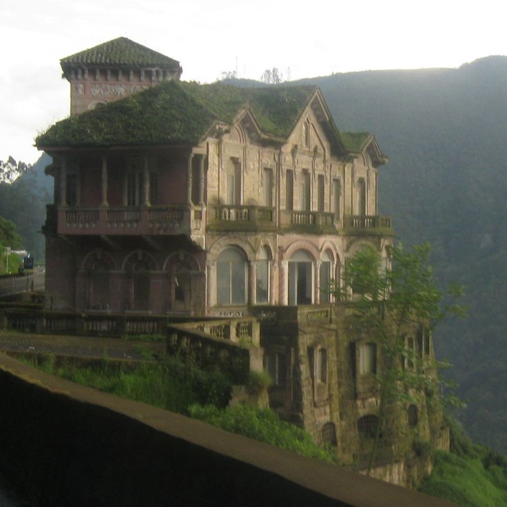
Salto del Tequendama is a waterfall in the mountains south of Bogotá, where the Río Bogotá drops 515 feet (157 meters) over a cliff into a forested canyon. The landscape connects the high plateau of the Sabana de Bogotá with the wooded valley of the Río Bogotá below. A historic hotel from 1923 stands at the canyon edge and now serves as a biodiversity museum. This waterfall demonstrates the geographic contrasts of Colombia between Andean highlands and lower valleys. The site is located roughly 19 miles (30 kilometers) southwest of Bogotá and can be reached via the road to Mesitas del Colegio.
Amacayacu National Park extends across 725,000 acres (293,500 hectares) of rainforest in the Colombian Amazon and contains more than 150 mammal species along with traditional settlements of the Ticuna community. This park demonstrates the biological diversity of the Amazon basin and preserves important habitats for river dolphins, jaguars, and howler monkeys. The Ticuna have inhabited this region for centuries and maintain sustainable use of the forest for their traditional practices. This park lies along the Amazon River and provides access to flooded forests, oxbow lakes, and forest trails that connect different ecosystems.
These thermal springs are located at 7,000 feet (2,100 meters) above sea level in the Andean highlands of Risaralda department and feed several mineral pools with water temperatures ranging from 104 to 158 degrees Fahrenheit (40 to 70 degrees Celsius). The springs originate from volcanic rock and flow through dense Andean forest before reaching various pools. The site sits approximately 9 miles (15 kilometers) from Santa Rosa de Cabal and is accessed by a trail through cloud forest. These thermal springs demonstrate the geothermal activity of Colombia's central Andes region, where volcanic formations produce naturally heated mineral water. The surrounding vegetation consists of high-altitude mountain forests with native tree species and ferns.
The Valle de Cocora is home to wax palms, Colombia's national symbols, which reach heights of up to 197 feet (60 meters). This valley sits in the coffee zone of the Colombian Andes and offers hiking trails through cloud forests and open grasslands. The tall palms grow at elevations between 5900 and 7900 feet (1800 to 2400 meters) and form a distinctive landscape. The valley serves as an access point to Los Nevados National Park and demonstrates the natural contrasts of the region from Caribbean coasts to Andean peaks.
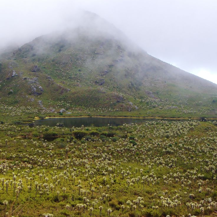
This park extends across 58,300 hectares (144,000 acres) in Colombia's central Andes and contains five volcanoes. Nevado del Ruiz reaches the highest point at 17,470 feet (5,325 meters). The landscape ranges from glaciated peaks to páramo highlands where specialized plant species like frailejones grow. Thermal springs emerge at several locations due to volcanic activity. Hiking trails traverse different elevation zones with changing vegetation. Parque Los Nevados demonstrates the geological processes of the Andean volcanic chain and their impact on climate and water supply for surrounding regions.
Barichara displays typical 18th-century colonial architecture with stone houses, paved streets, and a white church. This town in the Colombian Andes preserves its original structure and represents colonial construction using local materials. The stone facades and traditional roofs form part of Colombia's cultural contrasts, ranging from coastal areas to mountain regions.
Caño Cristales displays red, yellow, green, blue, and black hues between July and November due to the aquatic plant Macarenia clavigera. This river flows through the Serranía de la Macarena and forms part of Colombia's natural contrasts. The phenomenon depends on water levels and sunlight exposure. The colors emerge from the endemic plant that grows on the riverbed. The river connects with other waterways in the region and demonstrates the ecological diversity between the Andes and the Orinoco basin.
This desert borders the Caribbean Sea and hosts indigenous Wayuu communities in traditional Rancheria settlements. La Guajira Desert extends across the northernmost peninsula of Colombia and forms a contrast between barren dune landscapes and coastal stretches. The region experiences extreme climatic conditions with temperatures exceeding 104 degrees Fahrenheit (40 degrees Celsius) and less than 12 inches (300 millimeters) of rainfall annually. The Wayuu have inhabited this area for centuries and maintain their cultural traditions despite the harsh environmental conditions.
Gorgona Island sits in the Pacific Ocean off Colombia's coast and demonstrates the contrast between its history as a maximum security prison from 1959 to 1984 and its current role as a protected natural area. This island contains coral reefs, various whale species during their migrations, and a significant population of endemic snakes. The marine environment around Gorgona serves as an important habitat for humpback whales that arrive to calve between July and October. The tropical vegetation and surrounding waters provide habitat for numerous marine and terrestrial species, making the island an important example of the natural diversity that characterizes Colombia's Pacific region.
Jardín sits among mountain ranges and coffee plantations in the Antioquia department. This town preserves traditional houses with wooden balconies painted in red, blue and green. The main streets lead to the central park where the colonial heritage of the region remains visible. The surrounding mountains provide access to hiking trails and waterfalls. The architecture of this municipality represents the building style that prevails in Colombia's coffee-growing regions. The plantations around Jardín produce Arabica coffee at elevations ranging from 4,265 feet to 6,560 feet (1,300 to 2,000 meters) above sea level.
Punta Gallinas marks the northernmost point of South America at the Caribbean coast. Tall sand dunes extend to the sea, forming a landscape of golden slopes and turquoise waters. This region is inhabited by the Wayuu community, whose territory spans the La Guajira Peninsula. The Taroa dunes stand among the highest coastal dunes on the continent. Visitors reach this remote location after a journey of several hours through the desert from Riohacha. The area lies beyond paved roads and requires suitable vehicles for access.
This desert landscape in Huila presents geological formations of sandstone and clay in reddish tones. The Tatacoa Desert features temperatures that reach 104 degrees Fahrenheit (40 degrees Celsius) and houses an observatory for nighttime sky observations. The geological structures show millions of years of erosion and form contrasts with the surrounding green regions of Colombia. This dry zone serves as an astronomical observation point due to low light pollution and clear night skies.
This colonial town on the banks of Río Magdalena preserves buildings from the 16th century established by Spanish settlers. The cobblestone streets of Mompox lead to several historic churches with white facades. Local artisans produce traditional gold jewelry, a craft that has continued since colonial times. The town represents Colombia's colonial contrasts between the Andes and the Caribbean coast.
This island lies 450 miles (720 kilometers) from the Colombian mainland and demonstrates the natural and cultural contrasts that define Colombia. Providencia Island offers coral reefs in clear Caribbean waters, sand beaches and traditional Caribbean architecture. The island forms part of the Seaflower UNESCO Biosphere Reserve and preserves the Creole heritage of the region. The destination represents the Caribbean side of Colombia and complements the diversity of Andean landscapes, deserts and colonial towns found throughout the country.
The Las Lajas Sanctuary is a neo-Gothic basilica in Nariño built between 1916 and 1949 that spans the Guáitara River at a height of 328 feet (100 meters). This church rises from a canyon and connects both sides of the cliff through a stone bridge leading to the sanctuary. The pilgrimage site attracts visitors who appreciate the architectural achievement and religious significance of this church built at a dramatic natural location. The sanctuary represents the cultural and religious traditions of Colombia in one of the country's most geologically diverse regions, connecting the Andean highlands with spiritual heritage.
This natural reserve in Valle del Cauca provides habitat for more than 300 bird species and 80 mammal species, making it a significant destination for nature observation in Colombia. San Cipriano is surrounded by tropical vegetation and clear rivers that invite swimming and exploration of regional biodiversity. The reserve is accessed through an unusual transportation method: wooden platforms that run on railroad tracks, carrying visitors through the forest to the reserve. This connection between Andean landscape and Pacific coast demonstrates the natural contrasts that characterize Colombia.
This national park supplies 80 percent of Bogotá's drinking water and spans elevations from 2,625 to 13,189 feet (800 to 4,020 meters) above sea level. Chingaza encompasses páramo ecosystems, cloud forests, and glacial lakes within the eastern Andes mountain range. The protected area covers more than 188,000 acres (76,000 hectares) and safeguards water sources vital to the capital city. Visitors can observe spectacled bears, white-tailed deer, and over 380 bird species while hiking through diverse climate zones ranging from tropical mountain rainforests to alpine grasslands.
Quebrada Las Gachas in Santander presents a geological feature along a riverbed containing multiple round, reddish depressions filled with clear water. These natural pools formed through erosion of the bedrock over thousands of years, creating an unusual formation within the Colombian landscape. The pools demonstrate the volcanic and sedimentary processes of the region and provide insight into the geological development of Santander. River water flows between the depressions and continues to shape these landscape structures. The red coloring comes from mineral deposits in the rock. Guadalupe offers access to this natural formation, which forms part of the diverse contrasts found throughout Colombia.
This circular lake sits in a crater at an elevation of approximately 10,000 feet (3,000 meters) in the eastern Andes of Colombia. The Muisca indigenous people conducted religious ceremonies here, including offerings of gold and emeralds. Laguna de Guatavita is considered a possible origin of the El Dorado legend. Access is by a walking trail that leads from the park entrance to the lake. The area provides views of the surrounding highland landscapes and páramo vegetation. This lake is part of a protected area that preserves the natural and cultural values of the region.
This granite rock rises 200 meters (656 feet) from the ground near the Guatapé reservoir and provides a viewpoint over the surrounding Andean landscape. El Peñón de Guatapé is located in the Antioquia region and can be accessed via a staircase of 740 steps built into the rock face. The climb leads to a platform at the summit from which visitors can observe the lake and green hills. The monolith is part of Colombia's natural contrasts that extend from mountain regions to coastal areas. The formation stands isolated in the landscape and represents a geological feature of the area. Access is from the nearby town of Guatapé, known for its colorful houses.
This stratovolcano reaches a height of 17598 feet (5364 meters) and forms the highest point of the Central Cordillera. The four peaks of Nevado del Huila remain covered in ice throughout the year. The active volcano lies in the Colombian Andes and belongs to the most significant geological formations of the region. This summit massif marks an important reference point in Colombia's natural geography between the Caribbean coast and the Andean region.
The Otun Quimbaya Wildlife Sanctuary protects 489 hectares (1,209 acres) of Andean mountain forest in Colombia's coffee region. Visitors to this sanctuary can observe over 300 bird species and various native mammals including howler monkeys, capuchin monkeys, and white-tailed deer. This protected area ranges from 5,905 to 7,382 feet (1,800 to 2,250 meters) in elevation and preserves cloud forest and river ecosystems along the Otún River. Trails lead through different vegetation zones and provide views of the biological diversity found in Colombia's central Andes.
This Pacific coastal municipality covers 1667 square miles (4319 square kilometers) in a region where humpback whales migrate through tropical waters from July to October. Bahia Solano provides access to rainforests, waterfalls, and beaches reachable only by plane or boat. The remote location has helped preserve natural habitats with minimal development. Fishing communities and small settlements characterize life along the coast, while tourism focuses on whale watching and nature exploration. The area receives substantial rainfall throughout the year, supporting dense vegetation and diverse wildlife.
This mountain range contains the Caño Cristales river system with its red aquatic plants and numerous waterfalls across 75 miles (120 kilometers). La Macarena Mountain Range forms a geological formation that represents part of Colombia's natural contrasts from the Caribbean to the Andes. The system extends through Meta Department and connects different ecosystems between the Amazon basin and the Llanos. The rivers and waterfalls of this range are among the natural features between Ciudad Perdida and the Tatacoa Desert.
These granite formations in Guainía rise 170 meters (558 feet) above the Inírida River and form part of the Guiana Shield, a geological formation from Precambrian times. The Mavecure Hills rank among Colombia's least visited natural sites, located in a remote region of the Amazon basin. The three distinct peaks emerge from tropical rainforest and provide access to trails that pass through indigenous Puinave territory. The area surrounding these rock formations allows observation of the river landscape and surrounding vegetation. The climb to the summits takes approximately 45 minutes and requires good physical condition.
Playa Belén is located in Norte de Santander and displays geological formations amid fields and farmland. The stone structures define the landscape of this village and provide insight into Colombia's natural contrasts between the Andes and other regions. These geological features formed through natural processes over thousands of years and create a characteristic environment that differs from the country's coastal areas and desert landscapes. The formations extend across the agricultural land and form distinctive points in the rural region.
This archaeological site sits in the Sierra Nevada de Santa Marta at 3940 feet (1200 meters) elevation and ranks among Colombia's most significant pre-Columbian settlements. Ciudad Perdida was built by the Tayrona people between the 8th and 14th centuries and consists of more than 170 stone terraces carved into the mountainside. The ascent to this site takes several days through dense rainforest and passes through different climate zones of the Sierra Nevada. The terraces, staircases, and plazas demonstrate the advanced construction knowledge of the Tayrona culture and provide insight into their settlement patterns.
Palomino sits at the Caribbean Sea where the Palomino River reaches the ocean after flowing from the Sierra Nevada through tropical forest. This coastal location connects Caribbean beaches with the natural diversity of the adjacent mountain region. The area shows the contrast between the river course from the high mountains and the flat coastal zone. The natural environment provides access to different ecosystems, from mountain forest to sea, and represents the geographic diversity of Colombia between mountains and Caribbean coast.
Salto del Tequendama is a waterfall in the mountains south of Bogotá, where the Río Bogotá drops 515 feet (157 meters) over a cliff into a forested canyon. The landscape connects the high plateau of the Sabana de Bogotá with the wooded valley of the Río Bogotá below. A historic hotel from 1923 stands at the canyon edge and now serves as a biodiversity museum. This waterfall demonstrates the geographic contrasts of Colombia between Andean highlands and lower valleys. The site is located roughly 19 miles (30 kilometers) southwest of Bogotá and can be reached via the road to Mesitas del Colegio.
Amacayacu National Park extends across 725,000 acres (293,500 hectares) of rainforest in the Colombian Amazon and contains more than 150 mammal species along with traditional settlements of the Ticuna community. This park demonstrates the biological diversity of the Amazon basin and preserves important habitats for river dolphins, jaguars, and howler monkeys. The Ticuna have inhabited this region for centuries and maintain sustainable use of the forest for their traditional practices. This park lies along the Amazon River and provides access to flooded forests, oxbow lakes, and forest trails that connect different ecosystems.
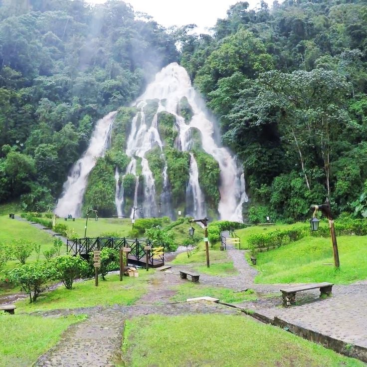
These thermal springs are located at 7,000 feet (2,100 meters) above sea level in the Andean highlands of Risaralda department and feed several mineral pools with water temperatures ranging from 104 to 158 degrees Fahrenheit (40 to 70 degrees Celsius). The springs originate from volcanic rock and flow through dense Andean forest before reaching various pools. The site sits approximately 9 miles (15 kilometers) from Santa Rosa de Cabal and is accessed by a trail through cloud forest. These thermal springs demonstrate the geothermal activity of Colombia's central Andes region, where volcanic formations produce naturally heated mineral water. The surrounding vegetation consists of high-altitude mountain forests with native tree species and ferns.
The Valle de Cocora is home to wax palms, Colombia's national symbols, which reach heights of up to 197 feet (60 meters). This valley sits in the coffee zone of the Colombian Andes and offers hiking trails through cloud forests and open grasslands. The tall palms grow at elevations between 5900 and 7900 feet (1800 to 2400 meters) and form a distinctive landscape. The valley serves as an access point to Los Nevados National Park and demonstrates the natural contrasts of the region from Caribbean coasts to Andean peaks.
This park extends across 58,300 hectares (144,000 acres) in Colombia's central Andes and contains five volcanoes. Nevado del Ruiz reaches the highest point at 17,470 feet (5,325 meters). The landscape ranges from glaciated peaks to páramo highlands where specialized plant species like frailejones grow. Thermal springs emerge at several locations due to volcanic activity. Hiking trails traverse different elevation zones with changing vegetation. Parque Los Nevados demonstrates the geological processes of the Andean volcanic chain and their impact on climate and water supply for surrounding regions.
Barichara displays typical 18th-century colonial architecture with stone houses, paved streets, and a white church. This town in the Colombian Andes preserves its original structure and represents colonial construction using local materials. The stone facades and traditional roofs form part of Colombia's cultural contrasts, ranging from coastal areas to mountain regions.
Caño Cristales displays red, yellow, green, blue, and black hues between July and November due to the aquatic plant Macarenia clavigera. This river flows through the Serranía de la Macarena and forms part of Colombia's natural contrasts. The phenomenon depends on water levels and sunlight exposure. The colors emerge from the endemic plant that grows on the riverbed. The river connects with other waterways in the region and demonstrates the ecological diversity between the Andes and the Orinoco basin.
This desert borders the Caribbean Sea and hosts indigenous Wayuu communities in traditional Rancheria settlements. La Guajira Desert extends across the northernmost peninsula of Colombia and forms a contrast between barren dune landscapes and coastal stretches. The region experiences extreme climatic conditions with temperatures exceeding 104 degrees Fahrenheit (40 degrees Celsius) and less than 12 inches (300 millimeters) of rainfall annually. The Wayuu have inhabited this area for centuries and maintain their cultural traditions despite the harsh environmental conditions.
Gorgona Island sits in the Pacific Ocean off Colombia's coast and demonstrates the contrast between its history as a maximum security prison from 1959 to 1984 and its current role as a protected natural area. This island contains coral reefs, various whale species during their migrations, and a significant population of endemic snakes. The marine environment around Gorgona serves as an important habitat for humpback whales that arrive to calve between July and October. The tropical vegetation and surrounding waters provide habitat for numerous marine and terrestrial species, making the island an important example of the natural diversity that characterizes Colombia's Pacific region.
Jardín sits among mountain ranges and coffee plantations in the Antioquia department. This town preserves traditional houses with wooden balconies painted in red, blue and green. The main streets lead to the central park where the colonial heritage of the region remains visible. The surrounding mountains provide access to hiking trails and waterfalls. The architecture of this municipality represents the building style that prevails in Colombia's coffee-growing regions. The plantations around Jardín produce Arabica coffee at elevations ranging from 4,265 feet to 6,560 feet (1,300 to 2,000 meters) above sea level.
Punta Gallinas marks the northernmost point of South America at the Caribbean coast. Tall sand dunes extend to the sea, forming a landscape of golden slopes and turquoise waters. This region is inhabited by the Wayuu community, whose territory spans the La Guajira Peninsula. The Taroa dunes stand among the highest coastal dunes on the continent. Visitors reach this remote location after a journey of several hours through the desert from Riohacha. The area lies beyond paved roads and requires suitable vehicles for access.
This desert landscape in Huila presents geological formations of sandstone and clay in reddish tones. The Tatacoa Desert features temperatures that reach 104 degrees Fahrenheit (40 degrees Celsius) and houses an observatory for nighttime sky observations. The geological structures show millions of years of erosion and form contrasts with the surrounding green regions of Colombia. This dry zone serves as an astronomical observation point due to low light pollution and clear night skies.
This colonial town on the banks of Río Magdalena preserves buildings from the 16th century established by Spanish settlers. The cobblestone streets of Mompox lead to several historic churches with white facades. Local artisans produce traditional gold jewelry, a craft that has continued since colonial times. The town represents Colombia's colonial contrasts between the Andes and the Caribbean coast.
This island lies 450 miles (720 kilometers) from the Colombian mainland and demonstrates the natural and cultural contrasts that define Colombia. Providencia Island offers coral reefs in clear Caribbean waters, sand beaches and traditional Caribbean architecture. The island forms part of the Seaflower UNESCO Biosphere Reserve and preserves the Creole heritage of the region. The destination represents the Caribbean side of Colombia and complements the diversity of Andean landscapes, deserts and colonial towns found throughout the country.
The Las Lajas Sanctuary is a neo-Gothic basilica in Nariño built between 1916 and 1949 that spans the Guáitara River at a height of 328 feet (100 meters). This church rises from a canyon and connects both sides of the cliff through a stone bridge leading to the sanctuary. The pilgrimage site attracts visitors who appreciate the architectural achievement and religious significance of this church built at a dramatic natural location. The sanctuary represents the cultural and religious traditions of Colombia in one of the country's most geologically diverse regions, connecting the Andean highlands with spiritual heritage.
This natural reserve in Valle del Cauca provides habitat for more than 300 bird species and 80 mammal species, making it a significant destination for nature observation in Colombia. San Cipriano is surrounded by tropical vegetation and clear rivers that invite swimming and exploration of regional biodiversity. The reserve is accessed through an unusual transportation method: wooden platforms that run on railroad tracks, carrying visitors through the forest to the reserve. This connection between Andean landscape and Pacific coast demonstrates the natural contrasts that characterize Colombia.
This national park supplies 80 percent of Bogotá's drinking water and spans elevations from 2,625 to 13,189 feet (800 to 4,020 meters) above sea level. Chingaza encompasses páramo ecosystems, cloud forests, and glacial lakes within the eastern Andes mountain range. The protected area covers more than 188,000 acres (76,000 hectares) and safeguards water sources vital to the capital city. Visitors can observe spectacled bears, white-tailed deer, and over 380 bird species while hiking through diverse climate zones ranging from tropical mountain rainforests to alpine grasslands.
Quebrada Las Gachas in Santander presents a geological feature along a riverbed containing multiple round, reddish depressions filled with clear water. These natural pools formed through erosion of the bedrock over thousands of years, creating an unusual formation within the Colombian landscape. The pools demonstrate the volcanic and sedimentary processes of the region and provide insight into the geological development of Santander. River water flows between the depressions and continues to shape these landscape structures. The red coloring comes from mineral deposits in the rock. Guadalupe offers access to this natural formation, which forms part of the diverse contrasts found throughout Colombia.
This circular lake sits in a crater at an elevation of approximately 10,000 feet (3,000 meters) in the eastern Andes of Colombia. The Muisca indigenous people conducted religious ceremonies here, including offerings of gold and emeralds. Laguna de Guatavita is considered a possible origin of the El Dorado legend. Access is by a walking trail that leads from the park entrance to the lake. The area provides views of the surrounding highland landscapes and páramo vegetation. This lake is part of a protected area that preserves the natural and cultural values of the region.
This granite rock rises 200 meters (656 feet) from the ground near the Guatapé reservoir and provides a viewpoint over the surrounding Andean landscape. El Peñón de Guatapé is located in the Antioquia region and can be accessed via a staircase of 740 steps built into the rock face. The climb leads to a platform at the summit from which visitors can observe the lake and green hills. The monolith is part of Colombia's natural contrasts that extend from mountain regions to coastal areas. The formation stands isolated in the landscape and represents a geological feature of the area. Access is from the nearby town of Guatapé, known for its colorful houses.
This stratovolcano reaches a height of 17598 feet (5364 meters) and forms the highest point of the Central Cordillera. The four peaks of Nevado del Huila remain covered in ice throughout the year. The active volcano lies in the Colombian Andes and belongs to the most significant geological formations of the region. This summit massif marks an important reference point in Colombia's natural geography between the Caribbean coast and the Andean region.
The Otun Quimbaya Wildlife Sanctuary protects 489 hectares (1,209 acres) of Andean mountain forest in Colombia's coffee region. Visitors to this sanctuary can observe over 300 bird species and various native mammals including howler monkeys, capuchin monkeys, and white-tailed deer. This protected area ranges from 5,905 to 7,382 feet (1,800 to 2,250 meters) in elevation and preserves cloud forest and river ecosystems along the Otún River. Trails lead through different vegetation zones and provide views of the biological diversity found in Colombia's central Andes.
This Pacific coastal municipality covers 1667 square miles (4319 square kilometers) in a region where humpback whales migrate through tropical waters from July to October. Bahia Solano provides access to rainforests, waterfalls, and beaches reachable only by plane or boat. The remote location has helped preserve natural habitats with minimal development. Fishing communities and small settlements characterize life along the coast, while tourism focuses on whale watching and nature exploration. The area receives substantial rainfall throughout the year, supporting dense vegetation and diverse wildlife.
This mountain range contains the Caño Cristales river system with its red aquatic plants and numerous waterfalls across 75 miles (120 kilometers). La Macarena Mountain Range forms a geological formation that represents part of Colombia's natural contrasts from the Caribbean to the Andes. The system extends through Meta Department and connects different ecosystems between the Amazon basin and the Llanos. The rivers and waterfalls of this range are among the natural features between Ciudad Perdida and the Tatacoa Desert.
These granite formations in Guainía rise 170 meters (558 feet) above the Inírida River and form part of the Guiana Shield, a geological formation from Precambrian times. The Mavecure Hills rank among Colombia's least visited natural sites, located in a remote region of the Amazon basin. The three distinct peaks emerge from tropical rainforest and provide access to trails that pass through indigenous Puinave territory. The area surrounding these rock formations allows observation of the river landscape and surrounding vegetation. The climb to the summits takes approximately 45 minutes and requires good physical condition.
Playa Belén is located in Norte de Santander and displays geological formations amid fields and farmland. The stone structures define the landscape of this village and provide insight into Colombia's natural contrasts between the Andes and other regions. These geological features formed through natural processes over thousands of years and create a characteristic environment that differs from the country's coastal areas and desert landscapes. The formations extend across the agricultural land and form distinctive points in the rural region.
This archaeological site sits in the Sierra Nevada de Santa Marta at 3940 feet (1200 meters) elevation and ranks among Colombia's most significant pre-Columbian settlements. Ciudad Perdida was built by the Tayrona people between the 8th and 14th centuries and consists of more than 170 stone terraces carved into the mountainside. The ascent to this site takes several days through dense rainforest and passes through different climate zones of the Sierra Nevada. The terraces, staircases, and plazas demonstrate the advanced construction knowledge of the Tayrona culture and provide insight into their settlement patterns.
Palomino sits at the Caribbean Sea where the Palomino River reaches the ocean after flowing from the Sierra Nevada through tropical forest. This coastal location connects Caribbean beaches with the natural diversity of the adjacent mountain region. The area shows the contrast between the river course from the high mountains and the flat coastal zone. The natural environment provides access to different ecosystems, from mountain forest to sea, and represents the geographic diversity of Colombia between mountains and Caribbean coast.
Salto del Tequendama is a waterfall in the mountains south of Bogotá, where the Río Bogotá drops 515 feet (157 meters) over a cliff into a forested canyon. The landscape connects the high plateau of the Sabana de Bogotá with the wooded valley of the Río Bogotá below. A historic hotel from 1923 stands at the canyon edge and now serves as a biodiversity museum. This waterfall demonstrates the geographic contrasts of Colombia between Andean highlands and lower valleys. The site is located roughly 19 miles (30 kilometers) southwest of Bogotá and can be reached via the road to Mesitas del Colegio.
Amacayacu National Park extends across 725,000 acres (293,500 hectares) of rainforest in the Colombian Amazon and contains more than 150 mammal species along with traditional settlements of the Ticuna community. This park demonstrates the biological diversity of the Amazon basin and preserves important habitats for river dolphins, jaguars, and howler monkeys. The Ticuna have inhabited this region for centuries and maintain sustainable use of the forest for their traditional practices. This park lies along the Amazon River and provides access to flooded forests, oxbow lakes, and forest trails that connect different ecosystems.
These thermal springs are located at 7,000 feet (2,100 meters) above sea level in the Andean highlands of Risaralda department and feed several mineral pools with water temperatures ranging from 104 to 158 degrees Fahrenheit (40 to 70 degrees Celsius). The springs originate from volcanic rock and flow through dense Andean forest before reaching various pools. The site sits approximately 9 miles (15 kilometers) from Santa Rosa de Cabal and is accessed by a trail through cloud forest. These thermal springs demonstrate the geothermal activity of Colombia's central Andes region, where volcanic formations produce naturally heated mineral water. The surrounding vegetation consists of high-altitude mountain forests with native tree species and ferns.
The Valle de Cocora is home to wax palms, Colombia's national symbols, which reach heights of up to 197 feet (60 meters). This valley sits in the coffee zone of the Colombian Andes and offers hiking trails through cloud forests and open grasslands. The tall palms grow at elevations between 5900 and 7900 feet (1800 to 2400 meters) and form a distinctive landscape. The valley serves as an access point to Los Nevados National Park and demonstrates the natural contrasts of the region from Caribbean coasts to Andean peaks.
This park extends across 58,300 hectares (144,000 acres) in Colombia's central Andes and contains five volcanoes. Nevado del Ruiz reaches the highest point at 17,470 feet (5,325 meters). The landscape ranges from glaciated peaks to páramo highlands where specialized plant species like frailejones grow. Thermal springs emerge at several locations due to volcanic activity. Hiking trails traverse different elevation zones with changing vegetation. Parque Los Nevados demonstrates the geological processes of the Andean volcanic chain and their impact on climate and water supply for surrounding regions.