Providence Island

Log in to your account

AroundUs is a community-driven map of interesting places, built by curious explorers like you. It grows with every review, story, and photo you share.
Connect to save your favorite spots, contribute locations, and create personalized routes.
By continuing, you accept our Terms and Conditions and our Privacy Policy

Providence Island

Add to collection
Map
Suggest a change
Share

Providence Island, Caribbean island in San Andrés and Providencia archipelago, Colombia.

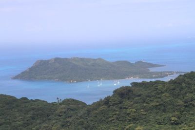
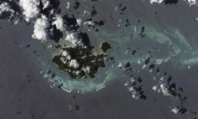
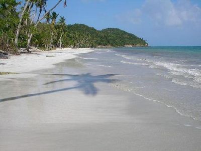
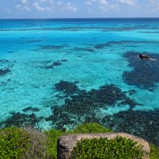
Providence Island sits in the western Caribbean and covers an area of about 17 square kilometers (6.5 square miles) with mountainous terrain rising up to 360 meters (1,180 feet) above sea level. The coastline features small bays and coral reefs, while the interior is covered with tropical rainforest.

An English Puritan settlement was founded here in 1629 under the Providence Island Company and lasted until Spanish forces captured it in 1641. Control shifted several times between European powers before the territory became part of Colombia in the 19th century.

Residents speak an English-based creole that sets the island apart from mainland Colombia and reflects centuries of Caribbean influence. In the villages, you find small wooden churches and brightly painted houses that show traditional building methods of the region.

Travelers reach the island through El Embrujo Airport with connecting flights from nearby San Andrés or take boat services that operate depending on sea conditions. Lodging options range from small guesthouses to simple hotels, and booking ahead is often advisable.

The waters around the island form part of Old Providence McBean Lagoon National Park within the UNESCO Seaflower Biosphere Reserve, protecting mangrove forests and coral reefs. Snorkelers and divers can observe a wide range of marine life here, including colorful fish and many coral species.

Location: Insular Region

Elevation above the sea: 0 m

Part of: Archipelago of San Andrés, Providencia and Santa Catalina

Website: https://providencia-sanandres.gov.co

GPS coordinates: 13.34889,-81.37472

Latest update: December 12, 2025 17:59

Photos
Colombia travel destinations: mountains, deserts, waterfalls, and colonial towns

Colombia presents geographic diversity that spans Caribbean coastlines, Andean highlands, Pacific forests, and eastern plains. The country encompasses colonial architecture in towns like Barichara and Mompox, where centuries-old stone buildings and churches reflect Spanish heritage. Natural...

Reviews

Visited this place? Tap the stars to rate it and share your experience / photos with the community! Try now! You can cancel it anytime.

« Providence Island - Caribbean island in San Andrés and Providencia archipelago, Colombia » is provided by Around Us (aroundus.com). Images and texts are derived from Wikimedia project under a Creative Commons license. You are allowed to copy, distribute, and modify copies of this page, under the conditions set by the license, as long as this note is clearly visible.

Discover hidden gems everywhere you go!

From secret cafés to breathtaking viewpoints, skip the crowded tourist spots and find places that match your style. Our app makes it easy with voice search, smart filtering, route optimization, and insider tips from travelers worldwide. Download now for the complete mobile experience.

Around Us App Screenshot

A unique approach to discovering new places

Le Figaro

All the places worth exploring

France Info

A tailor-made excursion in just a few clicks

20 Minutes