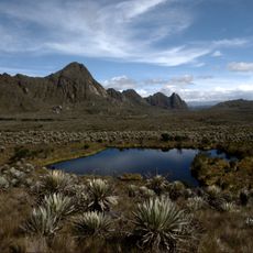
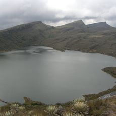
Serranía de la Macarena, Mountain range in Meta department, Colombia
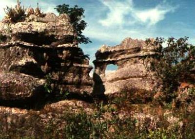
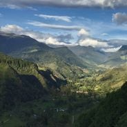
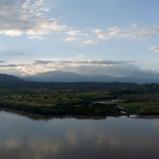
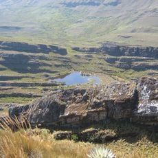
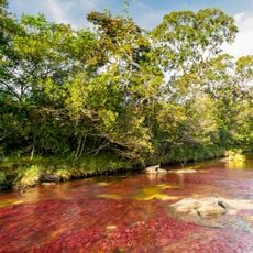
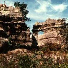
Serranía de la Macarena is a mountain range in central Colombia's Meta department that runs roughly 120 kilometers from north to south and rises to elevations around 1600 meters. The peaks stand between wide plains and dense rainforest, with numerous rivers cutting through the steep slopes and forming gorges.
The Colombian government declared this area the country's first national nature reserve in 1948. It later gained national park status in 1971.
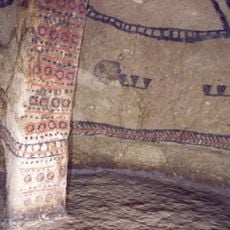
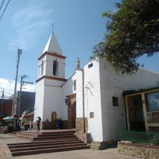
The range takes its name from an old chapel dedicated to Mary that early settlers built at the foot of the peaks. Along the riverbanks, rock carvings still remain from the people who lived here long before colonial times.
Travelers reach the area by road from Villavicencio to San Juan de Arama or by plane to the settlement of La Macarena. Most visitor routes involve walking through dense forest and require guided hikes with local guides who know the trails and terrain.
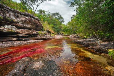
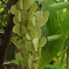
Four different ecosystems meet here: the Andes, the Amazon basin, the Orinoco region, and the Guiana Shield. This rare overlap creates an exceptional diversity of plants and animals not found together anywhere else.
Location: La Macarena
Elevation above the sea: 2,615 m
GPS coordinates: 2.30458,-73.84040
Latest update: December 12, 2025 17:58
Sumapaz Paramo
236.9 km
Estadio Bello Horizonte - Rey Pelé
205.7 km
Tierradentro
245.8 km
Chiribiquete National Park
212.5 km
Lake Betania
182.9 km
Sumapaz Natural Park
236.9 km
Bioparque Los Ocarros
210.9 km
Estadio Guillermo Plazas Alcid
174.9 km
Chiribiquete's rock shelters
162 km
Cordillera de los Picachos National Natural Park
103.7 km
Tinigua National Natural Park
41.4 km
Our Lady of Mount Carmel Cathedral, Villavicencio
206.9 km
La Venta
178.6 km
Immaculate Conception Cathedral, Neiva
175.3 km
Our Lady of Lourdes Cathedral, Florencia
211.9 km
Archeological Museum of Pasca
228.9 km
Terminal de Transportes de Florencia
211.1 km
Plaza de toros de Santo Domingo
215.7 km
Parque Usme Pueblo
243.5 km
Capilla Paéz San Andrés de Pisimbalá
247.2 km
Lac Chisaca
234.5 km
Íquira, Huila Main Park
203.4 km
Old Train Station
246.5 km
Jardín Botánico de La Macarena
14.7 km
Sierra de la Macarena National Nature Park
64.1 km
Gaitan Cortes Park
252.4 km
Cathedral of Our Lady of Mount Carmel, Granada, Meta
138.5 kmVisited this place? Tap the stars to rate it and share your experience / photos with the community! Try now! You can cancel it anytime.
Discover hidden gems everywhere you go!
From secret cafés to breathtaking viewpoints, skip the crowded tourist spots and find places that match your style. Our app makes it easy with voice search, smart filtering, route optimization, and insider tips from travelers worldwide. Download now for the complete mobile experience.
A unique approach to discovering new places❞
— Le Figaro
All the places worth exploring❞
— France Info
A tailor-made excursion in just a few clicks❞
— 20 Minutes