Serra do Aracá State Park, State park in Barcelos, Brazil
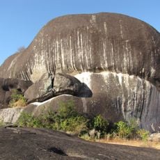
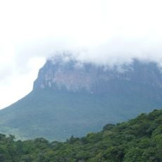
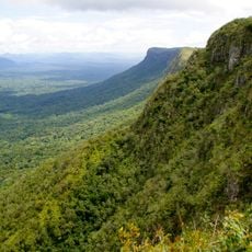
Serra do Aracá State Park is a protected area in northern Amazonas covering around 1.8 million hectares. The land consists of thick rainforest, mountains rising to 2000 meters, and multiple river systems winding through it.
The park was established in 1990 and now overlaps by about 82 percent with Yanomami Indigenous Territory that received official recognition shortly after. This overlap continues to shape how the land is managed and protected today.
The Yanomami people have lived across these lands for generations, maintaining their way of life within areas that now overlap with the protected zone. Visitors who travel here may encounter signs of their presence and learn about how indigenous communities coexist with conservation efforts.
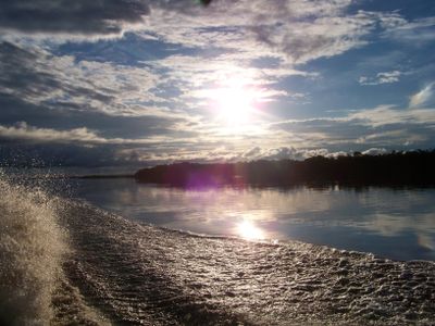
Reaching this park requires several days of travel by boat from Barcelos, navigating the Rio Negro and its tributaries. Visitors need official authorization and should arrange the trip with experienced local guides familiar with river conditions.
Within the park lies a powerful waterfall dropping about 400 meters, among the tallest in South America. This natural feature draws many visitors as a centerpiece of their journey into this remote area.
Location: Amazonas
Inception: 1990
GPS coordinates: 1.56574,-63.37115
Latest update: December 14, 2025 16:44
Pico da Neblina
305.7 km
Pedra Pintada
376.9 km
Piedra del Cocuy
385.7 km
Pico da Neblina National Park
318.3 km
Pico 31 de Março
305.3 km
Serranía La Neblina National Park
304.7 km
Piedra del Cocuy Natural Monument
385.7 km
Jaua-Sarisariñama National Park
359.5 km
Parima-Tapirapecó National Park
246.1 km
Serra do Tepequém
305.3 km
Fuerte de São Joaquim do Rio Branco
360.4 km
Duida-Marahuaca National Park
325.7 km
Cachoeira do El Dorado
77.1 km
Cerro Duida
327.8 km
Morro dos Seis Lagos Biological Reserve
394.9 km
Serra da Mocidade National Park
173.7 km
Viruá National Park
251.1 km
Forte de São José de Marabitanas
388.3 km
Cué-cué/Marabitanas Indigenous Territory
399.3 km
Reserva Extrativista do Rio Unini
413.3 km
Parú-Euaja Massif Natural Monument
401.9 km
União Operária Beneficente
331.5 km
Cerros Vinilla y Aratitiyope Natural Monument
247.1 km
Sierra Unturan Natural Monument
230 km
Sierra Marutani Natural Monument
245.8 km
Cerros Tapirapecó y Tamacuari Natural Monument
157.7 km
Cathedral Cristo Redentor in Boa Vista
330.9 km
Cerros Ichúm y Guanacoco Natural Monument
345 kmVisited this place? Tap the stars to rate it and share your experience / photos with the community! Try now! You can cancel it anytime.
Discover hidden gems everywhere you go!
From secret cafés to breathtaking viewpoints, skip the crowded tourist spots and find places that match your style. Our app makes it easy with voice search, smart filtering, route optimization, and insider tips from travelers worldwide. Download now for the complete mobile experience.
A unique approach to discovering new places❞
— Le Figaro
All the places worth exploring❞
— France Info
A tailor-made excursion in just a few clicks❞
— 20 Minutes