Serra da Mocidade National Park, Nature reserve in Roraima and Amazonas, Brazil
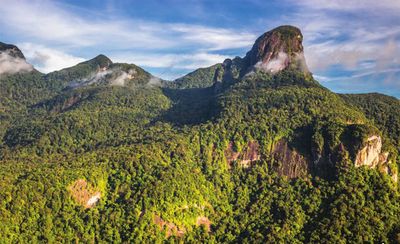
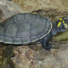
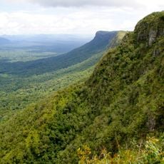
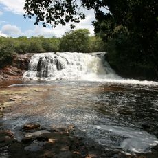
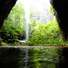
Serra da Mocidade National Park is a nature reserve in Roraima and Amazonas covering over 375,000 hectares of tropical rainforest. The region features mountain ranges with elevations between 100 and 1,700 meters, creating different zones that support diverse habitats for amphibians and reptiles.
The reserve was established in 1998 by the Brazilian government to protect natural ecosystems in northern Amazon region. This creation came at a time when pressure on the Amazon was increasing and special measures became necessary to safeguard these areas.
The park borders Yanomami Indigenous Territory and acts as a protective buffer for communities living there. The forest landscape shapes the daily life of Indigenous peoples who have inhabited this region for generations.
The area is difficult to access and is mainly visited by research teams studying amphibians and reptiles. Visitors should know that infrastructure is minimal and careful planning with support from local guides is necessary.
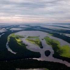
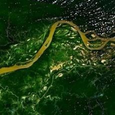
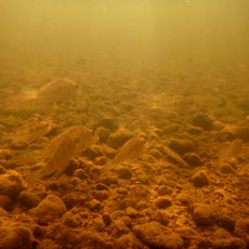
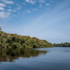
The park contains rivers with distinct chemical compositions such as the Catrimani River and Água Boa do Univini River. These waterways flow through dense forest areas and create unusual aquatic environments that are rarely encountered elsewhere.
Operator: Instituto Chico Mendes de Conservação da Biodiversidade
GPS coordinates: 1.17335,-61.86072
Latest update: December 14, 2025 12:22
Pedra Pintada
319.7 km
Anavilhanas National Park
410.7 km
Jaú National Park
381.6 km
Serranía La Neblina National Park
465.7 km
Parima-Tapirapecó National Park
397.1 km
Jasper Creek
424.6 km
Serra do Tepequém
290.9 km
Fuerte de São Joaquim do Rio Branco
258 km
Cachoeira do El Dorado
167.9 km
Central Amazon Conservation Complex
390.7 km
Pitinga mine
290.3 km
Uatumã Biological Reserve
375.8 km
Serra do Aracá State Park
173.7 km
Viruá National Park
82.3 km
St. Helen's Cathedral
390.8 km
Rio Negro Left Bank Environmental Protection Area
402 km
Caverna do Maroaga Environmental Protection Area
414.8 km
Lower Rio Negro Mosaic
422.1 km
Reserva Extrativista do Rio Unini
318 km
União Operária Beneficente
226.5 km
Cerros Vinilla y Aratitiyope Natural Monument
420.8 km
Sierra Unturan Natural Monument
402.4 km
Sierra Marutani Natural Monument
309.8 km
Cerros Tapirapecó y Tamacuari Natural Monument
323.4 km
Cathedral Cristo Redentor in Boa Vista
225.9 km
Cerros Ichúm y Guanacoco Natural Monument
441.1 km
Cachoeira Iracema
404.9 km
Maroaga Cave
416.3 kmVisited this place? Tap the stars to rate it and share your experience / photos with the community! Try now! You can cancel it anytime.
Discover hidden gems everywhere you go!
From secret cafés to breathtaking viewpoints, skip the crowded tourist spots and find places that match your style. Our app makes it easy with voice search, smart filtering, route optimization, and insider tips from travelers worldwide. Download now for the complete mobile experience.
A unique approach to discovering new places❞
— Le Figaro
All the places worth exploring❞
— France Info
A tailor-made excursion in just a few clicks❞
— 20 Minutes