Itapuranga, Municipality in northern Goiás, Brazil.
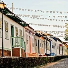
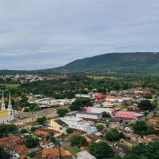
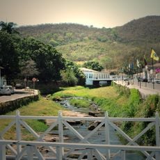
Itapuranga is a municipality in northern Goiás located at about 651 meters elevation. The area spans 1,277 square kilometers with a mix of rural land and built-up zones supporting around 25,600 residents.
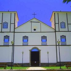
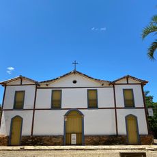
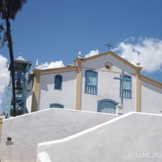
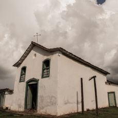
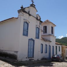
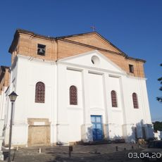
The area was established in 1933 when Dominican friars founded a settlement called Xixá, named after the Xixazeiro tree where they held their first Mass. This religious foundation marked the beginning of organized settlement in the location.
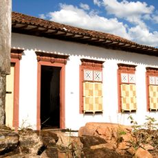
The name Itapuranga comes from the Tupi language, meaning 'red stone' or 'place of pretty stones', connecting residents and visitors to the region's indigenous roots. This heritage remains visible in local traditions and how people relate to the land around them.
The municipality has good schools and medical services, with around 27 schools and several hospitals supporting the local population. Visitors should expect rural infrastructure typical of a smaller Brazilian town and be prepared accordingly.
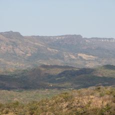
The territory features two distinct climate seasons and fertile soil where sugarcane dominates the agricultural landscape. This agricultural focus shapes the rhythms and economy of life throughout the region.
Location: Goiás
Elevation above the sea: 651 m
Shares border with: Carmo do Rio Verde, Faina, Goiás, Guaraíta, Heitoraí, Morro Agudo de Goiás, São Patrício, Uruana
GPS coordinates: -15.56194,-49.94889
Latest update: December 7, 2025 20:20
Historic Centre of the Town of Goiás
45.8 km
Parish Church of Our Lady of the Rosary
110.9 km
Museu Casa de Cora Coralina
46 km
Count of Arcos Palace
46.3 km
Museu das Bandeiras
46.6 km
Church of Our Lady of the Good Death
46.2 km
Historic center of Pirenópolis
110.9 km
Serra Dourada State Park
68.7 km
Church of Our Lord of Bonfim
111.5 km
Church of Our Lady of Carmo
110.8 km
House of the Babilónia Estate
105.8 km
Church of Saint Francis of Paola
46.3 km
Parque Estadual da Serra de Jaraguá
71.4 km
Casa de Câmara e Cadeia
110.8 km
Museum of Sacred Art
46.3 km
Church of Saint John the Baptist
42.4 km
Largo do Chafariz
46.5 km
Church of Saint Barbara
45.8 km
Igreja de Nossa Senhora da Conceição
69.3 km
Conjunto arquitetônico e urbanístico da Rua João Pessoa, antiga da Fundição
46.2 km
Casa de Câmara e Cadeia
46.6 km
Igreja de Nossa Senhora do Rosário
68.9 km
Cachoeira das Araras
100.1 km
Church of Our Lady of the Abbey
46 km
Conjunto Arquitetônico e Urbanístico da Rua Sebastião Fleury Curado
46.1 km
Roman Catholic Cathedral of Goiás
46.2 km
Fazenda Gleba Vargem I Private Natural Heritage Reserve
114.8 km
Casa com Janelas de Rótulas e Forro Pintado, na Rua da Cadeia
97.6 kmVisited this place? Tap the stars to rate it and share your experience / photos with the community! Try now! You can cancel it anytime.
Discover hidden gems everywhere you go!
From secret cafés to breathtaking viewpoints, skip the crowded tourist spots and find places that match your style. Our app makes it easy with voice search, smart filtering, route optimization, and insider tips from travelers worldwide. Download now for the complete mobile experience.
A unique approach to discovering new places❞
— Le Figaro
All the places worth exploring❞
— France Info
A tailor-made excursion in just a few clicks❞
— 20 Minutes