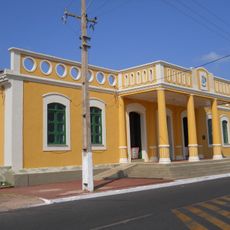
Senador José Porfírio, Municipal administrative division in Sudoeste Paraense region, Brazil.
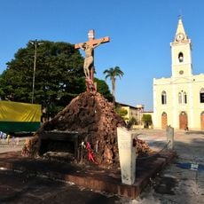
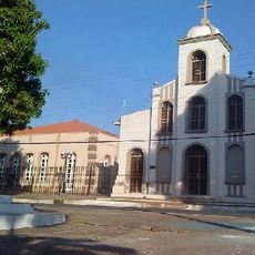
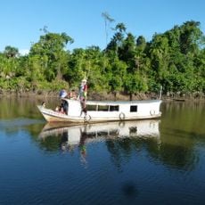
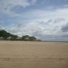
Senador José Porfírio is a municipality in Pará state in northern Brazil, encompassing a large territory with numerous scattered settlements and communities. The landscape remains predominantly rural, with few major urban centers.
The area became an official municipality within Pará state, evolving from a small settlement into a formally recognized administrative territory. This development shaped its current local governance structure.
Portuguese serves as the primary language across this Pará municipality, where residents identify themselves as porfiriense and maintain traditional Brazilian customs.
The municipality operates on UTC-3 time zone and provides basic Brazilian infrastructure including schools and health facilities. Visitors should expect longer travel times between communities due to the rural setting.
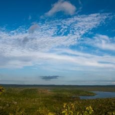
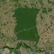
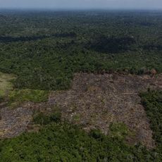
The territory maintains one of the lowest population densities in Pará state, with vast uninhabited areas and extensive rainforest. This isolation shapes the pace and character of daily life today.
GPS coordinates: -2.59354,-51.94821
Latest update: December 8, 2025 13:43
Marabá Combined Bridge
439.6 km
João Fona cultural centre
307.6 km
Carajás National Forest
433.2 km
Pau do Presidente
68.5 km
Estádio Municipal Zinho de Oliveira
437.8 km
Caxiuanã National Forest
106 km
National Forest Tapajós
362.2 km
Monumento das Castanheiras Mortas
486.2 km
Terra Indígena Mãe Maria
437.8 km
Serra do Pardo National Park
373.8 km
Apyterewa Indigenous Territory
339.6 km
Fort of Saint Antony of Gurupá
136.8 km
Terra do Meio Ecological Station
236.4 km
Rio Cajari Extractive Reserve
168.9 km
Parakanã Indigenous Territory
317.9 km
Jari Ecological Station
245.9 km
Trincheira/Bacajá Indigenous Territory
243.9 km
Lago Piratuba Biological Reserve
299.4 km
Tapirapé Biological Reserve
365.2 km
Terra Indígena Koatinemo
190.2 km
Tapajós-Arapiuns Extractive Reserve
387.9 km
Our Lady of the Conception Cathedral, Abaetetuba
354 km
Biblioteca Pública Municipal Orlando Lima Lobo
437.7 km
Cajàzeira River
374.6 km
Rio Xingu Extractive Reserve
215.9 km
Reserva de Desenvolvimento Sustentável Itatupã-Baquiá
233.5 km
Quilombo Moju-miri
356.2 km
Terra Indígena Barreirinha
400.1 kmVisited this place? Tap the stars to rate it and share your experience / photos with the community! Try now! You can cancel it anytime.
Discover hidden gems everywhere you go!
From secret cafés to breathtaking viewpoints, skip the crowded tourist spots and find places that match your style. Our app makes it easy with voice search, smart filtering, route optimization, and insider tips from travelers worldwide. Download now for the complete mobile experience.
A unique approach to discovering new places❞
— Le Figaro
All the places worth exploring❞
— France Info
A tailor-made excursion in just a few clicks❞
— 20 Minutes