Brotas de Macaúbas, Rural municipality in Bahia, Brazil
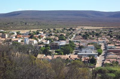
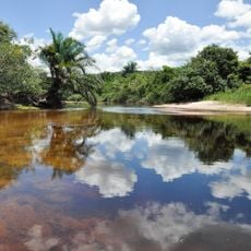
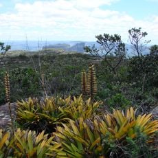
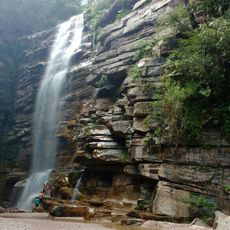
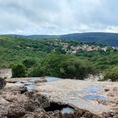
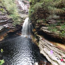
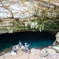
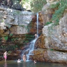
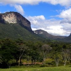
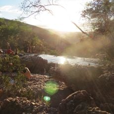
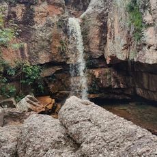
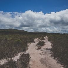
Brotas de Macaúbas is a rural administrative center in Bahia situated on elevated terrain at approximately 773 meters above sea level, characterized by hills, natural vegetation, and agricultural lands. The municipality spans diverse landscapes that shape the character of this northern region.
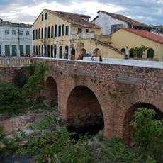
The settlement originated from agricultural communities established during Brazil's colonial period and gradually became the administrative hub for surrounding rural areas. This development shaped the infrastructure and local governance that persist today.
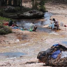
The town hosts celebrations featuring traditional music and regional food that reflect the mixed heritage of indigenous, African, and Portuguese roots. Visitors can experience these cultural expressions through local gatherings and community events.
The municipal offices operate Monday through Friday, providing public services through departments focused on health, education, and infrastructure. Visitors should plan their activities with weekday schedules in mind when seeking local services.
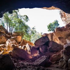
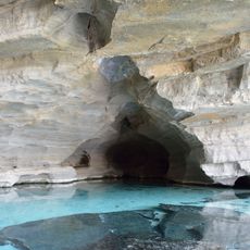
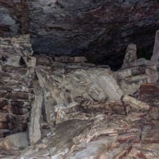
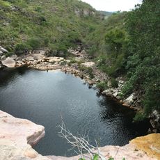
The Pedra do Urubu viewpoint provides a complete overview of the municipality's landscapes and the natural formations that characterize this region. From this elevated vantage point, visitors can see how the geography shapes the entire area.
Location: Bahia
Elevation above the sea: 773 m
Shares border with: Barra do Mendes, Gentio do Ouro, Ibitiara, Ipupiara, Morpará, Oliveira dos Brejinhos, Seabra, Xique-Xique
Website: http://brotasdemacaubas.ba.gov.br
GPS coordinates: -11.99889,-42.62583
Latest update: December 7, 2025 20:40
Manuscript 512
57.2 km
Cachoeira da Fumaça
143.9 km
Morro do Pai Inácio
135.6 km
Lapa Doce
119.5 km
Quilombo Remanso
148.1 km
Área de Proteção Ambiental Marimbus / Iraquara
147.1 km
Gruta da Torrinha
94.6 km
Gruta da Pratinha
124.5 km
Rio Lençóis (Bahia)
146.2 km
Morro do Camelo
134.9 km
Gruta da Fumaça
118 km
Parque Natural Municipal do Morro do Pai Inácio
135.3 km
Cachoeira do Mosquito
142.7 km
Cachoeira do Riachinho
136.6 km
Parque Natural Municipal da Muritiba
147.4 km
Cachoeira do Sossego
147.3 km
Gruta Azul (Iraquara)
124.8 km
Cachoeira da Purificação
144.4 km
Parque Natural Municipal do Boqueirão
139 km
Gruta do Lapão
146.1 km
Parque Natural Municipal do Riachinho
136.8 km
Cachoeira da Primavera
146.7 km
Cachoeira do Vinte e Um
143.4 km
Monumento Natural Municipal da Carrapeta
138.7 km
Conjunto Paisagístico do Morro do Pai Inácio
135.3 km
Sítio Pedra Furada
57.7 km
Ponte Sobre o Rio Lençois
148.3 km
Poço do Diabo
141.5 kmVisited this place? Tap the stars to rate it and share your experience / photos with the community! Try now! You can cancel it anytime.
Discover hidden gems everywhere you go!
From secret cafés to breathtaking viewpoints, skip the crowded tourist spots and find places that match your style. Our app makes it easy with voice search, smart filtering, route optimization, and insider tips from travelers worldwide. Download now for the complete mobile experience.
A unique approach to discovering new places❞
— Le Figaro
All the places worth exploring❞
— France Info
A tailor-made excursion in just a few clicks❞
— 20 Minutes