Água Branca, Municipal district in Alagoas, Brazil
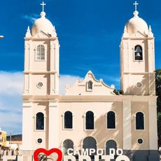
Água Branca is a municipality in Alagoas state in northeastern Brazil, serving as an administrative center for the surrounding communities. The area consists of residential neighborhoods, farmland, and local public services that serve the population.
The municipality was established during territorial expansion in Alagoas state in the late 1800s as new administrative areas were created. This founding came as part of the broader development and settlement of northeastern Brazil at that time.
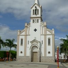
Local people gather for regional celebrations and communal events that reflect the rhythms of daily life in this area. These occasions give visitors a sense of how the community comes together and what matters to the people living here.
Visitors can find local administrative services and information centers that help with navigation and local details. It is useful to plan ahead regarding transportation options and timing for exploring the area.
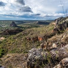
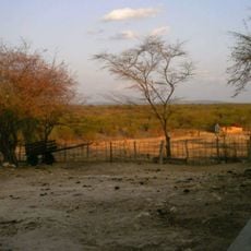
Agriculture shapes the landscape here, with farmers growing beans, corn, and seasonal fruits on surrounding farmland. This cultivation and the skills of local growers are central to how the area sustains itself.
GPS coordinates: -9.26136,-37.93611
Latest update: December 7, 2025 20:24
Catimbau National Park
112.4 km
Paulo Afonso Hydroelectric Complex
32.9 km
Bendegó meteorite
173.8 km
Paulo Afonso Falls
31.9 km
Rio São Francisco Natural Monument
29.2 km
Canyon of Xingo
30.1 km
Usina Hidrelétrica de Angiquinho
31.9 km
Parque dos Falcões
176.4 km
Pedra Talhada Biological Reserve
165.9 km
Canudos State Park
147.7 km
Igreja de Nossa Senhora do Rosário
101.1 km
Museu do Sertão
45.1 km
Chapel of the Nossa Senhora da Penha Sugar Plantation
178.6 km
Casa de Graciliano Ramos
144.5 km
Serra Branca / Raso da Catarina Environmental Protection Area
103.5 km
Igreja Matriz do Santuário Nossa Senhora Divina Pastora
180 km
Igreja Santo Antônio de Pádua
42.1 km
Capela do Engenho Nossa Senhora da Penha
178.6 km
Grupo Escolar Coronel João Fernandes de Brito
160.6 km
Cine Teatro Guarany
159.6 km
Igreja Matriz do Senhor da Ascensão
173.1 km
Cine Laser Itabaiana
171.4 km
Parish Church of Divina Pastora
180 km
Mother Church of Nossa Senhora da Boa Hora and São Roque (Campo do Brito/SE)
172.4 km
Quilombo Riacho dos Porcos
150.4 km
Old Petrolandia Church
45 km
Igreja Matriz de Senhora Santana
165 km
Ponte Metálica Dom Pedro II
33.8 kmVisited this place? Tap the stars to rate it and share your experience / photos with the community! Try now! You can cancel it anytime.
Discover hidden gems everywhere you go!
From secret cafés to breathtaking viewpoints, skip the crowded tourist spots and find places that match your style. Our app makes it easy with voice search, smart filtering, route optimization, and insider tips from travelers worldwide. Download now for the complete mobile experience.
A unique approach to discovering new places❞
— Le Figaro
All the places worth exploring❞
— France Info
A tailor-made excursion in just a few clicks❞
— 20 Minutes