Ipú, Municipality in northwestern Ceará, Brazil.
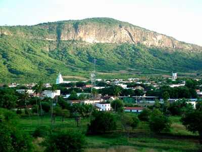
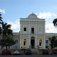
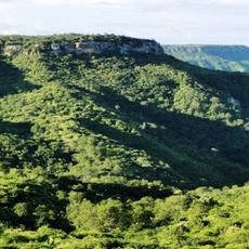
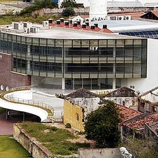
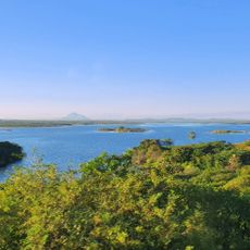
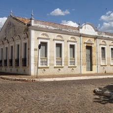
Ipú is a municipality in northwestern Ceará that sits at 760 meters elevation in a mountainous setting shaped by the Chapada da Ibiapaba formation. The town covers around 831 square kilometers (321 square miles) and is surrounded by highlands that define its landscape.
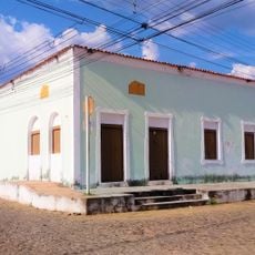
The area was originally inhabited by the Tapuia indigenous people and grew from a settlement called Sítio São José before becoming a municipality in October 1827. The rubber cycle of the 19th century brought waves of migrants seeking work, shaping its early economic development.
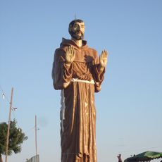
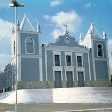
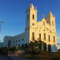
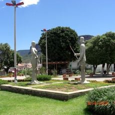
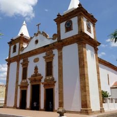
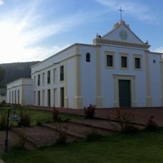
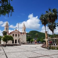
The Nossa Senhora da Conceição festival shapes religious life and brings residents together to celebrate their faith traditions. This celebration shows how deeply Catholic practices are woven into the town's everyday culture.
The town sits roughly 257 kilometers (160 miles) from Fortaleza and operates on Brazil's standard UTC-3 time zone. Visitors should prepare for the mountainous location, as the higher elevation affects both climate and accessibility.
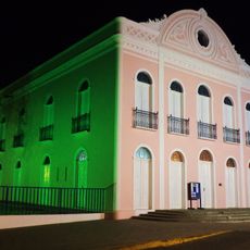
The town was founded from an earlier settlement whose name pointed to Saint Joseph, reflecting its religious roots from the beginning. This connection to saint veneration continues to shape the place's character today.
Location: Ceará
Elevation above the sea: 270 m
Shares border with: Pires Ferreira, Croatá, Guaraciaba do Norte, Hidrolândia, Ipueiras, Nova Russas, Reriutaba
Website: http://ipu.ce.gov.br
GPS coordinates: -4.32194,-40.71083
Latest update: December 7, 2025 10:06
Sete Cidades National Park
114.3 km
Estatua de San Francisco de Asís
156.1 km
Ubajara National Park
65.3 km
Mother Church of Our Lady of the Assumption (Viçosa do Ceará)
94.3 km
Santa Casa de Misericórdia de Sobral
80.2 km
Estádio do Junco
81.8 km
Museu do Eclipse
80.8 km
Teatro São João
81.4 km
Serra das Almas Private Natural Heritage Reserve
93.6 km
Sobral Cathedral
80.9 km
Museu Dom José
81.6 km
Tatajuba
163.3 km
Serra da Ibiapaba Environmental Protection Area
80.4 km
Praça Clóvis Beviláqua
94.2 km
Biblioteca Municipal Lustosa da Costa
80.8 km
Batalhão Cemetery
164.4 km
Pinacoteca de Sobral
81.4 km
Casarão do Embaixador
118.4 km
Casa de Fazenda da Dona Alemã
137.5 km
Iracema e o Guerreiro Branco Martim
345 m
Camocim Lighthouse
163.3 km
Barra dos remédios
164.4 km
Igreja Matriz de Nossa Senhora do Carmo
118.9 km
Igreja Nossa Senhora do Desterro
382 m
Antiga Intendência de Piracuruca
118.9 km
Cathedral of Our Lady of Mercy, Itapipoca
155.2 km
Açude Forquilha
77.5 km
Memorial Tertuliano Brandão Filho
83.9 kmVisited this place? Tap the stars to rate it and share your experience / photos with the community! Try now! You can cancel it anytime.
Discover hidden gems everywhere you go!
From secret cafés to breathtaking viewpoints, skip the crowded tourist spots and find places that match your style. Our app makes it easy with voice search, smart filtering, route optimization, and insider tips from travelers worldwide. Download now for the complete mobile experience.
A unique approach to discovering new places❞
— Le Figaro
All the places worth exploring❞
— France Info
A tailor-made excursion in just a few clicks❞
— 20 Minutes