·

Enable Location

We need your location to show you interesting places around you

Discover nearby places

Find interesting locations and hidden gems around you

Precise directions

Get accurate directions and distances to places

Your location is never shared with other users. It's only used when you tap the location button.

Mamanguape

Log in to your account

Start exploring — it's free

Trusted by 62,638 travelers worldwide

Continue with Google
Continue with Apple
or

We will send you a code to connect

By continuing, you accept our Terms and Conditions and our Privacy Policy

Check your inbox

We've sent a pincode in your inbox. Please enter the code below.

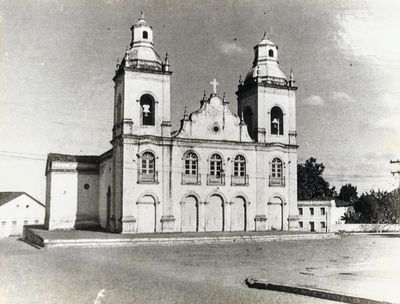
Mamanguape, Municipality in Paraíba, Brazil

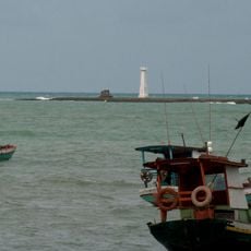
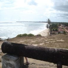
Mamanguape is a municipality in northeastern Brazil situated in Paraíba state, with a mix of terrain features and local settlements. The town sits roughly 138 kilometers from Recife and serves as a local administrative center for the surrounding area.

The municipality was officially founded on October 25, 1855, which reorganized how Paraíba state managed its territories. This establishment allowed for better local administration in the region.

The name Mamanguape comes from indigenous languages and reflects how deeply this place is rooted in the heritage of Brazil's original peoples. This connection shapes how locals see themselves and their community today.

The municipality connects to surrounding towns through a network of roads and is best explored by car. Plan travel time generously when visiting from larger cities, as distances between towns can be considerable.

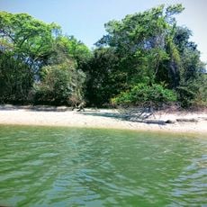
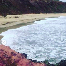
The territory includes sections of Guaribas Biological Reserve and Pau-Brasil Ecological Station, which protect rare native tree species. These protected areas make the region an important refuge for threatened forests.

The community of curious travelers

AroundUs brings together thousands of curated places, local tips, and hidden gems, enriched daily by 60,000 contributors worldwide.

Start exploring
Location
Inception
October 25, 1855
Elevation above the sea
79 m
Shares border with
Rio Tinto, Baía Formosa, Canguaretama, Capim, Curral de Cima, Itapororoca, Jacaraú, Mataraca, Pedro Velho
GPS coordinates
-6.83889,-35.12583
Latest update
December 23, 2025 00:19
« Mamanguape - Municipality in Paraíba, Brazil » is provided by Around Us (aroundus.com). Images and texts are derived from Wikimedia project under a Creative Commons license. You are allowed to copy, distribute, and modify copies of this page, under the conditions set by the license, as long as this note is clearly visible.

Discover hidden gems everywhere you go!

From secret cafés to breathtaking viewpoints, skip the crowded tourist spots and find places that match your style. Our app makes it easy with voice search, smart filtering, route optimization, and insider tips from travelers worldwide. Download now for the complete mobile experience.

Around Us App Screenshot

A unique approach to discovering new places

Le Figaro

All the places worth exploring

France Info

A tailor-made excursion in just a few clicks

20 Minutes

Around Us
Travel Guide & Maps
Download

Send to your phone

QR Code
1

Open the camera app on your mobile.

2

Point at the QR code with your camera. A notification will appear.

3

Tap the notification to open the link.