Enable Location

We need your location to show you interesting places around you

Discover nearby places

Find interesting locations and hidden gems around you

Precise directions

Get accurate directions and distances to places

Your location is never shared with other users. It's only used when you tap the location button.

Sedibeng District Municipality

Log in to your account

Start exploring — it's free

Trusted by 60,649 travelers worldwide

Continue with Google
Continue with Apple
or

We will send you a code to connect

By continuing, you accept our Terms and Conditions and our Privacy Policy

Check your inbox

We've sent a pincode in your inbox. Please enter the code below.

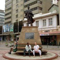
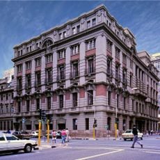
Sedibeng District Municipality, District municipality in Gauteng, South Africa.

Description

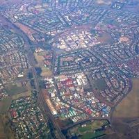
Sedibeng District Municipality is an administrative region in Gauteng province comprising three local municipalities: Emfuleni, Midvaal, and Lesedi, with Vereeniging serving as the administrative center. The territory encompasses connected urban areas, rural zones, and industrial regions with distinct characteristics and development patterns.

History

Sedibeng District Municipality was established on 5 December 2000 as an administrative entity following South Africa's municipal reorganization. This creation emerged from the country's broader transformation after 1994, establishing a new governance framework for coordinated service delivery across the region.

Culture

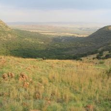
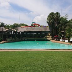
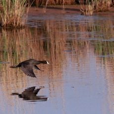
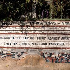
The name Sedibeng derives from Sotho language meaning 'place of water', reflecting the district's connection to major river systems. Visitors can observe this water-centered identity in local activities and how communities relate to their surrounding waterways.

Practical

The district sits at around 1,500 meters elevation and is easily accessible by car from neighboring urban areas. Visitors should contact local administration offices directly or visit in person for specific information, as many services are coordinated through municipal representatives on site.

Did you know?

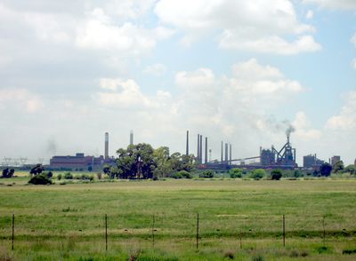
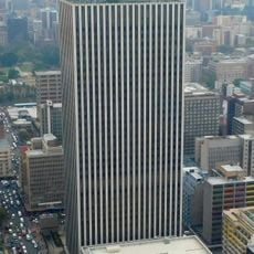
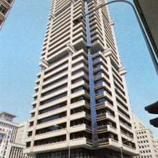
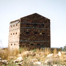
The region hosts major steel production plants that have provided employment for decades and shaped the district's economic character. These factories are a visible feature of the landscape and represent the area's industrial heritage.

Location
Inception
December 5, 2000
Capital city
Vereeniging
Elevation above the sea
1,582 m
Shares border with
West Rand District Municipality, City of Johannesburg Metropolitan Municipality, City of Ekurhuleni Metropolitan Municipality, Nkangala District Municipality, Gert Sibande District Municipality, Fezile Dabi District Municipality, Dr Kenneth Kaunda District Municipality
GPS coordinates
-26.50000,28.25000
Latest update
December 7, 2025 20:20

AroundUs brings together thousands of curated places, local tips, and hidden gems, enriched daily by 60,000 contributors worldwide. Discover all places nearby (Gauteng).

« Sedibeng District Municipality - District municipality in Gauteng, South Africa » is provided by Around Us (aroundus.com). Images and texts are derived from Wikimedia project under a Creative Commons license. You are allowed to copy, distribute, and modify copies of this page, under the conditions set by the license, as long as this note is clearly visible.

Discover hidden gems everywhere you go!

From secret cafés to breathtaking viewpoints, skip the crowded tourist spots and find places that match your style. Our app makes it easy with voice search, smart filtering, route optimization, and insider tips from travelers worldwide. Download now for the complete mobile experience.

Around Us App Screenshot

A unique approach to discovering new places

Le Figaro

All the places worth exploring

France Info

A tailor-made excursion in just a few clicks

20 Minutes

Around Us
Travel Guide & Maps
Download

Send to your phone

QR Code
1

Open the camera app on your mobile.

2

Point at the QR code with your camera. A notification will appear.

3

Tap the notification to open the link.