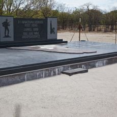
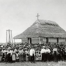
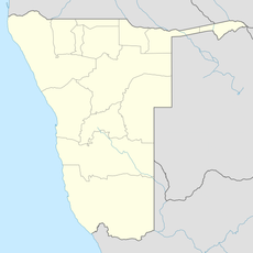
Kavango West Region, region of Namibia
Location: Namibia
Inception: 2013
Capital city: Nkurenkuru
Shares border with: Kavango East Region, Otjozondjupa Region, Oshikoto Region, Ohangwena Region, Cuando Cubango Province
GPS coordinates: -18.25000,18.91670
Latest update: March 6, 2025 16:17
Hoba meteorite
181.8 km
Etosha National Park
286.3 km
Drachenhauchloch
180.5 km
Tsodilo
303.5 km
Waterberg Plateau
262.7 km
101 Battalion
91.9 km
Waterberg Plateau Park
300.1 km
Khaudom National Park
212.4 km
Baobab Tree
94.3 km
Popa Game Park
282.4 km
Mahango Game Park
179.8 km
Mucusso National Park
266.3 km
St. Barbara Catholic Church
168.1 km
Fort Grootfontein
168.7 km
Mavinga National Park
271.5 km
Ghaub Cave
184.2 km
Baganibrücke
279.8 km
Khorab Memorial
221.8 km
Omhedi Cultural Landscape
335.5 km
Rundu-Stadion
97.6 km
OMEG-Minenbüro
168.8 km
Grave of Axel W Eriksson
169.4 km
Second Director's House
168.8 km
Monument of the Unknown PLAN Soldiers at Ondeshifiilwa
336.9 km
House of the first Native Commissioner of Kavango
97.5 km
Nakambale House, Church and Cemetery
313.5 km
Rundu Rurale Est
96.6 km
German Private School
168.8 kmReviews
Visited this place? Tap the stars to rate it and share your experience / photos with the community! Try now! You can cancel it anytime.
Discover hidden gems everywhere you go!
From secret cafés to breathtaking viewpoints, skip the crowded tourist spots and find places that match your style. Our app makes it easy with voice search, smart filtering, route optimization, and insider tips from travelers worldwide. Download now for the complete mobile experience.
A unique approach to discovering new places❞
— Le Figaro
All the places worth exploring❞
— France Info
A tailor-made excursion in just a few clicks❞
— 20 Minutes