Buay Madang, district in East Ogan Komering Ulu Regency, South Sumatra Province, Indonesia
Location: East Ogan Komering Ulu
Elevation above the sea: 67 m
GPS coordinates: -4.05000,104.72361
Latest update: March 31, 2025 08:07
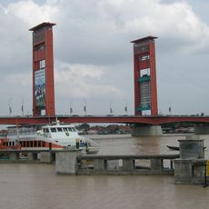
Ampera Bridge
117.9 km
Way Kambas National Park
151.3 km
Dempo
177.2 km
Lake Ranau
126.5 km
Bukit Barisan Selatan National Park
147.7 km
Muhammad Cheng Hoo Mosque
114.3 km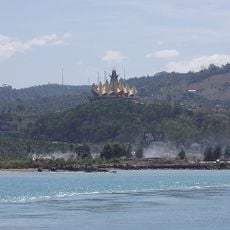
Siger Tower
231.9 km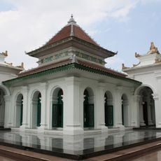
Great Mosque of Palembang
118.3 km
Hutan Wisata Punti Kayu
123 km
Gunung Rajabasa
217.4 km
Sultan Mahmud Badaruddin II Museum
118 km
Balaputradeva Museum
122.4 km
Sembilang National Park
227.2 km
Amanzi Waterpark
123.9 km
Tambling Wildlife Nature Conservation
208.6 km
Way Halim Stadium
160.3 km
Mount Besar
124.5 km
Pantai Pasir Putih
178.9 km
Serasan Sekate Stadium
162.7 km
Palembang Water Tower
117.9 km
Gita Persada Butterfly Park
161 km
Pantai Nek Aji
223.6 km
Baitul Mukhlisin Islamic Center Mosque
127.1 km
Maung
148 km
Pantai Hili
177.7 km
Waterpark Kali miring
78.2 km
Pantai Sebagin
206 km
Pantai Batu Bedaun Desa Rajik
208.2 kmVisited this place? Tap the stars to rate it and share your experience / photos with the community! Try now! You can cancel it anytime.
Discover hidden gems everywhere you go!
From secret cafés to breathtaking viewpoints, skip the crowded tourist spots and find places that match your style. Our app makes it easy with voice search, smart filtering, route optimization, and insider tips from travelers worldwide. Download now for the complete mobile experience.

A unique approach to discovering new places❞
— Le Figaro
All the places worth exploring❞
— France Info
A tailor-made excursion in just a few clicks❞
— 20 Minutes