Wolli Creek Regional Park, Regional park in Bardwell Park, New South Wales, Australia.
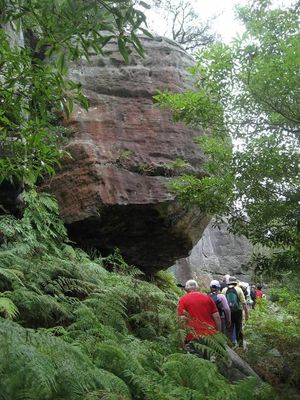
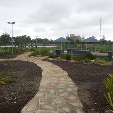
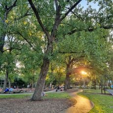
Wolli Creek Regional Park is a 50 hectare protected area featuring sandstone cliffs and thick bushland vegetation within a valley between several suburbs. The site has multiple walking tracks at different levels, several picnic areas including Girrahween, and a dense network of vegetation zones supporting over 360 native plant species.
The area became a regional park in 1998 after local groups fought to protect the valley and successfully had a major freeway moved underground. This victory preserved the valley and allowed it to develop into a recreation area.
The valley takes its name from an Aboriginal word and serves as a natural corridor where people walk, watch birds, and connect with bushland surrounded by urban neighborhoods. This role has made it an important green space for the surrounding communities.
The park is accessible from multiple entry points and has trails at different difficulty levels, ranging from easy walks to more challenging hikes. It is helpful to bring a torch or flashlight when exploring the shaded areas beneath the cliffs, and staying on marked paths is important.
Grey-headed flying foxes form large colonies in the trees and are most visible during dawn or dusk when they become active. These bats perform acrobatic movements between branches and are memorable to watch.
The community of curious travelers
AroundUs brings together thousands of curated places, local tips, and hidden gems, enriched daily by 60,000 contributors worldwide.