Glass House Mountains, Mountain range in Queensland, Australia
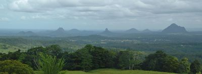
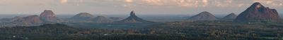
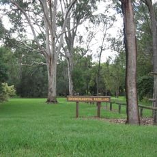
Glass House Mountains consist of eleven distinct volcanic peaks rising from the flat coastal plain near the Sunshine Coast. Each summit displays its own profile and rock formations, shaped by millions of years of geological processes.
Captain James Cook named these mountains in 1770 after their profiles reminded him of glass furnaces from his Yorkshire home. The name reflected what he saw during his exploration of the eastern coast.
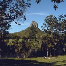
The mountains hold deep spiritual meaning for the Jinibara and Gubbi Gubbi peoples, with Mount Beerwah representing the mother figure in Aboriginal traditions. This connection shapes how visitors and locals perceive and respect the place today.
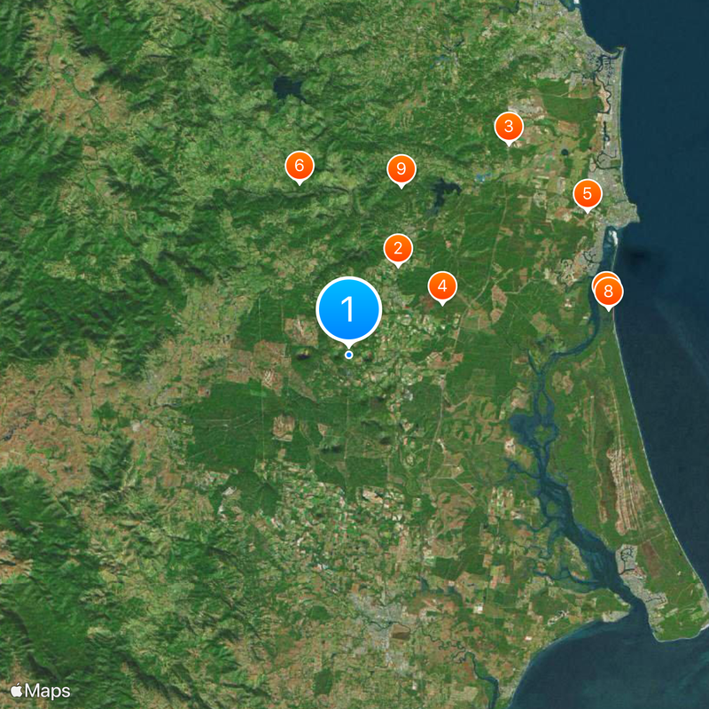
Mount Ngungun and Mount Tibrogargan offer established walking trails and climbing routes suitable for different fitness levels. Visitor centers near the main peaks provide information about geology and local conditions, with parking areas available at trailheads.
Mount Beerwah displays distinctive vertical basalt columns called the Organ Pipes, formed roughly 27 million years ago during volcanic activity. These striking formations are visible from several viewpoints and stand as evidence of the region's powerful geological past.
Location: Queensland
Elevation above the sea: 556 m
GPS coordinates: -26.90000,152.92000
Latest update: December 6, 2025 21:22
Australia Zoo
8.1 km
Aussie World
20.9 km
Glass House Mountains National Park
8.4 km
Queensland Air Museum
22 km
Mary Cairncross Reserve
14.1 km
Bribie Island Second World War Fortifications
20.7 km
Bribie Island National Park
20.8 km
Dularcha Railway Tunnel
13.9 km
Bellthorpe National Park
23.2 km
Dularcha National Park
13.1 km
Tripcony Hibiscus Caravan Park
22.9 km
Bankfoot House
1.6 km
Crohamhurst Observatory
11.2 km
New Caloundra Light
24.2 km
Lagoon Creek Pumping Station
19.4 km
Morayfield State School
23.1 km
North Coast Roadside Rest Areas
18.3 km
Anzac Avenue Memorial Trees
7.6 km
Fairview, Maleny
16.7 km
Oaklands Sugar Mill
22.5 km
Landsborough Air Raid Shelter
11.1 km
Montville Memorial Precinct
23.7 km
Landsborough Shire Council Chambers
11 km
Peachester Public Dip
8.8 km
Landsborough Shire Museum
11 km
Pumicestone National Park
17.7 km
Caboolture Warplane Museum
20.9 km
Australian Narrow Gauge Railway Museum Society
15.2 kmVisited this place? Tap the stars to rate it and share your experience / photos with the community! Try now! You can cancel it anytime.
Discover hidden gems everywhere you go!
From secret cafés to breathtaking viewpoints, skip the crowded tourist spots and find places that match your style. Our app makes it easy with voice search, smart filtering, route optimization, and insider tips from travelers worldwide. Download now for the complete mobile experience.
A unique approach to discovering new places❞
— Le Figaro
All the places worth exploring❞
— France Info
A tailor-made excursion in just a few clicks❞
— 20 Minutes