Coronation Drive retaining wall, Heritage-listed embankment in Brisbane, Queensland, Australia
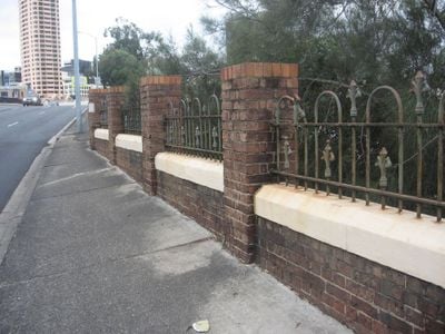
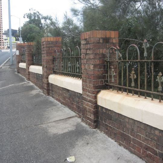
The Coronation Drive retaining wall is a mass concrete embankment wall topped by a brick parapet with wrought iron railings, running about 200 metres along the northern bank of the Brisbane River between Boomerang Street and Eagle Terrace. It is built into bedrock at depths of 3 to 8 metres and thickens from almost 1 metre at ground level to between 1.2 and 2.4 metres at the base. From the road only the brick piers and railings show; the concrete face is seen from the bike path and the river.
After storms in January 1887 caused the North Quay riverbank and road to collapse into the Brisbane River, the Brisbane Municipal Council chose Chief Engineer Thomas Kirk's plan for a mass concrete wall over masonry, at a cost of about £13,000. Contractor George Charles Willcocks began work in May 1887 and opened the road four months later. The wall was added to the Queensland Heritage Register on 21 October 1992.
The best views of the structure are from the footpath or bike path along the river, where you can see the raw concrete base beneath the brick finish. The site is easily accessible at any time, making it convenient for visitors to view and photograph the wall from different angles.
The wall bears marble plaques inscribed with 'James Hipwood Mayor 1887', honoring the mayor during construction and linking the structure to a pivotal moment in the city's history. These markers serve as a reminder of how Brisbane mobilized its resources and leadership to address natural disasters and protect its riverfront.
The community of curious travelers
AroundUs brings together thousands of curated places, local tips, and hidden gems, enriched daily by 94,013 contributors worldwide.