Chest opened
+${chestReward.xp} XP
Explorer
NOUVEAU ×${chestReward.collectible.quantity}
tapez pour fermer

See the monuments around you in AR Open chests in the app

Around Us is built for your phone — point your camera at the streets and discover the monuments and places around you in augmented reality. Around Us is built for your phone — chests unlock when you walk, explore and capture nearby places.

Enable Location

We need your location to show you interesting places around you

Discover nearby places

Find interesting locations and hidden gems around you

Precise directions

Get accurate directions and distances to places

Your location is never shared with other users. It's only used when you tap the location button.

Tabuaeran

Log in to your account

Start exploring — it's free

Trusted by 85,512 travelers worldwide

Continue with Google
Continue with Apple
or

We will send you a code to connect

By continuing, you accept our Terms and Conditions and our Privacy Policy

Check your inbox

We've sent a pincode in your inbox. Please enter the code below.

Discussion Reviews 3 Photos 1 Collection
30.9k Popularity

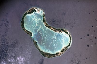
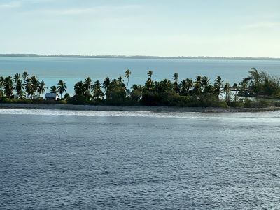
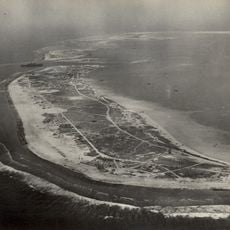
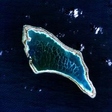
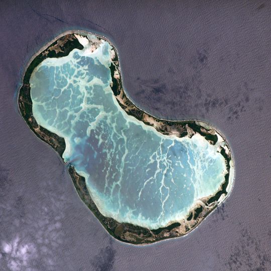
Tabuaeran, Ring-shaped coral atoll in Line Islands, Kiribati

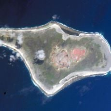
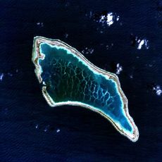
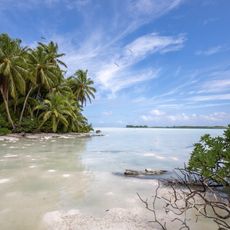
Tabuaeran is a ring-shaped coral atoll in the Line Islands with several islets surrounding a central lagoon. The lagoon spans roughly 51 kilometers around its edge and features numerous white sand beaches.

American trader Edmund Fanning discovered the previously uninhabited atoll in 1798. The British subsequently annexed it and established a cable station there.

The local community practices traditional fishing methods and creates handcrafted items, including decorative knives made with shark teeth and palm wood. These crafts remain part of everyday life and connect people to their maritime heritage.

A circular dirt road runs around the lagoon, making it easy to get around the atoll. Bicycles can be rented near the main dock for exploring the area at your own pace.

The atoll serves as an important humanitarian stopover for cruise ships traveling between Hawaii and French Polynesia. These visits connect the remote community with the broader Pacific world.

The community of curious travelers

AroundUs brings together thousands of curated places, local tips, and hidden gems, enriched daily by 60,000 contributors worldwide.
Start exploring
Location
Elevation above the sea
3 m
Part of
Line Islands
Address
Tabuaeran, Kiribati
GPS coordinates
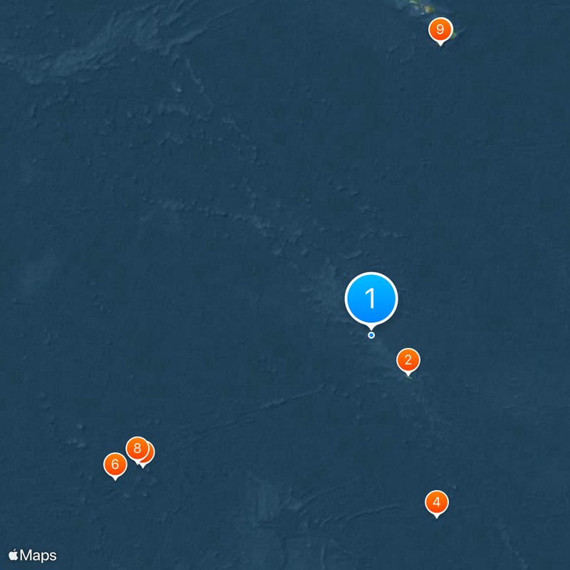
3.87300,-159.31751
Latest update
August 30, 2026 12:38
Top sites in Kiribati Islands

The Kiribati Islands are scattered across the Pacific Ocean, offering visitors a mix of natural beauty and history. At these islands, you will find white sand beaches, traditional fishing villages, and thriving coral reefs that support an incredible variety of marine life. Several islands still bear...

Around this place
Kiritimati
Kiribati

Kiritimati

193.4 mi
Papakolea Beach
United States of America

Papakolea Beach

1071.1 mi
Starbuck Island
Kiribati

Starbuck Island

699.7 mi
Ka Lae
United States of America

Ka Lae

1068.8 mi
Phoenix Islands Protected Area
Kiribati

Phoenix Islands Protected Area

1071.6 mi
Canton and Enderbury Islands
United Kingdom

Canton and Enderbury Islands

961 mi
Kanton Island
Kiribati

Kanton Island

971.4 mi
Ala Kahakai National Historic Trail
United States of America

Ala Kahakai National Historic Trail

1068.8 mi
Spam Island
Kiribati

Spam Island

973.6 mi
Mahana Beach
United States of America

Mahana Beach

1071.1 mi
Palmyra Atoll National Wildlife Refuge
United States of America

Palmyra Atoll National Wildlife Refuge

235.9 mi
Jarvis Island Lighthouse
United States of America

Jarvis Island Lighthouse

297.4 mi
United States of America

Kaʻilikiʻi Beach

1071.3 mi
Jarvis Island National Wildlife Refuge
United States of America

Jarvis Island National Wildlife Refuge

297.6 mi
Kiribati

Landing Beach (lapyahan sa Kiribati)

622.7 mi
United States of America

Waiʻahukini Beach

1071 mi
United States of America

Kingman Reef National Wildlife Refuge

275.9 mi
Kiribati

Starbuck Island Wildlife Sanctuary

699.3 mi
United States of America

Pōhākea

1070 mi
United States of America

Palihāʻukeʻuke

1069.3 mi
United States of America

Pacific Remote Islands Marine National Monument

274.9 mi
Kiribati

Malden Island Wildlife Sanctuary

624.3 mi
United States of America

Pacific Remote Islands Marine National Monument

297.6 mi
United States of America

Pacific Remote Islands Marine National Monument

234 mi
United States of America

Cliff Jump

1069 mi
United States of America

Lua Mākālei

1069.6 mi
United States of America

Sea arch

1070.2 mi
United States of America

Broken landing

1069.6 mi
Show the full map
Reviews
Share your experience

No review yet

Discussions
Start a discussion...

No discussion yet

« Tabuaeran - Ring-shaped coral atoll in Line Islands, Kiribati » is provided by Around Us (aroundus.com). Images and texts are derived from Wikimedia project under a Creative Commons license. You are allowed to copy, distribute, and modify copies of this page, under the conditions set by the license, as long as this note is clearly visible.

Discover hidden gems everywhere you go!

From secret cafés to breathtaking viewpoints, skip the crowded tourist spots and find places that match your style. Our app makes it easy with voice search, smart filtering, route optimization, and insider tips from travelers worldwide. Download now for the complete mobile experience.

Around Us App Screenshot

A unique approach to discovering new places

Le Figaro

All the places worth exploring

France Info

A tailor-made excursion in just a few clicks

20 Minutes

Around Us
Travel Guide & Maps
Download

Send to your phone

QR Code
1

Open the camera app on your mobile.

2

Point at the QR code with your camera. A notification will appear.

3

Tap the notification to open the link.