Enable Location

We need your location to show you interesting places around you

Discover nearby places

Find interesting locations and hidden gems around you

Precise directions

Get accurate directions and distances to places

Your location is never shared with other users. It's only used when you tap the location button.

Huilua Fishpond

Log in to your account

Start exploring — it's free

Trusted by 61,380 travelers worldwide

Continue with Google
Continue with Apple
or

We will send you a code to connect

By continuing, you accept our Terms and Conditions and our Privacy Policy

Check your inbox

We've sent a pincode in your inbox. Please enter the code below.

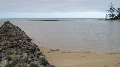
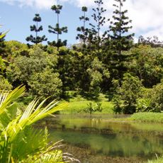
Huilua Fishpond, Ancient fish pond in Kahana Bay, Honolulu County, United States.

Description

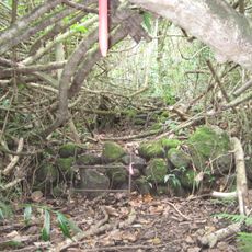
Huilua Fishpond is a large historical water enclosure in Kahana Bay built with a substantial rock seawall stretching roughly 500 feet. Two sluice gates control water movement between the ocean and freshwater sources, allowing the pond to maintain conditions suited for raising mullet and young fish.

History

The fishpond was built between 1200 and 1600 and represents one of the few surviving examples of large Hawaiian aquaculture installations. Of the original 97 fishponds once lining Oahu's coast, only six remain today, highlighting how rare and significant this structure has become.

Culture

The fishpond served as a shared resource where a local keeper oversaw fish distribution and maintained traditional practices central to community life. Local residents depended on the regular harvest, making this an important part of how neighbors worked together and fed their families.

Practical

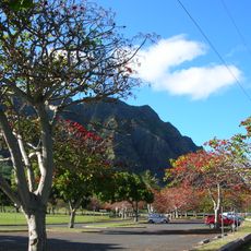
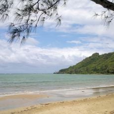
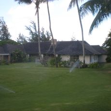
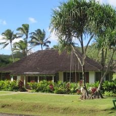
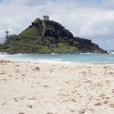
The fishpond is easily visible from the public shoreline along Kahana Bay, making it simple to spot from the main access points. Visiting in the early morning offers the best experience, as the water is usually calmer and fewer people are around.

Did you know?

Stone shrines called ko'a were positioned near the pond where people left offerings to encourage fish reproduction and abundance. These sacred sites reveal how fishing and spiritual beliefs were deeply connected in daily life.

Location
GPS coordinates
21.55740,-157.86800
Latest update
December 14, 2025 13:06

AroundUs brings together thousands of curated places, local tips, and hidden gems, enriched daily by 60,000 contributors worldwide. Discover all places nearby (Honolulu County).

Around this place
Haiku Stairs
United States of America

Haiku Stairs

18.2 km
Aloha Stadium
United States of America

Aloha Stadium

21.5 km
Kualoa Ranch
United States of America

Kualoa Ranch

5.2 km
Interstate H-3
United States of America

Interstate H-3

21 km
Polynesian Cultural Center
United States of America

Polynesian Cultural Center

10.6 km
Laie Hawaii Temple
United States of America

Laie Hawaii Temple

11.9 km
Wheeler Army Airfield
United States of America

Wheeler Army Airfield

19.8 km
Plantation Estate
United States of America

Plantation Estate

19.7 km
Koʻolau Range
United States of America

Koʻolau Range

12.4 km
Waimea Valley
United States of America

Waimea Valley

20.9 km
Ho'omaluhia Botanical Garden
United States of America

Ho'omaluhia Botanical Garden

19.9 km
Sacred Falls State Park
United States of America

Sacred Falls State Park

5.1 km
Kukaniloko Birth Site
United States of America

Kukaniloko Birth Site

18.6 km
James Campbell National Wildlife Refuge
United States of America

James Campbell National Wildlife Refuge

17.3 km
Kualoa Regional Park
United States of America

Kualoa Regional Park

6.1 km
Wahiawa Botanical Garden
United States of America

Wahiawa Botanical Garden

16.6 km
Keaīwa Heiau State Recreation Area
United States of America

Keaīwa Heiau State Recreation Area

17.6 km
Ahupua'a O Kahana State Park
United States of America

Ahupua'a O Kahana State Park

2.5 km
Boettcher Estate
United States of America

Boettcher Estate

21.6 km
Windward Viaducts
United States of America

Windward Viaducts

17.7 km
He‘eia State Park
United States of America

He‘eia State Park

14.5 km
Kaneohe Ranch Building
United States of America

Kaneohe Ranch Building

21.7 km
Kahaluu Taro Lo'i
United States of America

Kahaluu Taro Lo'i

14.5 km
Waimalu Shopping Center
United States of America

Waimalu Shopping Center

20.9 km
Pyramid Rock
United States of America

Pyramid Rock

15.1 km
Tropic Lightning Museum
United States of America

Tropic Lightning Museum

20.4 km
Kualoa Ranch
United States of America

Kualoa Ranch

5.2 km
Pineapple Garden Maze
United States of America

Pineapple Garden Maze

18 km
Show the full map
« Huilua Fishpond - Ancient fish pond in Kahana Bay, Honolulu County, United States » is provided by Around Us (aroundus.com). Images and texts are derived from Wikimedia project under a Creative Commons license. You are allowed to copy, distribute, and modify copies of this page, under the conditions set by the license, as long as this note is clearly visible.

Discover hidden gems everywhere you go!

From secret cafés to breathtaking viewpoints, skip the crowded tourist spots and find places that match your style. Our app makes it easy with voice search, smart filtering, route optimization, and insider tips from travelers worldwide. Download now for the complete mobile experience.

Around Us App Screenshot

A unique approach to discovering new places

Le Figaro

All the places worth exploring

France Info

A tailor-made excursion in just a few clicks

20 Minutes

Around Us
Travel Guide & Maps
Download

Send to your phone

QR Code
1

Open the camera app on your mobile.

2

Point at the QR code with your camera. A notification will appear.

3

Tap the notification to open the link.