Chest opened
+${chestReward.xp} XP
Explorer
NOUVEAU ×${chestReward.collectible.quantity}
tapez pour fermer
Chest locked

Open chests in the app

Around Us is built for your phone — chests unlock when you walk, explore and capture nearby places.

Enable Location

We need your location to show you interesting places around you

Discover nearby places

Find interesting locations and hidden gems around you

Precise directions

Get accurate directions and distances to places

Your location is never shared with other users. It's only used when you tap the location button.

Log in to your account

Start exploring — it's free

Trusted by 72,888 travelers worldwide

Continue with Google
Continue with Apple
or

We will send you a code to connect

By continuing, you accept our Terms and Conditions and our Privacy Policy

Check your inbox

We've sent a pincode in your inbox. Please enter the code below.

Iditarod River
Discussion Reviews Photo
1.5k Popularity

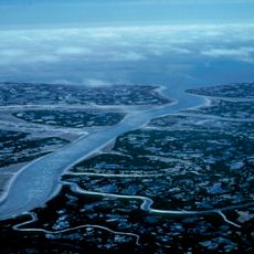
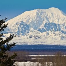
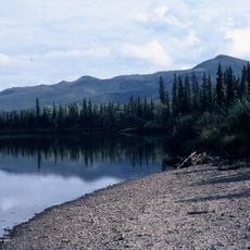
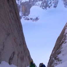
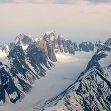
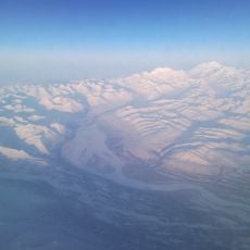
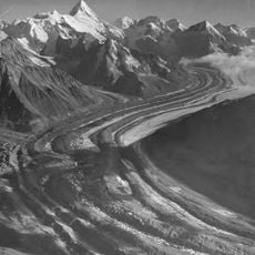
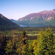
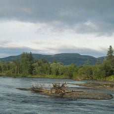
Iditarod River, Brook in central Alaska, US

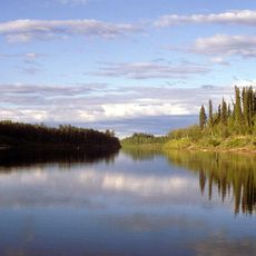
The Iditarod River is a waterway in central Alaska that winds through remote wilderness near the historic Iditarod mining district. It functions as a natural landmark within a network of water routes that cross this isolated landscape.

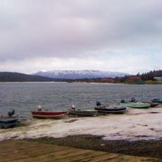
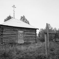
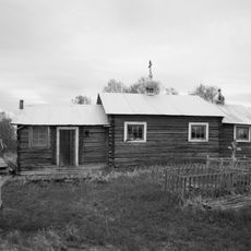
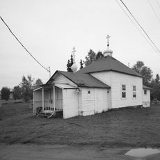
During the gold rush of the early 1900s, the river supported the transportation of prospectors and settlers seeking the region's mineral wealth. This period established human presence in this wilderness and left traces still visible today.

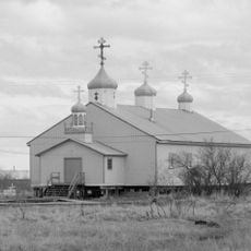
The name comes from Deg Xinag and Holikachuk Athabascan languages, showing the long-standing Indigenous presence in this region. This linguistic connection reflects how Indigenous peoples shaped the names and identity of the land they inhabited.

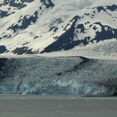
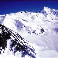
Visitors exploring this region should prepare for the cold and changing conditions typical of Alaska's wilderness. The best time to explore is during warmer months when access on foot or by boat is possible.

The river forms part of the legendary Iditarod National Historic Trail, where a famous sled dog race takes place each year. Its role as a landmark for this world-renowned race makes it more than just a natural waterway.

The community of curious travelers

AroundUs brings together thousands of curated places, local tips, and hidden gems, enriched daily by 60,000 contributors worldwide.

Start exploring
GPS coordinates
62.59205,-158.12946
Latest update
December 14, 2025 15:01
Around this place
Yukon Delta National Wildlife Refuge
United States of America

Yukon Delta National Wildlife Refuge

311.4 km
Wood-Tikchik State Park
United States of America

Wood-Tikchik State Park

285.6 km
Nowitna River
United States of America

Nowitna River

248.7 km
Mount Torbert
United States of America

Mount Torbert

326.3 km
Innoko National Wildlife Refuge
United States of America

Innoko National Wildlife Refuge

83.8 km
Kichatna Spire
United States of America

Kichatna Spire

278.4 km
Mount Russell
United States of America

Mount Russell

319.6 km
Innoko Wilderness
United States of America

Innoko Wilderness

54.7 km
Nowitna National Wildlife Refuge
United States of America

Nowitna National Wildlife Refuge

308.1 km
Unalakleet River
United States of America

Unalakleet River

179.9 km
Christ Church Mission
United States of America

Christ Church Mission

106.3 km
Surprise Glacier (Alaska Range)
United States of America

Surprise Glacier (Alaska Range)

298 km
Mount Dall
United States of America

Mount Dall

299 km
Shadows Glacier
United States of America

Shadows Glacier

279 km
Iyatayet Site
United States of America

Iyatayet Site

262.9 km
Yentna Glacier
United States of America

Yentna Glacier

329.8 km
St. Jacob's Church
United States of America

St. Jacob's Church

284.3 km
Sts. Constantine and Helen Chapel
United States of America

Sts. Constantine and Helen Chapel

197 km
St. Seraphim Chapel
United States of America

St. Seraphim Chapel

167.2 km
Cul-de-sac Glacier
United States of America

Cul-de-sac Glacier

275.6 km
Dall Glacier
United States of America

Dall Glacier

317.7 km
Presentation of Our Lord Chapel
United States of America

Presentation of Our Lord Chapel

206.3 km
Chedotlothna Glacier
United States of America

Chedotlothna Glacier

320.8 km
Bureau of Indian Affairs Unalakleet School
United States of America

Bureau of Indian Affairs Unalakleet School

194.9 km
Kijik Archeological District
United States of America

Kijik Archeological District

328.7 km
Johnson River
United States of America

Johnson River

229.9 km
Kwethluk River
United States of America

Kwethluk River

284.8 km
Hayes Glacier
United States of America

Hayes Glacier

308 km
Show the full map
Reviews
Share your experience

No review yet

Discussions
Start a discussion...

No discussion yet

« Iditarod River - Brook in central Alaska, US » is provided by Around Us (aroundus.com). Images and texts are derived from Wikimedia project under a Creative Commons license. You are allowed to copy, distribute, and modify copies of this page, under the conditions set by the license, as long as this note is clearly visible.

Discover hidden gems everywhere you go!

From secret cafés to breathtaking viewpoints, skip the crowded tourist spots and find places that match your style. Our app makes it easy with voice search, smart filtering, route optimization, and insider tips from travelers worldwide. Download now for the complete mobile experience.

Around Us App Screenshot

A unique approach to discovering new places

Le Figaro

All the places worth exploring

France Info

A tailor-made excursion in just a few clicks

20 Minutes

Around Us
Travel Guide & Maps
Download

Send to your phone

QR Code
1

Open the camera app on your mobile.

2

Point at the QR code with your camera. A notification will appear.

3

Tap the notification to open the link.