Enable Location

We need your location to show you interesting places around you

Discover nearby places

Find interesting locations and hidden gems around you

Precise directions

Get accurate directions and distances to places

Your location is never shared with other users. It's only used when you tap the location button.

Log in to your account

Start exploring — it's free

Trusted by 62,448 travelers worldwide

Continue with Google
Continue with Apple
or

We will send you a code to connect

By continuing, you accept our Terms and Conditions and our Privacy Policy

Check your inbox

We've sent a pincode in your inbox. Please enter the code below.

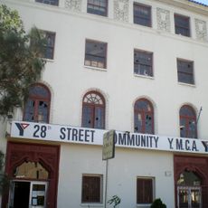
Cudahy, Residential city in Los Angeles County, US

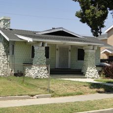
Cudahy is a residential city in southeastern Los Angeles County with one of the highest population densities among incorporated cities in the United States. The area is primarily residential, with homes tightly packed across a compact cityscape.

The city was founded in 1908 when meat-packing industrialist Michael Cudahy purchased land from the former Rancho San Antonio and subdivided it into small residential parcels. It developed as a working-class community designed to provide affordable housing for factory workers and their families.

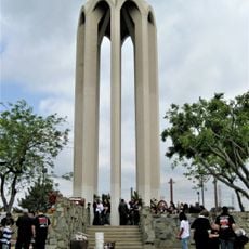
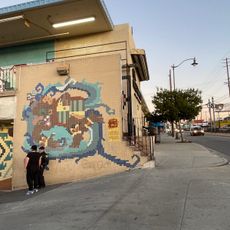
The city has a strong Latino presence, with Mexican and Salvadoran communities shaping daily life, local shops, and neighborhood celebrations. This cultural identity is woven throughout the community in visible ways, from food to festivals and local gathering spaces.

The city is easy to navigate by car due to its small, compact size, and most attractions and services are accessible on foot or by short drives. Parking is readily available on residential streets throughout the area.

In 2020, an unusual incident occurred when an aircraft released jet fuel over a school area in the city. The event sparked local discussions about air safety and environmental protection in the community.

The community of curious travelers

AroundUs brings together thousands of curated places, local tips, and hidden gems, enriched daily by 60,000 contributors worldwide.

Start exploring
Inception
1960
Elevation above the sea
37 m
Shares border with
Bell, Bell Gardens, South Gate, Huntington Park
GPS coordinates
33.96417,-118.18250
Latest update
December 20, 2025 01:20
Around this place
Watts Towers
United States of America

Watts Towers

6.1 km
Wrigley Field
United States of America

Wrigley Field

9.1 km
Linda Vista Community Hospital
United States of America

Linda Vista Community Hospital

8.9 km
Atchison, Topeka and Santa Fe Railway 3751
United States of America

Atchison, Topeka and Santa Fe Railway 3751

7.1 km
United States of America

Imperial Courts

5.9 km
Evergreen Cemetery
United States of America

Evergreen Cemetery

8.9 km
United States of America

South Central Farm

7.4 km
Dunbar Hotel
United States of America

Dunbar Hotel

8.3 km
Sears, Roebuck & Company Mail Order Building
United States of America

Sears, Roebuck & Company Mail Order Building

7.5 km
Johnie's Broiler
United States of America

Johnie's Broiler

3.7 km
Golden Gate Theater
United States of America

Golden Gate Theater

6.7 km
Armenian Genocide Martyrs Monument
United States of America

Armenian Genocide Martyrs Monument

8.6 km
Columbia Memorial Space Center
United States of America

Columbia Memorial Space Center

6.7 km
Los Angeles County Library
United States of America

Los Angeles County Library

4.5 km
Golf N' Stuff
United States of America

Golf N' Stuff

8.2 km
El Mercado de Los Angeles
United States of America

El Mercado de Los Angeles

8.2 km
28th Street YMCA
United States of America

28th Street YMCA

9.1 km
27th Street Historic District
United States of America

27th Street Historic District

9.1 km
Ralph J. Bunche House
United States of America

Ralph J. Bunche House

8.3 km
Lincoln Theatre
United States of America

Lincoln Theatre

9.1 km
52nd Place Historic District
United States of America

52nd Place Historic District

8.2 km
Punchbowl Formation
United States of America

Punchbowl Formation

4.3 km
United States of America

Shri Swaminarayan Mandir, Downey

6.4 km
Roosevelt Building
United States of America

Roosevelt Building

9 km
Casa de Parley Johnson
United States of America

Casa de Parley Johnson

4.7 km
Prince Hall Masonic Temple
United States of America

Prince Hall Masonic Temple

7.8 km
Bethlehem Baptist Church
United States of America

Bethlehem Baptist Church

7.1 km
Golden State Mutual Life Insurance Building
United States of America

Golden State Mutual Life Insurance Building

8.2 km
Show the full map
« Cudahy - Residential city in Los Angeles County, US » is provided by Around Us (aroundus.com). Images and texts are derived from Wikimedia project under a Creative Commons license. You are allowed to copy, distribute, and modify copies of this page, under the conditions set by the license, as long as this note is clearly visible.

Discover hidden gems everywhere you go!

From secret cafés to breathtaking viewpoints, skip the crowded tourist spots and find places that match your style. Our app makes it easy with voice search, smart filtering, route optimization, and insider tips from travelers worldwide. Download now for the complete mobile experience.

Around Us App Screenshot

A unique approach to discovering new places

Le Figaro

All the places worth exploring

France Info

A tailor-made excursion in just a few clicks

20 Minutes

Around Us
Travel Guide & Maps
Download

Send to your phone

QR Code
1

Open the camera app on your mobile.

2

Point at the QR code with your camera. A notification will appear.

3

Tap the notification to open the link.